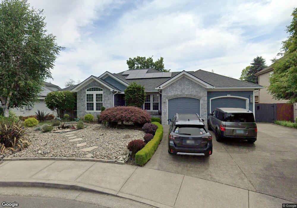
6878 Westridge Ct N Keizer, OR 97303
Estimated Value: $557,000 - $631,000
3
Beds
2
Baths
2,169
Sq Ft
$271/Sq Ft
Est. Value
About This Home
This home is located at 6878 Westridge Ct N, Keizer, OR 97303 and is currently estimated at $587,157, approximately $270 per square foot. 6878 Westridge Ct N is a home located in Marion County with nearby schools including Forest Ridge Elementary School, Whiteaker Middle School, and McNary High School.
Ownership History
Date
Name
Owned For
Owner Type
Purchase Details
Closed on
Jun 8, 2001
Sold by
Powell Todd N and Powell Jonika L
Bought by
Gillespie Donald Chris and Gillespie Terri Lyn
Current Estimated Value
Home Financials for this Owner
Home Financials are based on the most recent Mortgage that was taken out on this home.
Original Mortgage
$164,000
Outstanding Balance
$62,471
Interest Rate
7.14%
Mortgage Type
Purchase Money Mortgage
Estimated Equity
$524,686
Create a Home Valuation Report for This Property
The Home Valuation Report is an in-depth analysis detailing your home's value as well as a comparison with similar homes in the area
Home Values in the Area
Average Home Value in this Area
Purchase History
| Date | Buyer | Sale Price | Title Company |
|---|---|---|---|
| Gillespie Donald Chris | $222,000 | First American |
Source: Public Records
Mortgage History
| Date | Status | Borrower | Loan Amount |
|---|---|---|---|
| Open | Gillespie Donald Chris | $164,000 |
Source: Public Records
Tax History Compared to Growth
Tax History
| Year | Tax Paid | Tax Assessment Tax Assessment Total Assessment is a certain percentage of the fair market value that is determined by local assessors to be the total taxable value of land and additions on the property. | Land | Improvement |
|---|---|---|---|---|
| 2024 | $5,494 | $321,110 | -- | -- |
| 2023 | $5,231 | $311,760 | $0 | $0 |
| 2022 | $5,079 | $302,680 | $0 | $0 |
| 2021 | $4,920 | $293,870 | $0 | $0 |
| 2020 | $4,790 | $285,320 | $0 | $0 |
| 2019 | $4,467 | $277,010 | $0 | $0 |
| 2018 | $4,544 | $0 | $0 | $0 |
| 2017 | $4,082 | $0 | $0 | $0 |
| 2016 | $3,918 | $0 | $0 | $0 |
| 2015 | $3,941 | $0 | $0 | $0 |
| 2014 | $3,796 | $0 | $0 | $0 |
Source: Public Records
Map
Nearby Homes
- 6719 Westridge Ct N
- 336 Bolf Terrace N
- 271 McNary Heights Dr N
- 797 Laguna Dr NE
- 7033 8th Ct NE
- 283 McNary Heights Dr N Unit 283
- 674 Shannon Ct NE
- 6986 9th Ct NE
- 1056 Northshire Ct NE
- 1079 Northrup Ct NE
- 902 Mistletoe Loop N
- 452 Fountain Ct N
- 6467 Hogan Dr N
- 6648 Brookhollow Ct NE
- 1158 Meadowridge St NE
- 894 Crenshaw Loop N
- 6550 Whisper Creek Loop NE
- 6102 Trevino Ct N
- 1270 Hidden Creek Dr NE
- 1320 Hidden Creek Dr NE
- 6888 Westridge Ct N
- 6858 Westridge Ct N
- 6877 Fenwick Ct N
- 6897 Fenwick Ct N
- 6899 Westridge Ct N
- 6867 Fenwick Ct N
- 6917 Fenwick Ct N
- 6848 Westridge Ct N
- 6953 Fir Grove Ln N
- 6859 Westridge Ct N
- 6847 Fenwick Ct N
- 6937 Fenwick Ct N
- 6879 Westridge Ct N
- 6849 Westridge Ct N
- 6838 Westridge Ct N
- 6889 Westridge Ct N
- 6876 Fenwick Ct N
- 6896 Fenwick Ct N
- 6827 Fenwick Ct N
- 6866 Fenwick Ct N