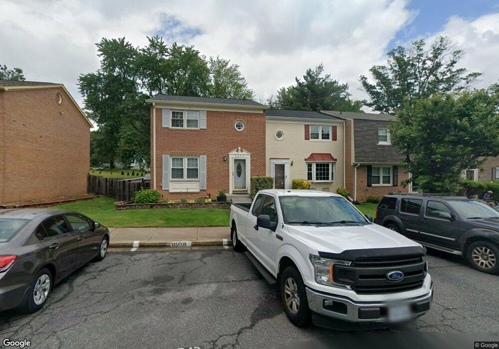
6879 Brian Michael Ct Springfield, VA 22153
Estimated Value: $579,159 - $627,000
3
Beds
4
Baths
1,408
Sq Ft
$434/Sq Ft
Est. Value
About This Home
This home is located at 6879 Brian Michael Ct, Springfield, VA 22153 and is currently estimated at $611,290, approximately $434 per square foot. 6879 Brian Michael Ct is a home located in Fairfax County with nearby schools including Orange Hunt Elementary School, Irving Middle School, and West Springfield High School.
Ownership History
Date
Name
Owned For
Owner Type
Purchase Details
Closed on
May 16, 2001
Sold by
Fernezian Levon H
Bought by
Tenkerian Ashkhen
Current Estimated Value
Home Financials for this Owner
Home Financials are based on the most recent Mortgage that was taken out on this home.
Original Mortgage
$118,800
Outstanding Balance
$44,360
Interest Rate
7.03%
Estimated Equity
$566,930
Create a Home Valuation Report for This Property
The Home Valuation Report is an in-depth analysis detailing your home's value as well as a comparison with similar homes in the area
Home Values in the Area
Average Home Value in this Area
Purchase History
| Date | Buyer | Sale Price | Title Company |
|---|---|---|---|
| Tenkerian Ashkhen | $148,500 | -- |
Source: Public Records
Mortgage History
| Date | Status | Borrower | Loan Amount |
|---|---|---|---|
| Open | Tenkerian Ashkhen | $118,800 |
Source: Public Records
Tax History Compared to Growth
Tax History
| Year | Tax Paid | Tax Assessment Tax Assessment Total Assessment is a certain percentage of the fair market value that is determined by local assessors to be the total taxable value of land and additions on the property. | Land | Improvement |
|---|---|---|---|---|
| 2025 | $6,019 | $537,000 | $170,000 | $367,000 |
| 2024 | $6,019 | $519,510 | $155,000 | $364,510 |
| 2023 | $5,560 | $492,700 | $155,000 | $337,700 |
| 2022 | $5,405 | $472,650 | $150,000 | $322,650 |
| 2021 | $5,088 | $433,580 | $135,000 | $298,580 |
| 2020 | $4,871 | $411,550 | $115,000 | $296,550 |
| 2019 | $4,685 | $395,850 | $115,000 | $280,850 |
| 2018 | $4,374 | $380,350 | $105,000 | $275,350 |
| 2017 | $4,416 | $380,350 | $105,000 | $275,350 |
| 2016 | $4,199 | $362,430 | $92,000 | $270,430 |
Source: Public Records
Map
Nearby Homes
- 9007 Okeith Ct
- 6433 Fenestra Ct Unit 56B
- 9436 William Kirk Ln
- 6710 Red Jacket Rd
- 6606 Huntsman Blvd
- 9523 Cherry Oak Ct
- 7200 Beachway Ct
- 9473 Cloverdale Ct
- 9075 Andromeda Dr
- 6246 Hillside Rd
- 7209 Drifter Ct
- 8600 Kentford Dr
- 9217 Dorothy Ln
- 9322 Elk Dr
- 9820 Westwood Manor Ct
- 8674 Center Rd Unit 1
- 7105 Galgate Dr
- 7222 Willow Oak Place
- 6020 Forrest Hollow Ln
- 9019 Octavia Ct
- 6881 Brian Michael Ct
- 6877 Brian Michael Ct
- 6875 Brian Michael Ct
- 6885 Brian Michael Ct
- 6873 Brian Michael Ct
- 6887 Brian Michael Ct
- 6871 Brian Michael Ct
- 6889 Brian Michael Ct
- 6852 Brian Michael Ct
- 6891 Brian Michael Ct
- 6854 Brian Michael Ct
- 6850 Brian Michael Ct
- 6856 Brian Michael Ct
- 6869 Brian Michael Ct
- 6858 Brian Michael Ct
- 6629 Keene Dr
- 6867 Brian Michael Ct
- 6846 Brian Michael Ct
- 6860 Brian Michael Ct
- 6894 Brian Michael Ct
