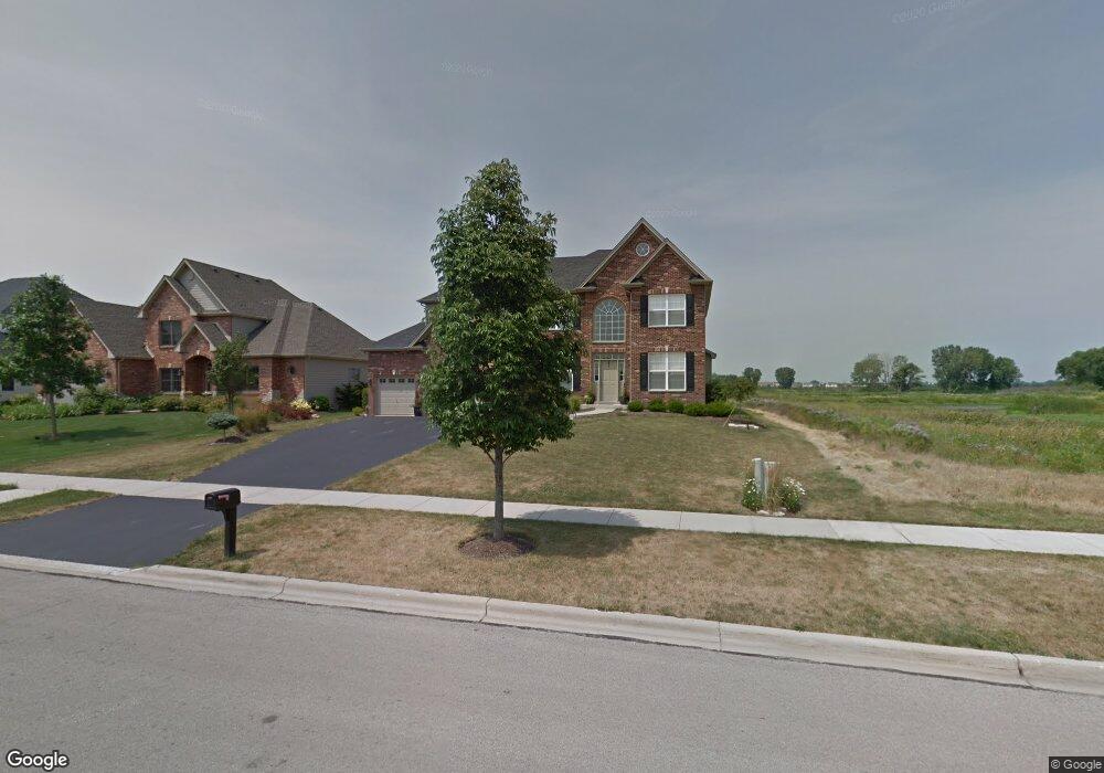
688 Bennett Dr North Aurora, IL 60542
Nelson Lake NeighborhoodEstimated Value: $497,473 - $597,000
4
Beds
3
Baths
2,835
Sq Ft
$193/Sq Ft
Est. Value
About This Home
This home is located at 688 Bennett Dr, North Aurora, IL 60542 and is currently estimated at $546,868, approximately $192 per square foot. 688 Bennett Dr is a home located in Kane County with nearby schools including Fearn Elementary School, Herget Middle School, and West Aurora High School.
Ownership History
Date
Name
Owned For
Owner Type
Purchase Details
Closed on
Jul 11, 2017
Sold by
Rodriguez Stephanie M and Rodriguez Mathew
Bought by
Rodriguez Stephanie E
Current Estimated Value
Purchase Details
Closed on
Apr 30, 2007
Sold by
R A Faganel Builders Inc
Bought by
Bagley Matthew J and Rodriguez Stephanie M
Home Financials for this Owner
Home Financials are based on the most recent Mortgage that was taken out on this home.
Original Mortgage
$335,200
Outstanding Balance
$204,225
Interest Rate
6.2%
Mortgage Type
Purchase Money Mortgage
Estimated Equity
$342,643
Create a Home Valuation Report for This Property
The Home Valuation Report is an in-depth analysis detailing your home's value as well as a comparison with similar homes in the area
Home Values in the Area
Average Home Value in this Area
Purchase History
| Date | Buyer | Sale Price | Title Company |
|---|---|---|---|
| Rodriguez Stephanie E | -- | Attorney | |
| Bagley Matthew J | $394,500 | Chicago Title Insurance Co |
Source: Public Records
Mortgage History
| Date | Status | Borrower | Loan Amount |
|---|---|---|---|
| Open | Bagley Matthew J | $335,200 |
Source: Public Records
Tax History
| Year | Tax Paid | Tax Assessment Tax Assessment Total Assessment is a certain percentage of the fair market value that is determined by local assessors to be the total taxable value of land and additions on the property. | Land | Improvement |
|---|---|---|---|---|
| 2024 | $9,712 | $120,753 | $14,860 | $105,893 |
| 2023 | $9,376 | $108,983 | $13,412 | $95,571 |
| 2022 | $10,136 | $113,261 | $12,309 | $100,952 |
| 2021 | $9,854 | $108,404 | $11,781 | $96,623 |
| 2020 | $9,682 | $105,863 | $11,505 | $94,358 |
| 2019 | $9,786 | $104,309 | $11,336 | $92,973 |
| 2018 | $10,537 | $108,957 | $11,336 | $97,621 |
| 2017 | $10,594 | $107,718 | $11,207 | $96,511 |
| 2016 | $11,049 | $109,882 | $10,911 | $98,971 |
| 2015 | -- | $105,117 | $10,485 | $94,632 |
| 2014 | -- | $102,346 | $11,666 | $90,680 |
| 2013 | -- | $98,784 | $11,666 | $87,118 |
Source: Public Records
Map
Nearby Homes
- 512 Bennett Dr
- 2408 Moutray Ln
- 459 Glover Dr
- 443 Glover Dr
- The Williamson Plan at Acres on Deerpath
- The Aspen - Front Load Plan at Acres on Deerpath
- The Ontario Plan at Acres on Deerpath
- The Superior Plan at Acres on Deerpath
- The Bettendorf Plan at Acres on Deerpath
- The Erie Plan at Acres on Deerpath
- The Ashbury Plan at Acres on Deerpath
- The Braxton Plan at Acres on Deerpath
- 1009 Bennett Ct
- 867 Fair Meadow Ct
- 3S177 Deerpath Rd
- 924 Fair Meadow St
- 925 Fair Meadow St
- 1792 Breton Ave
- 1663 Patterson Ave
- 1791 Breton Ave
- 680 Bennett Dr
- 672 Bennett Dr
- 2121 Westover Rd
- 664 Bennett Dr
- 671 Bennett Dr
- 2113 Westover Rd
- 703 Bennett Dr
- 656 Bennett Dr
- 663 Bennett Dr
- 711 Bennett Dr
- 655 Bennett Dr Unit 5
- 648 Bennett Dr
- 2104 Westover Rd
- 2097 Westover Rd
- 647 Bennett Dr
- 640 Bennett Dr
- 2096 Westover Rd
- 800 Bennett Dr
- 2089 Westover Rd
- 639 Bennett Dr
Your Personal Tour Guide
Ask me questions while you tour the home.