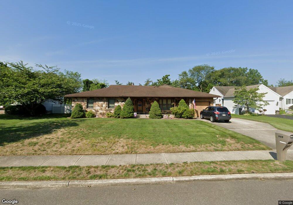
688 Michael Dr Toms River, NJ 08753
Estimated Value: $575,448 - $652,000
3
Beds
1
Bath
2,137
Sq Ft
$289/Sq Ft
Est. Value
About This Home
This home is located at 688 Michael Dr, Toms River, NJ 08753 and is currently estimated at $617,862, approximately $289 per square foot. 688 Michael Dr is a home located in Ocean County with nearby schools including St Joseph Grade School, Ambassador Christian Academy, and Donovan Catholic High School.
Ownership History
Date
Name
Owned For
Owner Type
Purchase Details
Closed on
Nov 25, 2015
Sold by
Hayes Ann
Bought by
Hayes Nancy Ann and Hayes Thomas
Current Estimated Value
Purchase Details
Closed on
Nov 3, 1986
Bought by
Hayes Charles and Hayes Ann
Create a Home Valuation Report for This Property
The Home Valuation Report is an in-depth analysis detailing your home's value as well as a comparison with similar homes in the area
Home Values in the Area
Average Home Value in this Area
Purchase History
We collect this data history from publicly available records. To have your information removed, we recommend requesting removal directly through your county’s website.
| Date | Buyer | Sale Price | Title Company |
|---|---|---|---|
| Hayes Nancy Ann | -- | Attorney | |
| Hayes Charles | $68,000 | -- |
Source: Public Records
Tax History
| Year | Tax Paid | Tax Assessment Tax Assessment Total Assessment is a certain percentage of the fair market value that is determined by local assessors to be the total taxable value of land and additions on the property. | Land | Improvement |
|---|---|---|---|---|
| 2025 | $8,240 | $421,700 | $177,000 | $244,700 |
| 2024 | $7,300 | $421,700 | $177,000 | $244,700 |
| 2023 | $7,038 | $421,700 | $177,000 | $244,700 |
| 2022 | $7,038 | $421,700 | $177,000 | $244,700 |
| 2021 | $6,906 | $275,700 | $99,300 | $176,400 |
| 2020 | $6,876 | $275,700 | $99,300 | $176,400 |
| 2019 | $6,578 | $275,700 | $99,300 | $176,400 |
| 2018 | $6,490 | $275,700 | $99,300 | $176,400 |
| 2017 | $6,435 | $275,700 | $99,300 | $176,400 |
| 2016 | $6,267 | $275,700 | $99,300 | $176,400 |
| 2015 | $6,030 | $275,700 | $99,300 | $176,400 |
| 2014 | $5,740 | $275,700 | $99,300 | $176,400 |
Source: Public Records
Map
Nearby Homes
- 684 Brookside Dr
- 846 Naryshkin Way
- 838 Naryshkin Way
- 833 Naryshkin Way
- 849 Naryshkin Way
- 837 Naryshkin Way
- 623 Brookside Dr
- 620 Hillside Dr
- 845 Naryshkin Way
- 689 Hill Rd
- 7 Musket Place
- 813 Raleigh Dr
- 834 Brookside Dr
- 230 Carol Dr
- 586 Peter Ave
- 860 Somerset Dr
- 829 Knight St
- 103 Ridge Dr
- 824 Knight St
- 541 Princess Ct
- 684 Michael Dr
- 692 Michael Dr
- 779 Hearthstone Rd
- 778 Hearthstone Rd
- 680 Michael Dr
- 696 Michael Dr
- 775 Hearthstone Rd
- 687 Michael Dr
- 691 Michael Dr
- 683 Michael Dr
- 774 Hearthstone Rd
- 676 Michael Dr
- 774 Briar Ave
- 705 Michael Dr
- 700 Michael Dr
- 675 Michael Dr
- 771 Hearthstone Rd
- 770 Hearthstone Rd
- 770 Briar Ave
- 704 Michael Dr
Your Personal Tour Guide
Ask me questions while you tour the home.