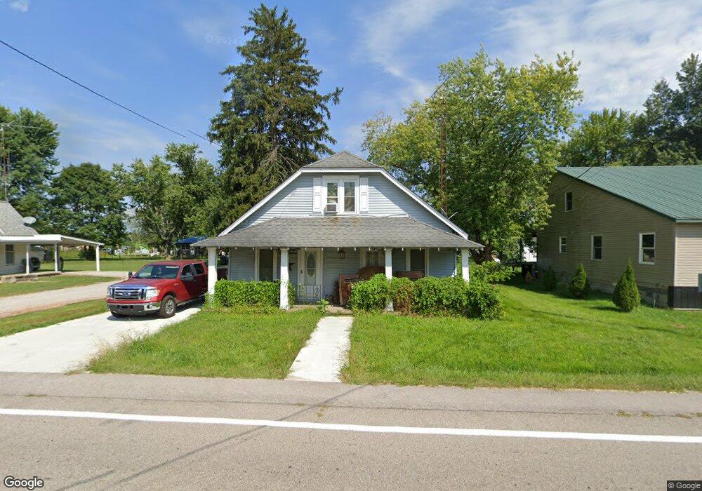
6883 N Maple St Freetown, IN 47235
Estimated Value: $109,000 - $176,000
3
Beds
1
Bath
1,800
Sq Ft
$83/Sq Ft
Est. Value
About This Home
This home is located at 6883 N Maple St, Freetown, IN 47235 and is currently estimated at $149,207, approximately $82 per square foot. 6883 N Maple St is a home located in Jackson County with nearby schools including Brownstown Elementary School, Brownstown Central Middle School, and Brownstown Central High School.
Create a Home Valuation Report for This Property
The Home Valuation Report is an in-depth analysis detailing your home's value as well as a comparison with similar homes in the area
Home Values in the Area
Average Home Value in this Area
Tax History Compared to Growth
Tax History
| Year | Tax Paid | Tax Assessment Tax Assessment Total Assessment is a certain percentage of the fair market value that is determined by local assessors to be the total taxable value of land and additions on the property. | Land | Improvement |
|---|---|---|---|---|
| 2024 | $245 | $70,200 | $18,400 | $51,800 |
| 2023 | $263 | $75,300 | $18,400 | $56,900 |
| 2022 | $283 | $74,800 | $18,400 | $56,400 |
| 2021 | $249 | $68,500 | $18,400 | $50,100 |
| 2020 | $242 | $68,500 | $18,400 | $50,100 |
| 2019 | $234 | $68,600 | $18,400 | $50,200 |
| 2018 | $227 | $68,600 | $18,400 | $50,200 |
| 2017 | $275 | $69,300 | $18,400 | $50,900 |
| 2016 | $212 | $69,400 | $18,400 | $51,000 |
| 2014 | $272 | $62,800 | $13,100 | $49,700 |
| 2013 | $272 | $62,400 | $13,100 | $49,300 |
Source: Public Records
Map
Nearby Homes
- 5000 W County Road 680 N
- 6100 W County Road 700 N
- 5000 W County Road 700 N
- 6000 W County Road 700 N
- 6725 W County Road 700 N
- 3000 W Block Co Rd 900 N
- 2221 Indiana 258
- 9649 N County Road 450 W
- 4325 N County Road 650 W
- 8000 W County Road 625 Tract 4 N
- 8000 W County Road 625 N Unit LotWP004
- 3780 W County Road 300 N
- 7594 W County Road 925 N
- 8515 N County Road 100 W
- 3264 N County Road 250 W
- 11000 N County Road 650 W
- 2000 Block W 1125 N
- 1109 N County Road 600 W Unit Medora
- 9601 Buffalo Pike
- 8650 Mount Nebo Rd
- 6863 N Maple St
- 6899 N Maple St
- 6882 N Maple St
- 6854 N Maple St
- 6845 N Hayes Ave
- 6862 N Poplar St
- 4645 W Columbus Pike
- 4775 W State Road 58
- 6840 N Maple St
- 6846 N Poplar St
- 4664 W Columbus Pike
- 4767 W State Road 58
- 6859 N Poplar St
- 6801 N Maple St
- 6873 N Poplar St
- 6824 N Poplar St
- 6845 N Poplar St
- 4768 W State Road 58
- 4482 W 3rd St
- 6810 N Poplar St