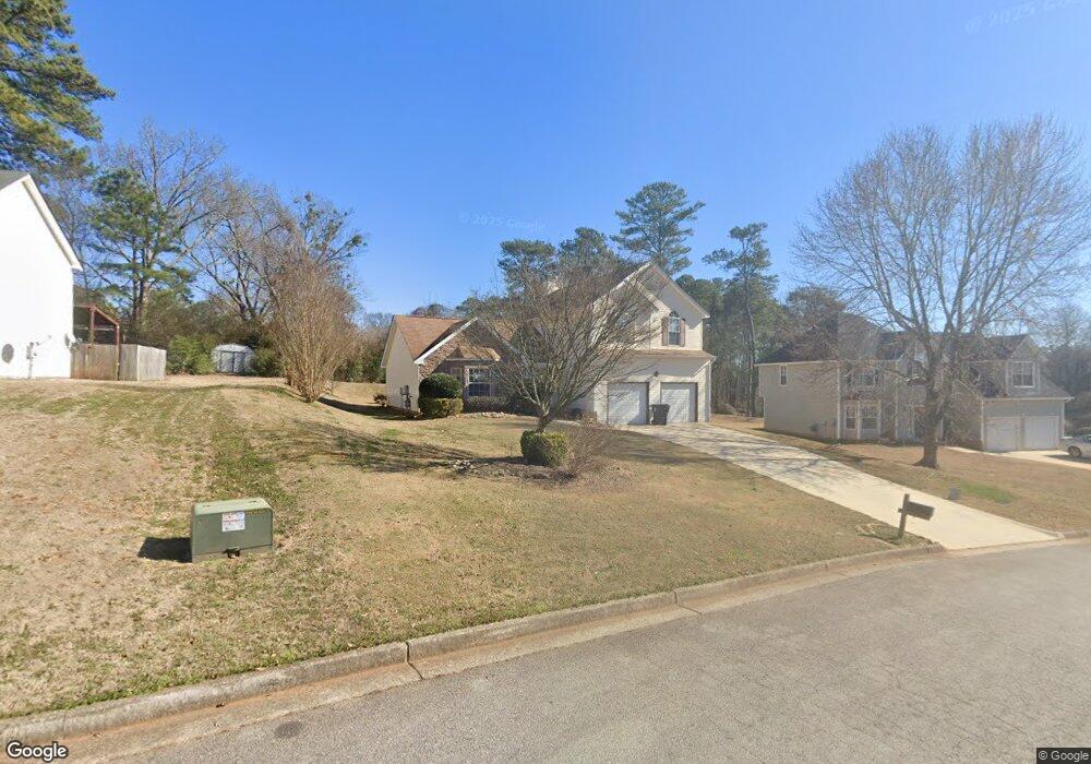
6887 Fields Dr Unit 92 Douglasville, GA 30135
Bill Arp NeighborhoodEstimated Value: $273,000 - $311,000
3
Beds
3
Baths
2,025
Sq Ft
$143/Sq Ft
Est. Value
About This Home
This home is located at 6887 Fields Dr Unit 92, Douglasville, GA 30135 and is currently estimated at $289,278, approximately $142 per square foot. 6887 Fields Dr Unit 92 is a home located in Douglas County with nearby schools including Mason Creek Elementary School, Mason Creek Middle School, and Alexander High School.
Ownership History
Date
Name
Owned For
Owner Type
Purchase Details
Closed on
Aug 6, 2018
Sold by
Mattis Adrian M
Bought by
Property Owner 7 Llc
Current Estimated Value
Purchase Details
Closed on
Sep 29, 2006
Sold by
Towns Latanya D
Bought by
Mattis Adrian M
Home Financials for this Owner
Home Financials are based on the most recent Mortgage that was taken out on this home.
Original Mortgage
$27,980
Interest Rate
6.36%
Mortgage Type
Stand Alone Refi Refinance Of Original Loan
Purchase Details
Closed on
Feb 24, 2002
Sold by
Douglas Builder Grp Inc
Bought by
Towns Latanya D
Home Financials for this Owner
Home Financials are based on the most recent Mortgage that was taken out on this home.
Original Mortgage
$137,400
Interest Rate
7.16%
Mortgage Type
FHA
Create a Home Valuation Report for This Property
The Home Valuation Report is an in-depth analysis detailing your home's value as well as a comparison with similar homes in the area
Home Values in the Area
Average Home Value in this Area
Purchase History
| Date | Buyer | Sale Price | Title Company |
|---|---|---|---|
| Property Owner 7 Llc | $162,000 | -- | |
| Mattis Adrian M | $139,900 | -- | |
| Towns Latanya D | $139,700 | -- |
Source: Public Records
Mortgage History
| Date | Status | Borrower | Loan Amount |
|---|---|---|---|
| Previous Owner | Mattis Adrian M | $27,980 | |
| Previous Owner | Towns Latanya D | $137,400 |
Source: Public Records
Tax History
| Year | Tax Paid | Tax Assessment Tax Assessment Total Assessment is a certain percentage of the fair market value that is determined by local assessors to be the total taxable value of land and additions on the property. | Land | Improvement |
|---|---|---|---|---|
| 2025 | $3,613 | $112,960 | $22,000 | $90,960 |
| 2024 | $3,657 | $114,160 | $22,000 | $92,160 |
| 2023 | $3,657 | $85,720 | $18,000 | $67,720 |
| 2022 | $2,856 | $85,720 | $18,000 | $67,720 |
| 2021 | $2,178 | $64,800 | $11,597 | $53,203 |
| 2020 | $2,205 | $64,800 | $11,597 | $53,203 |
| 2019 | $2,062 | $65,760 | $11,640 | $54,120 |
| 2018 | $1,867 | $62,280 | $11,280 | $51,000 |
| 2017 | $1,715 | $55,600 | $11,280 | $44,320 |
| 2016 | $1,646 | $52,600 | $11,280 | $41,320 |
| 2015 | $1,402 | $44,200 | $10,720 | $33,480 |
| 2014 | $1,336 | $41,440 | $10,720 | $30,720 |
| 2013 | -- | $34,120 | $8,960 | $25,160 |
Source: Public Records
Map
Nearby Homes
- 4099 Highway 5
- 4089 Hickory Nut Dr
- 4089 Roy Ct
- 4067 Lions Gate
- 8896 Hickory Hollow Dr
- 6535 Manor Creek Dr
- 6585 Manor Creek Dr
- 4028 Nations Dr
- 6790 Manor Creek Dr
- 6780 Manor Creek Dr
- 6715 Manor Creek Dr
- 6540 Pine Knotch Dr
- 3918 Sherwood Dr
- 4450 Poplar Ct Unit 3
- 6642 Forestdale Ln
- 6917 Laurelwood Dr
- 6829 Laurel View Ct
- 4462 Highway 5
- 6668 Prinston Cir
- 7130 Nantz Rd
- 6887 Fields Dr
- 6887 Fields Dr
- 6897 Fields Dr
- 6877 Fields Dr
- 4171 Jade Dr
- 4178 Jade Dr
- 6896 Fields Dr
- 6906 Fields Dr
- 4157 Jade Dr
- 6867 Fields Dr
- 0000 Berea Rd
- 0 Berea Rd
- 0 Berea Rd Unit 3001663
- 0 Berea Rd Unit 7406371
- 0 Berea Rd Unit 4171209
- 4183 Jade Dr
- 6886 Fields Dr Unit 15
- 6886 Fields Dr
- 6916 Fields Dr
- 6876 Fields Dr
Your Personal Tour Guide
Ask me questions while you tour the home.