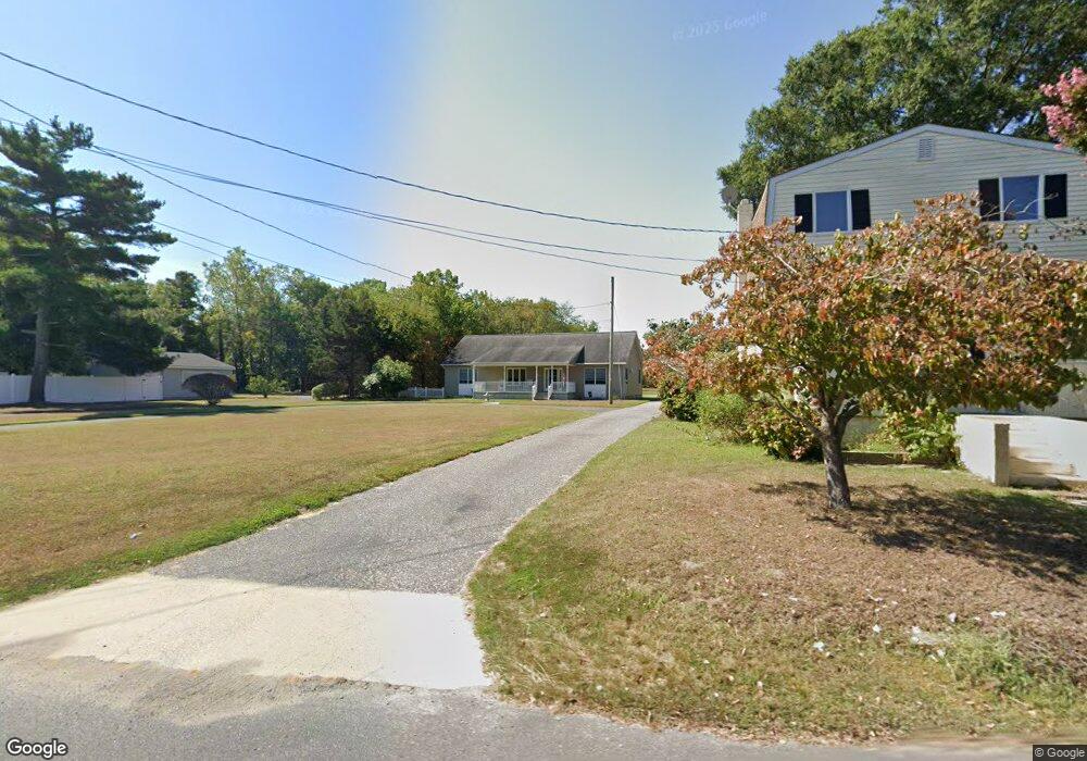
688A Town Bank Rd Cape May, NJ 08204
Estimated Value: $589,000 - $856,000
--
Bed
--
Bath
1,680
Sq Ft
$410/Sq Ft
Est. Value
About This Home
This home is located at 688A Town Bank Rd, Cape May, NJ 08204 and is currently estimated at $689,519, approximately $410 per square foot. 688A Town Bank Rd is a home located in Cape May County with nearby schools including Carl T. Mitnick School, David C. Douglass Veterans Memorial School, and Maud Abrams School.
Ownership History
Date
Name
Owned For
Owner Type
Purchase Details
Closed on
Sep 25, 2014
Sold by
Harris Bertha J and Estate Of James P Harris Sr
Bought by
Harris Bertha J
Current Estimated Value
Purchase Details
Closed on
Oct 4, 2006
Sold by
Bartleson Harold W and Bartleson Pattiann
Bought by
Harris James P and Harris Bertha J
Home Financials for this Owner
Home Financials are based on the most recent Mortgage that was taken out on this home.
Original Mortgage
$175,000
Outstanding Balance
$104,887
Interest Rate
6.54%
Mortgage Type
Credit Line Revolving
Estimated Equity
$584,632
Create a Home Valuation Report for This Property
The Home Valuation Report is an in-depth analysis detailing your home's value as well as a comparison with similar homes in the area
Home Values in the Area
Average Home Value in this Area
Purchase History
| Date | Buyer | Sale Price | Title Company |
|---|---|---|---|
| Harris Bertha J | -- | None Available | |
| Harris James P | $350,000 | The Title Company Of Jersey |
Source: Public Records
Mortgage History
| Date | Status | Borrower | Loan Amount |
|---|---|---|---|
| Open | Harris James P | $175,000 |
Source: Public Records
Tax History Compared to Growth
Tax History
| Year | Tax Paid | Tax Assessment Tax Assessment Total Assessment is a certain percentage of the fair market value that is determined by local assessors to be the total taxable value of land and additions on the property. | Land | Improvement |
|---|---|---|---|---|
| 2025 | $5,291 | $260,900 | $106,500 | $154,400 |
| 2024 | $5,291 | $260,900 | $106,500 | $154,400 |
| 2023 | $5,215 | $260,900 | $106,500 | $154,400 |
| 2022 | $5,056 | $260,900 | $106,500 | $154,400 |
| 2021 | $4,405 | $260,900 | $106,500 | $154,400 |
| 2020 | $4,827 | $260,900 | $106,500 | $154,400 |
| 2019 | $4,707 | $260,900 | $106,500 | $154,400 |
| 2018 | $4,594 | $260,900 | $106,500 | $154,400 |
| 2017 | $4,600 | $260,900 | $106,500 | $154,400 |
| 2016 | $4,529 | $260,900 | $106,500 | $154,400 |
| 2015 | $4,383 | $260,900 | $106,500 | $154,400 |
| 2014 | $4,240 | $260,900 | $106,500 | $154,400 |
Source: Public Records
Map
Nearby Homes
- 818 Shunpike Rd
- 668 Crawford Rd
- 808 Westfield Ave
- 54 Heron Way
- 207 Old Mill Dr
- 3911 Bayshore Rd
- 118 Old Mill Dr
- 3941 Bayshore Rd
- 753 Route 9 Unit U
- 67 Capewoods Rd
- 4 Osprey Dr
- 105 Orchard Dr
- 712 Gorham Ave
- 602 Gorham Ave
- 210 Pontaxit Ave
- 313 Nantucket Dr
- 305 Whildam Ave
- 402 Whildam Ave
- 1023 Shunpike Rd
- 113 Heidi Ave
- 688 Town Bank Rd
- 688 Town Bank Rd
- 686 Town Bank Rd
- 684 Town Bank Rd
- 690 Town Bank Rd
- 687 Town Bank Rd
- 683 Town Bank Rd
- 682 Town Bank Rd
- 692 Town Bank Rd
- 689 Town Bank Rd
- 6 Leigh Ct
- 4 Leigh Ct
- 691 Town Bank Rd
- 5 Clay Ct
- 694 Town Bank Rd
- 679 Town Bank Rd
- 7 Clay Ct
- 3 Clay Ct
- 696 Town Bank Rd
- 695 Town Bank Rd