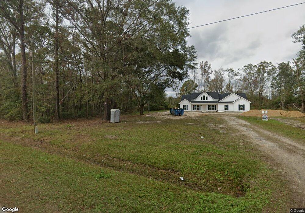
689 Dave Williams Rd Midway, GA 31320
Estimated Value: $133,000 - $420,000
2
Beds
2
Baths
1,484
Sq Ft
$185/Sq Ft
Est. Value
About This Home
This home is located at 689 Dave Williams Rd, Midway, GA 31320 and is currently estimated at $274,000, approximately $184 per square foot. 689 Dave Williams Rd is a home located in Liberty County with nearby schools including Liberty Elementary School, Midway Middle School, and Liberty County High School.
Ownership History
Date
Name
Owned For
Owner Type
Purchase Details
Closed on
Mar 1, 2024
Sold by
Williams Nathaniel M
Bought by
Roberts Michael Eugene and Roberts Sarah Brunswick
Current Estimated Value
Purchase Details
Closed on
Mar 9, 2021
Sold by
Williams Arlene Estate
Bought by
Williams Nathaniel
Purchase Details
Closed on
Jul 13, 2016
Sold by
Arleane
Bought by
Wilson Lakisha Marie
Purchase Details
Closed on
Jun 8, 1978
Bought by
Williams Arlene
Create a Home Valuation Report for This Property
The Home Valuation Report is an in-depth analysis detailing your home's value as well as a comparison with similar homes in the area
Home Values in the Area
Average Home Value in this Area
Purchase History
| Date | Buyer | Sale Price | Title Company |
|---|---|---|---|
| Roberts Michael Eugene | $22,500 | -- | |
| Williams Nathaniel | -- | -- | |
| Wilson Lakisha Marie | -- | -- | |
| Williams Arlene | -- | -- |
Source: Public Records
Tax History Compared to Growth
Tax History
| Year | Tax Paid | Tax Assessment Tax Assessment Total Assessment is a certain percentage of the fair market value that is determined by local assessors to be the total taxable value of land and additions on the property. | Land | Improvement |
|---|---|---|---|---|
| 2024 | $842 | $34,521 | $6,967 | $27,554 |
| 2023 | $842 | $31,230 | $6,967 | $24,263 |
| 2022 | $344 | $26,588 | $6,967 | $19,621 |
| 2021 | $268 | $24,679 | $6,967 | $17,712 |
| 2020 | $402 | $28,458 | $10,437 | $18,021 |
| 2019 | $517 | $28,766 | $10,437 | $18,329 |
| 2018 | $520 | $29,075 | $10,437 | $18,638 |
| 2017 | $968 | $29,384 | $10,437 | $18,947 |
| 2016 | $501 | $29,693 | $10,437 | $19,256 |
| 2015 | $561 | $29,190 | $9,934 | $19,256 |
| 2014 | $561 | $30,946 | $10,588 | $20,359 |
| 2013 | -- | $0 | $0 | $0 |
Source: Public Records
Map
Nearby Homes
- 176 Dave Williams Rd
- 2 Acres Walthour Rd
- 7337 E Oglethorpe Hwy
- 6228 E Oglethorpe Hwy
- 1.0 Acre Holmestown Rd
- 1 Acre Holmestown Rd
- 8701 E Oglethorpe Hwy
- 8578 E B Cooper Hwy
- 223 Claudia Ln
- 296 River Bend Dr
- 327 River Bend Dr
- 364 River Bend Dr
- 0 E Oglethorpe Unit SA341930
- 0 E Oglethorpe Unit 153327
- 0 E Oglethorpe Unit 10592168
- 334 Isaac Stevens Rd
- 90 Charleston Ct
- TRACT 1 U S Highway 84 E
- 1123 Stone Ct
- 21 Smiley Loop Rd
- 0 Big Star Ln
- 610 Dave Williams Rd
- 927 Dave Williams Rd
- 550 Dave Williams Rd
- 892 Dave Williams Rd
- 904 Dave Williams Rd
- 914 Dave Williams Rd
- 486 Dave Williams Rd
- 954 Dave Williams Rd
- 641 Screven Fork Rd
- 1001 Dave Williams Rd
- 847 Screven Fork Rd
- 397 Dave Williams Rd
- 397 Dave Williams Rd
- 386 Dave Williams Rd
- 1028 Dave Williams Rd
- 363 Dave Williams Rd
- 0 Pepper Rd
- 755 Screven Fork Rd
- 741 Screven Fork Rd