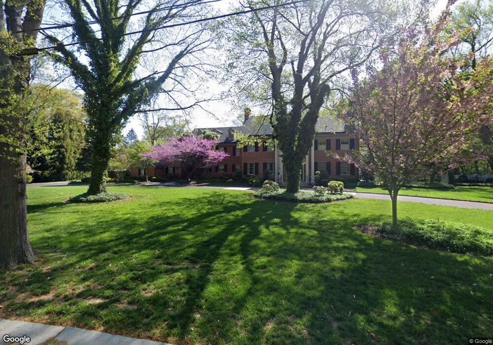
689 Golf View Rd Moorestown, NJ 08057
Estimated Value: $2,111,000 - $2,918,000
--
Bed
--
Bath
7,755
Sq Ft
$314/Sq Ft
Est. Value
About This Home
This home is located at 689 Golf View Rd, Moorestown, NJ 08057 and is currently estimated at $2,438,778, approximately $314 per square foot. 689 Golf View Rd is a home located in Burlington County with nearby schools including George C. Baker Elementary School, Moorestown Upper Elementary School, and William Allen Middle School.
Ownership History
Date
Name
Owned For
Owner Type
Purchase Details
Closed on
May 16, 2007
Sold by
Estate Of Eleanor Kelemen and Kelemen Charles F
Bought by
Kohn Henry and Kohn Cynthia
Current Estimated Value
Home Financials for this Owner
Home Financials are based on the most recent Mortgage that was taken out on this home.
Original Mortgage
$900,000
Interest Rate
6.72%
Mortgage Type
Purchase Money Mortgage
Create a Home Valuation Report for This Property
The Home Valuation Report is an in-depth analysis detailing your home's value as well as a comparison with similar homes in the area
Home Values in the Area
Average Home Value in this Area
Purchase History
| Date | Buyer | Sale Price | Title Company |
|---|---|---|---|
| Kohn Henry | $1,160,000 | Infinity Title Agency |
Source: Public Records
Mortgage History
| Date | Status | Borrower | Loan Amount |
|---|---|---|---|
| Previous Owner | Kohn Henry | $900,000 |
Source: Public Records
Tax History Compared to Growth
Tax History
| Year | Tax Paid | Tax Assessment Tax Assessment Total Assessment is a certain percentage of the fair market value that is determined by local assessors to be the total taxable value of land and additions on the property. | Land | Improvement |
|---|---|---|---|---|
| 2025 | $34,759 | $1,225,200 | $400,800 | $824,400 |
| 2024 | $33,705 | $1,225,200 | $400,800 | $824,400 |
| 2023 | $33,705 | $1,225,200 | $400,800 | $824,400 |
| 2022 | $33,362 | $1,225,200 | $400,800 | $824,400 |
| 2021 | $32,921 | $1,225,200 | $400,800 | $824,400 |
| 2020 | $32,713 | $1,225,200 | $400,800 | $824,400 |
| 2019 | $32,137 | $1,225,200 | $400,800 | $824,400 |
| 2018 | $31,267 | $1,225,200 | $400,800 | $824,400 |
| 2017 | $31,537 | $1,225,200 | $400,800 | $824,400 |
| 2016 | $31,426 | $1,225,200 | $400,800 | $824,400 |
| 2015 | $31,047 | $1,225,200 | $400,800 | $824,400 |
| 2014 | $29,478 | $1,225,200 | $400,800 | $824,400 |
Source: Public Records
Map
Nearby Homes
- 205 E Central Ave
- 744 Signal Light Rd
- 863 Golf View Rd
- 308 Elm St
- 133 Plum St Unit 6
- 408 E 2nd St
- 80 E 3rd St
- 82 E 3rd St
- 66 E 3rd St
- 50 E 3rd St
- 514 E Main St
- 7 Whitetail Ct
- 526 E Main St
- 15 E 2nd St
- 628 Windsock Way
- 633 E Main St Unit B7
- 129 S Church St
- 493 N Church St
- 543 Bethel Ave
- 11 E Sutton Ave