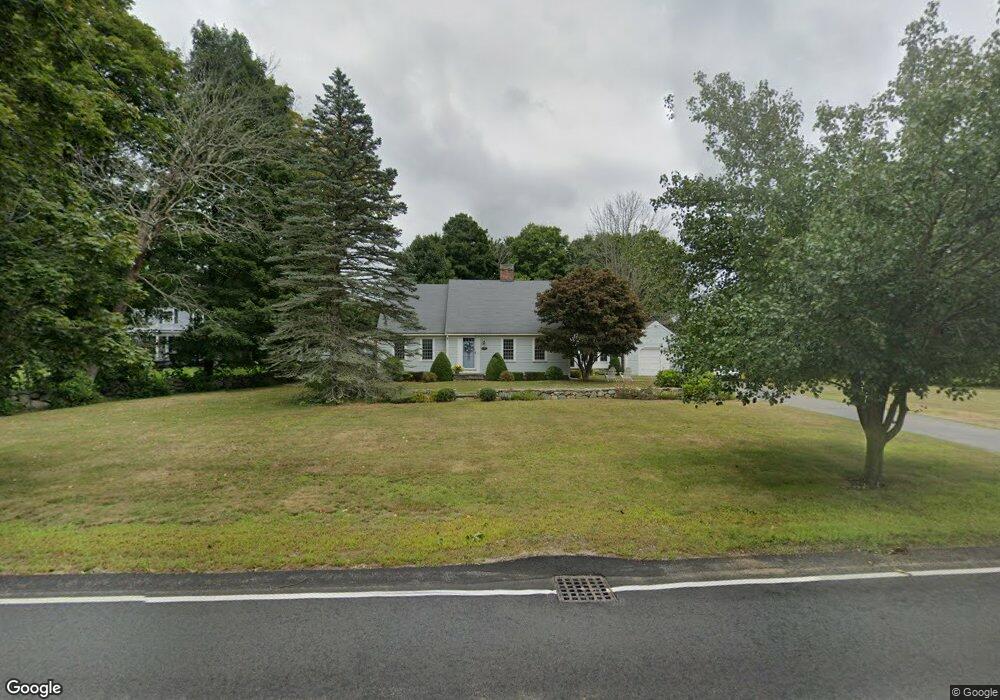
689 Main St Hanover, MA 02339
Estimated Value: $780,000 - $991,000
3
Beds
2
Baths
1,929
Sq Ft
$458/Sq Ft
Est. Value
About This Home
This home is located at 689 Main St, Hanover, MA 02339 and is currently estimated at $883,704, approximately $458 per square foot. 689 Main St is a home located in Plymouth County with nearby schools including Hanover High School, South Shore Charter Public School, and The Master's Academy.
Ownership History
Date
Name
Owned For
Owner Type
Purchase Details
Closed on
Nov 5, 2021
Sold by
Tokarz Lisa M and Tokarz Joseph
Bought by
Tokarz Lisa M
Current Estimated Value
Purchase Details
Closed on
Apr 3, 2012
Sold by
Tokarz Lisa M
Bought by
Tokarz Joseph and Tokarz Lisa M
Home Financials for this Owner
Home Financials are based on the most recent Mortgage that was taken out on this home.
Original Mortgage
$237,000
Interest Rate
3.88%
Mortgage Type
New Conventional
Purchase Details
Closed on
Aug 19, 2004
Sold by
Tokarz Joseph and Tokarz Lisa M
Bought by
Tokarz Lisa M
Home Financials for this Owner
Home Financials are based on the most recent Mortgage that was taken out on this home.
Original Mortgage
$171,600
Interest Rate
6.03%
Mortgage Type
Purchase Money Mortgage
Purchase Details
Closed on
Jun 28, 2000
Sold by
Rws Rt and Smith Frederick S
Bought by
Tokarz Lisa M and Tokarz Joseph
Purchase Details
Closed on
Jun 29, 1999
Sold by
Lebrun Jean and Lebrun Gladys
Bought by
Berlus Max Jc
Create a Home Valuation Report for This Property
The Home Valuation Report is an in-depth analysis detailing your home's value as well as a comparison with similar homes in the area
Home Values in the Area
Average Home Value in this Area
Purchase History
| Date | Buyer | Sale Price | Title Company |
|---|---|---|---|
| Tokarz Lisa M | -- | None Available | |
| Tokarz Joseph | -- | -- | |
| Tokarz Lisa M | -- | -- | |
| Tokarz Lisa M | $339,900 | -- | |
| Berlus Max Jc | $27,585 | -- |
Source: Public Records
Mortgage History
| Date | Status | Borrower | Loan Amount |
|---|---|---|---|
| Previous Owner | Tokarz Joseph | $237,000 | |
| Previous Owner | Berlus Max Jc | $245,000 | |
| Previous Owner | Berlus Max Jc | $75,000 | |
| Previous Owner | Berlus Max Jc | $171,600 | |
| Previous Owner | Berlus Max Jc | $176,500 |
Source: Public Records
Tax History
| Year | Tax Paid | Tax Assessment Tax Assessment Total Assessment is a certain percentage of the fair market value that is determined by local assessors to be the total taxable value of land and additions on the property. | Land | Improvement |
|---|---|---|---|---|
| 2025 | $8,740 | $707,700 | $337,500 | $370,200 |
| 2024 | $8,563 | $666,900 | $337,500 | $329,400 |
| 2023 | $8,294 | $614,800 | $307,200 | $307,600 |
| 2022 | $7,938 | $520,500 | $256,300 | $264,200 |
| 2021 | $7,979 | $488,600 | $233,200 | $255,400 |
| 2020 | $7,897 | $484,200 | $233,200 | $251,000 |
| 2019 | $7,403 | $451,100 | $233,200 | $217,900 |
| 2018 | $7,272 | $446,700 | $233,200 | $213,500 |
| 2017 | $6,919 | $418,800 | $238,500 | $180,300 |
| 2016 | $6,768 | $401,400 | $216,900 | $184,500 |
| 2015 | $6,663 | $412,600 | $236,500 | $176,100 |
Source: Public Records
Map
Nearby Homes
- 776 Main St
- 506 Main St
- 44 Stone Meadow Ln
- 47 Stone Meadow Ln
- 53 Chestnut St
- 62 Larchmont Ln
- 535 Webster St
- 168 Larchmont Ln
- 46 Brookwood Rd
- 36 Bayberry Ln
- 18 Winterberry Ln
- 49 Washington Park Dr
- 7 Assinippi Ave Unit 205
- 7 Assinippi Ave Unit 306
- 36 Grove St
- 250 Center St
- 738 Whiting St
- 561 Circuit St
- 51 Cervelli Farm Dr
- 37 Dr
- 33 Buttercup Ln
- 691 Main St
- 665 Main St
- 665 Main St Unit 1
- Lot 30 Main St
- 0 Main St
- 22 Buena Vista Way
- 29 Buena Vista Way
- 662 Main St
- 47 Buttercup Ln
- 0 Buttercup Ln
- 647 Main St
- 20 Buttercup Ln
- 32 Buttercup Ln
- 44 Buena Vista Way
- 715 Main St Unit 3
- 715 Main St Unit 2-South
- 715 Main St Unit 2
- 715 Main St
- 41 Buena Vista Way
Your Personal Tour Guide
Ask me questions while you tour the home.