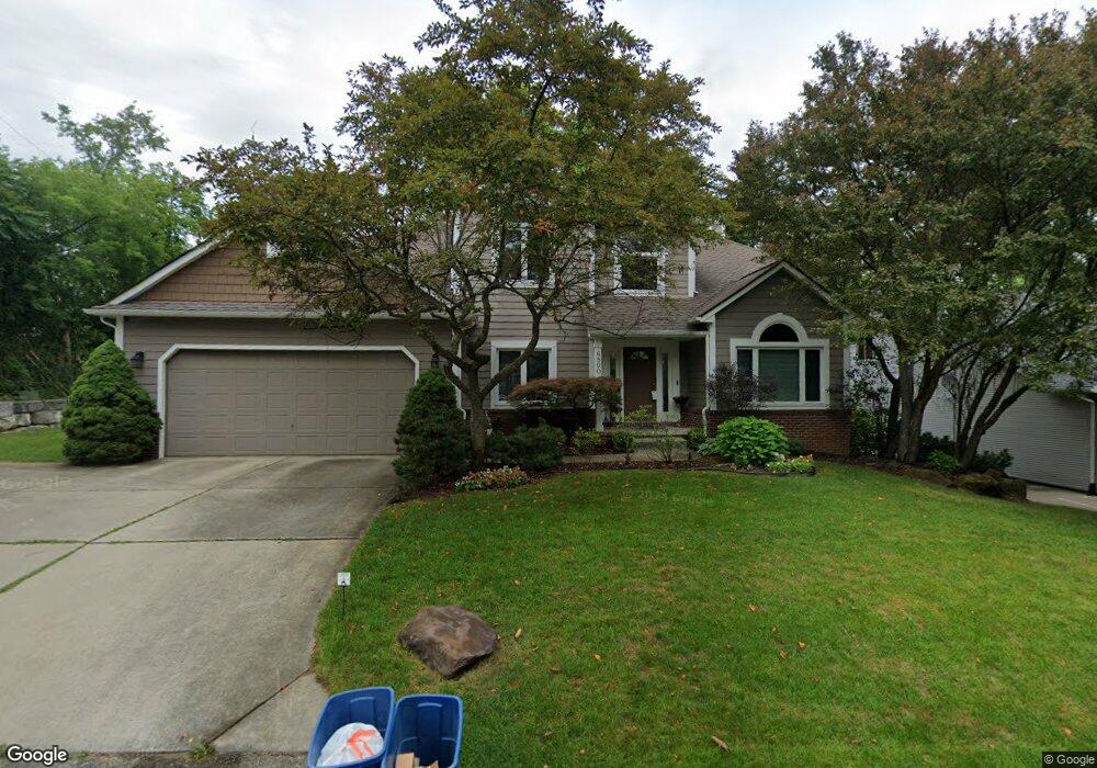
6890 Renshaw St West Bloomfield, MI 48323
Estimated Value: $498,000 - $656,000
3
Beds
5
Baths
2,346
Sq Ft
$245/Sq Ft
Est. Value
About This Home
This home is located at 6890 Renshaw St, West Bloomfield, MI 48323 and is currently estimated at $574,229, approximately $244 per square foot. 6890 Renshaw St is a home located in Oakland County with nearby schools including Walled Lake Central High School, The Susan And Rabbi Harold Loss Ecc, and Brookfield Academy - West Bloomfield.
Ownership History
Date
Name
Owned For
Owner Type
Purchase Details
Closed on
Feb 27, 2004
Sold by
Desautels Thomas P and Desautels Teresa L
Bought by
Stacey Donald
Current Estimated Value
Home Financials for this Owner
Home Financials are based on the most recent Mortgage that was taken out on this home.
Original Mortgage
$320,000
Outstanding Balance
$129,266
Interest Rate
3.75%
Mortgage Type
Purchase Money Mortgage
Estimated Equity
$444,963
Create a Home Valuation Report for This Property
The Home Valuation Report is an in-depth analysis detailing your home's value as well as a comparison with similar homes in the area
Home Values in the Area
Average Home Value in this Area
Purchase History
| Date | Buyer | Sale Price | Title Company |
|---|---|---|---|
| Stacey Donald | $400,000 | Philip R Seaver Title Co Inc |
Source: Public Records
Mortgage History
| Date | Status | Borrower | Loan Amount |
|---|---|---|---|
| Open | Stacey Donald | $320,000 |
Source: Public Records
Tax History Compared to Growth
Tax History
| Year | Tax Paid | Tax Assessment Tax Assessment Total Assessment is a certain percentage of the fair market value that is determined by local assessors to be the total taxable value of land and additions on the property. | Land | Improvement |
|---|---|---|---|---|
| 2024 | $2,902 | $230,120 | $0 | $0 |
| 2022 | $2,736 | $213,180 | $37,980 | $175,200 |
| 2021 | $4,499 | $202,980 | $0 | $0 |
| 2020 | $2,704 | $192,960 | $37,980 | $154,980 |
| 2018 | $4,379 | $168,330 | $37,980 | $130,350 |
| 2015 | -- | $140,110 | $0 | $0 |
| 2014 | -- | $130,010 | $0 | $0 |
| 2011 | -- | $112,900 | $0 | $0 |
Source: Public Records
Map
Nearby Homes
- 4442 Borland St
- 6980 Hambro St
- 4335 Crestdale Ave
- 4540 Rolling Pine Ct
- 4066 Green Lake Rd
- 6978 Colony Dr
- 0000 Langtoft
- 6675 Langtoft St
- 4245 Bunker Ave
- 3991 Fieldview Ave
- 3965 Carrick Ave
- 4212 Greendale Ave
- 3950 Bradmore Ave
- 6903 Dandison Blvd
- 7337 Richardson Rd
- 7381 Crestmore St
- 6768 Buckland Ave
- 7359 Woodlore Dr
- 3632 Fieldview Ave
- 7065 Deerwood Trail Unit 27
- 6858 Renshaw St
- 4460 Bethune Ct
- 6868 Renshaw St
- 4405 Welland Dr
- 4411 Welland Dr
- 4459 Bethune Ct
- 4470 Bethune Ct
- 4395 Welland Dr
- 4445 Welland Dr
- 4465 Bethune Ct
- 4480 Bethune Ct
- 4410 Borland St
- 4385 Welland Dr
- 4485 Bethune Ct
- 4408 Welland Dr
- 4454 Borland St
- 6900 Abbott
- 4466 Borland St
- 4384 Borland St
- 4490 Bethune Ct