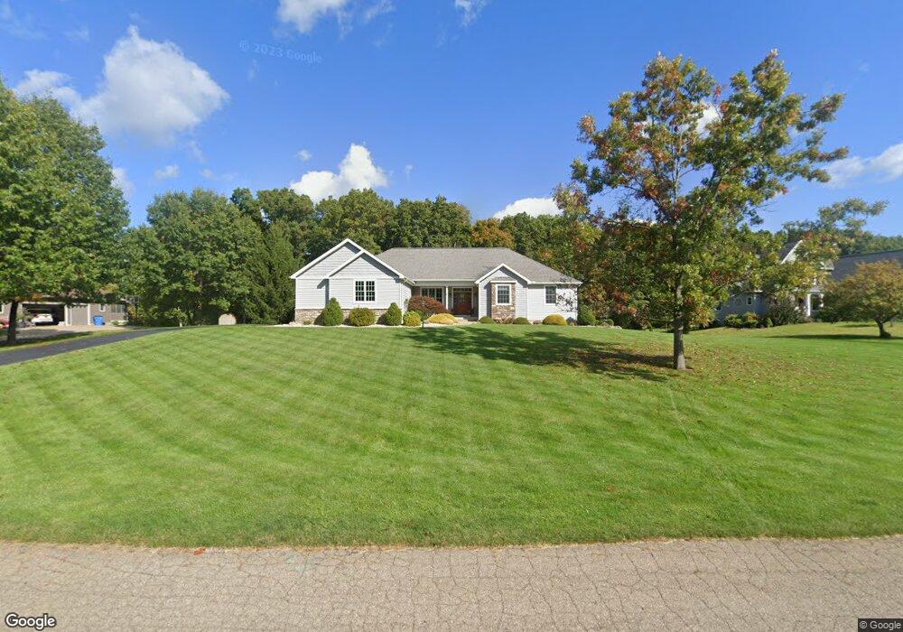
6892 Cambria Dr Unit 3 Spring Arbor, MI 49283
Estimated Value: $396,190 - $483,000
Studio
3
Baths
1,773
Sq Ft
$245/Sq Ft
Est. Value
About This Home
This home is located at 6892 Cambria Dr Unit 3, Spring Arbor, MI 49283 and is currently estimated at $435,048, approximately $245 per square foot. 6892 Cambria Dr Unit 3 is a home located in Jackson County with nearby schools including Western High School and Paragon Charter Academy.
Ownership History
Date
Name
Owned For
Owner Type
Purchase Details
Closed on
Nov 4, 2004
Sold by
Stonewood Associates Llc
Bought by
Luplow James D and Luplow Susan L
Current Estimated Value
Home Financials for this Owner
Home Financials are based on the most recent Mortgage that was taken out on this home.
Original Mortgage
$237,800
Outstanding Balance
$112,458
Interest Rate
5%
Mortgage Type
Purchase Money Mortgage
Estimated Equity
$322,590
Create a Home Valuation Report for This Property
The Home Valuation Report is an in-depth analysis detailing your home's value as well as a comparison with similar homes in the area
Purchase History
| Date | Buyer | Sale Price | Title Company |
|---|---|---|---|
| Luplow James D | $33,200 | At |
Source: Public Records
Mortgage History
| Date | Status | Borrower | Loan Amount |
|---|---|---|---|
| Open | Luplow James D | $237,800 |
Source: Public Records
Tax History
| Year | Tax Paid | Tax Assessment Tax Assessment Total Assessment is a certain percentage of the fair market value that is determined by local assessors to be the total taxable value of land and additions on the property. | Land | Improvement |
|---|---|---|---|---|
| 2025 | $4,808 | $202,100 | $0 | $0 |
| 2024 | $29 | $192,000 | $0 | $0 |
| 2023 | $2,855 | $188,300 | $0 | $0 |
| 2022 | $4,363 | $181,300 | $0 | $0 |
| 2021 | $4,284 | $168,710 | $0 | $0 |
| 2020 | $4,233 | $152,360 | $0 | $0 |
| 2019 | $4,024 | $139,300 | $0 | $0 |
| 2018 | $4,010 | $122,720 | $17,490 | $105,230 |
| 2017 | $3,798 | $120,490 | $0 | $0 |
| 2016 | $2,418 | $119,520 | $119,520 | $0 |
| 2015 | $99,354 | $111,850 | $111,850 | $0 |
| 2014 | $99,354 | $103,690 | $0 | $0 |
| 2013 | -- | $103,690 | $103,690 | $0 |
Source: Public Records
Map
Nearby Homes
- 7315 King Rd
- 2503 Milford Rd
- 6728 King Rd
- V/L S Dearing Rd Unit 40 Acres Vacant Land
- 0 King Rd Unit 25060444
- 1864 Chapel Rd
- 1570 Chapel Rd
- 1126 Chapel Rd
- 68 Dickens St
- 4920 Slayton Rd
- 4880 Indian Creek Dr Unit 26
- 4055 Mathews Rd
- 28 Engelhardt Strasse
- 4894 Indian Creek Dr
- 2659 Fairway Dr
- 4540 Westbrook Dr Unit 45
- 4040 Aviara Oaks Pkwy
- 1956 Trinity Ln
- 2431 N Dearing Rd
- 208 Glasgow Rd
- 6888 Cambria Dr Unit 4
- 6896 Cambria Dr Unit 2
- Lot 10 Cambria Dr Unit 6881 Cambria Dr.
- 0 Cambria Unit 6873,Unit 8
- 6884 Cambria Dr Unit 5
- 6893 Cambria Dr Unit 13
- 6903 Cambria Dr
- 6889 Cambria Dr
- 6889 Cambria Dr Unit 12
- 6885 Cambria Dr Unit 11
- 6901 Cambria Dr Unit 15
- 6901 Cambria Dr
- 6878 Cambria Dr Unit 6
- 6877 Cambria Dr Unit 9
- 6874 Cambria Dr Unit 7
- 2251 S Dearing Rd
- 2251 Dearing Rd
- 6900 Cambria Dr Unit 1
- 6900 Cambria Dr
- 2264 Dearing Rd
Your Personal Tour Guide
Ask me questions while you tour the home.