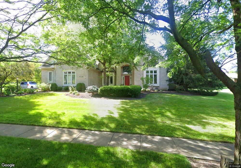
6893 Longest Dr Carmel, IN 46033
East Carmel NeighborhoodEstimated Value: $970,000 - $1,397,000
5
Beds
5
Baths
6,067
Sq Ft
$185/Sq Ft
Est. Value
About This Home
This home is located at 6893 Longest Dr, Carmel, IN 46033 and is currently estimated at $1,119,687, approximately $184 per square foot. 6893 Longest Dr is a home located in Hamilton County with nearby schools including Prairie Trace Elementary School, Clay Middle School, and Carmel High School.
Ownership History
Date
Name
Owned For
Owner Type
Purchase Details
Closed on
Nov 16, 2009
Sold by
Orme Matthew M and Orme Katherine D
Bought by
Orme Matthew M and Orme Katherine D
Current Estimated Value
Home Financials for this Owner
Home Financials are based on the most recent Mortgage that was taken out on this home.
Original Mortgage
$417,000
Interest Rate
5.11%
Mortgage Type
New Conventional
Purchase Details
Closed on
Dec 4, 2008
Sold by
Gerber Randy L and Gerber Debra S
Bought by
Orme Matthew M and Orme Katherine D
Home Financials for this Owner
Home Financials are based on the most recent Mortgage that was taken out on this home.
Original Mortgage
$513,600
Interest Rate
6.49%
Mortgage Type
Purchase Money Mortgage
Purchase Details
Closed on
Aug 25, 2004
Sold by
Discovery Custom Builders Inc
Bought by
Gerber Randy L and Gerber Debra S
Create a Home Valuation Report for This Property
The Home Valuation Report is an in-depth analysis detailing your home's value as well as a comparison with similar homes in the area
Home Values in the Area
Average Home Value in this Area
Purchase History
| Date | Buyer | Sale Price | Title Company |
|---|---|---|---|
| Orme Matthew M | -- | First American Title Ins Co | |
| Orme Matthew M | -- | None Available | |
| Gerber Randy L | -- | -- |
Source: Public Records
Mortgage History
| Date | Status | Borrower | Loan Amount |
|---|---|---|---|
| Closed | Orme Matthew M | $417,000 | |
| Closed | Orme Matthew M | $513,600 |
Source: Public Records
Tax History
| Year | Tax Paid | Tax Assessment Tax Assessment Total Assessment is a certain percentage of the fair market value that is determined by local assessors to be the total taxable value of land and additions on the property. | Land | Improvement |
|---|---|---|---|---|
| 2025 | $9,384 | $850,500 | $154,700 | $695,800 |
| 2024 | $7,781 | $817,000 | $154,700 | $662,300 |
| 2023 | $7,781 | $669,700 | $154,700 | $515,000 |
| 2022 | $7,952 | $670,600 | $153,600 | $517,000 |
| 2021 | $7,370 | $627,100 | $153,600 | $473,500 |
| 2020 | $7,534 | $639,900 | $153,600 | $486,300 |
| 2019 | $7,466 | $634,400 | $161,900 | $472,500 |
| 2018 | $7,426 | $636,200 | $161,900 | $474,300 |
| 2017 | $6,751 | $604,600 | $161,900 | $442,700 |
| 2016 | $6,758 | $615,000 | $161,900 | $453,100 |
| 2014 | $6,461 | $589,900 | $134,200 | $455,700 |
| 2013 | $6,461 | $595,100 | $134,200 | $460,900 |
Source: Public Records
Map
Nearby Homes
- 13137 Brooks Landing Place
- 5873 Lost Oaks Dr
- 5741 Turnbull Ct
- 5790 Annandale Dr
- 5971 Sandalwood Dr
- 7191 Pymbroke Cir
- 7300 Pymbroke Cir
- 13135 Player Cir
- 14081 Trueblood Ln
- 13165 Allisonville Rd
- 12751 Kiawah Dr
- 7248 River Glen Dr
- 7257 River Glen Dr
- 220 Heady Ln
- 12550 Scottish Bend
- 6966 Cherry Creek Blvd
- 11927 Halla Place
- 7212 Cherry Creek Blvd
- 14219 Larson Dr
- 5872 Sandalwood Dr
- 6899 Longest Dr
- 5958 Kirkendall Ct
- 5960 Kirkendall Ct
- 5956 Kirkendall Ct
- 6905 Longest Dr
- 13102 Thomas Morris Trace
- 13105 Thomas Morris Trace
- 5962 Kirkendall Ct
- 13098 Mcduffee Run
- 13103 Franklin Hall Trail
- 13084 Mcduffee Run
- 13104 Thomas Morris Trace
- 13070 Mcduffee Run
- 5959 Kirkendall Ct
- 13105 Franklin Hall Trail
- 13107 Thomas Morris Trace
- 5957 Kirkendall Ct
- 5964 Kirkendall Ct
- 5961 Kirkendall Ct
- 13106 Thomas Morris Trace
Your Personal Tour Guide
Ask me questions while you tour the home.