Estimated Value: $327,339 - $357,000
3
Beds
2
Baths
1,602
Sq Ft
$215/Sq Ft
Est. Value
About This Home
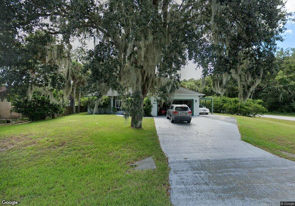
This home is located at 6894 Hartford Rd, Cocoa, FL 32927 and is currently estimated at $344,335, approximately $214 per square foot. 6894 Hartford Rd is a home located in Brevard County with nearby schools including Atlantis Elementary School, Space Coast Junior/Senior High School, and Sculptor Charter School.
Ownership History
Date
Name
Owned For
Owner Type
Purchase Details
Closed on
Jul 1, 2021
Sold by
Elder David L
Bought by
David L Elder Revocable Trust
Current Estimated Value
Purchase Details
Closed on
Apr 29, 2021
Sold by
Elder David L and Elder Shirley P
Bought by
Elder David L
Purchase Details
Closed on
Feb 20, 2004
Sold by
Lovretin Donald and Lovretin Welna
Bought by
Elder David L and Elder Shirley P
Purchase Details
Closed on
Sep 30, 1999
Sold by
Wiler Thomas A and Wiler Theresa M
Bought by
Lovretin Donald and Lovretin Welna
Purchase Details
Closed on
Sep 12, 1994
Sold by
Lamicella Angela M and Bruzzese Nicholas
Bought by
Wiler Thomas A and Wiler Theresa M
Create a Home Valuation Report for This Property
The Home Valuation Report is an in-depth analysis detailing your home's value as well as a comparison with similar homes in the area
Home Values in the Area
Average Home Value in this Area
Purchase History
| Date | Buyer | Sale Price | Title Company |
|---|---|---|---|
| David L Elder Revocable Trust | $100 | None Listed On Document | |
| Elder David L | -- | Accommodation | |
| Elder David L | $32,000 | -- | |
| Lovretin Donald | $13,500 | -- | |
| Wiler Thomas A | $9,500 | -- |
Source: Public Records
Tax History Compared to Growth
Tax History
| Year | Tax Paid | Tax Assessment Tax Assessment Total Assessment is a certain percentage of the fair market value that is determined by local assessors to be the total taxable value of land and additions on the property. | Land | Improvement |
|---|---|---|---|---|
| 2025 | $630 | $112,030 | -- | -- |
| 2024 | $612 | $105,680 | -- | -- |
| 2023 | $612 | $102,610 | $0 | $0 |
| 2022 | $871 | $99,630 | $0 | $0 |
| 2021 | $857 | $96,730 | $0 | $0 |
| 2020 | $1,285 | $95,400 | $0 | $0 |
| 2019 | $1,221 | $93,260 | $0 | $0 |
| 2018 | $1,214 | $91,530 | $0 | $0 |
| 2017 | $1,207 | $89,650 | $0 | $0 |
| 2016 | $1,208 | $87,810 | $18,000 | $69,810 |
| 2015 | $1,221 | $87,200 | $15,000 | $72,200 |
| 2014 | $1,222 | $86,510 | $11,000 | $75,510 |
Source: Public Records
Map
Nearby Homes
- 4760 Ivan St
- 7035 Jasmine Ave
- 6840 Anecia Ave
- 6735 Grissom Pkwy
- 4859 Horton St
- 4635 Alfred St
- 4390 Everglades St
- 7160 Carlowe Ave
- 7155 Export Ave
- 7020 Ackerman Ave
- 4688 Fairsun St
- 7065 Bright Ave
- 5090 Market St
- 6839 Ackerman Ave
- 6499 Pleasant Ave
- 7081 Bayfront Rd
- 7315 Darien Rd
- 5155 Mayflower St
- 6390 Depot Ave
- 0000 Grissom Pkwy