Estimated Value: $499,000 - $570,000
4
Beds
3
Baths
2,386
Sq Ft
$223/Sq Ft
Est. Value
About This Home
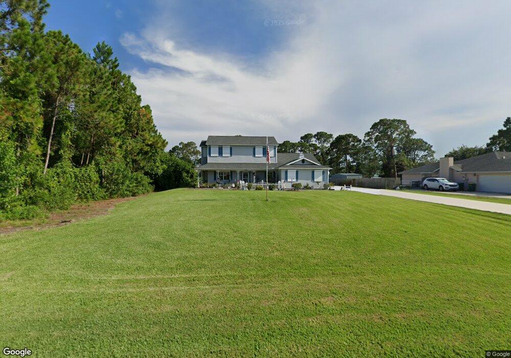
This home is located at 6895 Hundred Acre Dr, Cocoa, FL 32927 and is currently estimated at $531,351, approximately $222 per square foot. 6895 Hundred Acre Dr is a home located in Brevard County with nearby schools including Enterprise Elementary School, Space Coast Junior/Senior High School, and East Atlantic Prep of Brevard County.
Ownership History
Date
Name
Owned For
Owner Type
Purchase Details
Closed on
Mar 19, 2013
Sold by
Sparkman Gloria Lee and Metz Gloria L
Bought by
Sparkman Gloria Lee and Sparkman James Timothy
Current Estimated Value
Purchase Details
Closed on
Jul 21, 2003
Sold by
Metz Richard D and Metz Gloria L
Bought by
Metz Gloria L
Purchase Details
Closed on
Dec 22, 1993
Sold by
Romar Homes Inc
Bought by
Metz Gloria L and Metz Richard D
Home Financials for this Owner
Home Financials are based on the most recent Mortgage that was taken out on this home.
Original Mortgage
$15,200
Interest Rate
7.05%
Create a Home Valuation Report for This Property
The Home Valuation Report is an in-depth analysis detailing your home's value as well as a comparison with similar homes in the area
Home Values in the Area
Average Home Value in this Area
Purchase History
| Date | Buyer | Sale Price | Title Company |
|---|---|---|---|
| Sparkman Gloria Lee | -- | None Available | |
| Metz Gloria L | -- | -- | |
| Metz Gloria L | $19,000 | -- |
Source: Public Records
Mortgage History
| Date | Status | Borrower | Loan Amount |
|---|---|---|---|
| Previous Owner | Metz Gloria L | $15,200 |
Source: Public Records
Tax History Compared to Growth
Tax History
| Year | Tax Paid | Tax Assessment Tax Assessment Total Assessment is a certain percentage of the fair market value that is determined by local assessors to be the total taxable value of land and additions on the property. | Land | Improvement |
|---|---|---|---|---|
| 2025 | $2,516 | $188,490 | -- | -- |
| 2024 | $2,469 | $183,530 | -- | -- |
| 2023 | $2,469 | $178,190 | $0 | $0 |
| 2022 | $2,368 | $173,000 | $0 | $0 |
| 2021 | $2,405 | $167,970 | $0 | $0 |
| 2020 | $2,325 | $165,660 | $0 | $0 |
| 2019 | $2,269 | $161,940 | $0 | $0 |
| 2018 | $2,278 | $158,930 | $0 | $0 |
| 2017 | $2,291 | $155,670 | $0 | $0 |
| 2016 | $2,317 | $152,470 | $32,000 | $120,470 |
| 2015 | $2,373 | $151,420 | $32,000 | $119,420 |
| 2014 | $2,384 | $150,220 | $32,000 | $118,220 |
Source: Public Records
Map
Nearby Homes
- 6643 Emil Ave
- 7065 Hundred Acre Dr
- 6581 Bancroft Ave
- 6615 Dock Ave
- 5575 Curtis Blvd
- 4650 N Highway 1 Hwy
- 5715 Fairbridge St
- 6665 Addie Ave
- TBD Freeport Rd
- 7230 Venus Ave
- 5730 Friendly St
- 6105 Banyan St
- 6545 Addie Ave
- 5155 Mayflower St
- 00 Unknown
- 5090 Market St
- 7358 Crepe Myrtle Ct
- 7635 Fringe Place
- 5149 Arlington Rd Unit 104
- 23-35-21-JX-B-2 Aruin St
- 6885 Hundred Acre Dr
- 6915 Hundred Acre Dr
- 6875 Hundred Acre Dr
- 6900 Hundred Acre Dr
- 6925 Hundred Acre Dr
- 6865 Hundred Acre Dr
- 6890 Hundred Acre Dr
- 6725 Hundred Acre Dr
- 6715 Hundred Acre Dr
- 6735 Hundred Acre Dr
- 6880 Hundred Acre Dr
- 6920 Hundred Acre Dr
- 6745 Hundred Acre Dr
- 6935 Hundred Acre Dr
- 6855 Hundred Acre Dr
- 6870 Hundred Acre Dr
- 6930 Hundred Acre Dr
- 6695 Hundred Acre Dr
- 6755 Hundred Acre Dr
- 6705 Hundred Acre Dr