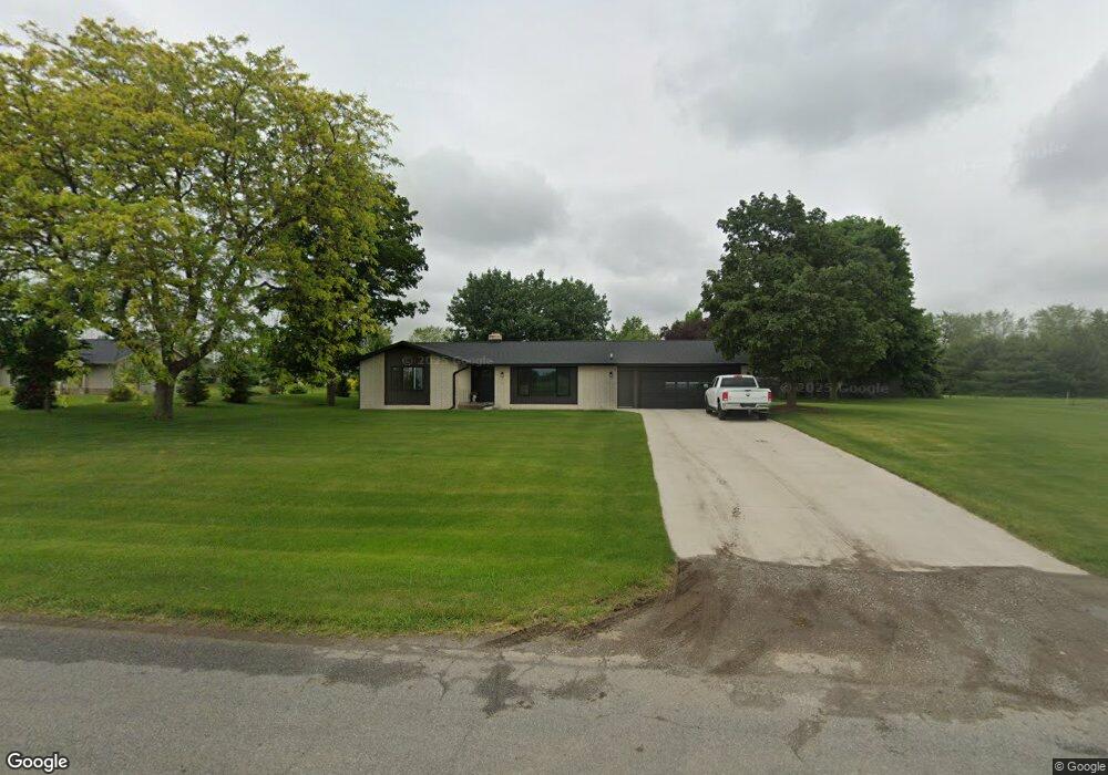
6895 Osborn St Allendale, MI 49401
Estimated Value: $324,477 - $378,000
--
Bed
1
Bath
1,432
Sq Ft
$244/Sq Ft
Est. Value
About This Home
This home is located at 6895 Osborn St, Allendale, MI 49401 and is currently estimated at $349,369, approximately $243 per square foot. 6895 Osborn St is a home located in Ottawa County with nearby schools including Evergreen Elementary School, Allendale Middle School, and Allendale High School.
Ownership History
Date
Name
Owned For
Owner Type
Purchase Details
Closed on
Jan 27, 2021
Sold by
Breen Roger and Breen Barbara
Bought by
Breen Roger and Breen Barbara
Current Estimated Value
Purchase Details
Closed on
Jul 17, 2020
Sold by
Weg Shirley A Van De and The Joe B Rotman Trust
Bought by
Breen Roger and Breen Barbara
Home Financials for this Owner
Home Financials are based on the most recent Mortgage that was taken out on this home.
Original Mortgage
$218,405
Interest Rate
2.8%
Mortgage Type
New Conventional
Create a Home Valuation Report for This Property
The Home Valuation Report is an in-depth analysis detailing your home's value as well as a comparison with similar homes in the area
Home Values in the Area
Average Home Value in this Area
Purchase History
| Date | Buyer | Sale Price | Title Company |
|---|---|---|---|
| Breen Roger | -- | None Available | |
| Breen Roger | $229,900 | Premier Lakeshore Ttl Agcy L |
Source: Public Records
Mortgage History
| Date | Status | Borrower | Loan Amount |
|---|---|---|---|
| Previous Owner | Breen Roger | $218,405 |
Source: Public Records
Tax History Compared to Growth
Tax History
| Year | Tax Paid | Tax Assessment Tax Assessment Total Assessment is a certain percentage of the fair market value that is determined by local assessors to be the total taxable value of land and additions on the property. | Land | Improvement |
|---|---|---|---|---|
| 2025 | $3,534 | $157,100 | $0 | $0 |
| 2024 | $3,071 | $141,700 | $0 | $0 |
| 2023 | $2,931 | $127,200 | $0 | $0 |
| 2022 | $3,213 | $98,500 | $0 | $0 |
| 2021 | $3,179 | $97,200 | $0 | $0 |
| 2020 | $2,119 | $92,800 | $0 | $0 |
| 2019 | $2,079 | $86,900 | $0 | $0 |
| 2018 | $1,952 | $78,800 | $0 | $0 |
| 2017 | $1,904 | $74,100 | $0 | $0 |
| 2016 | $1,828 | $68,100 | $0 | $0 |
| 2015 | -- | $65,800 | $0 | $0 |
| 2014 | -- | $60,500 | $0 | $0 |
Source: Public Records
Map
Nearby Homes
- 6590 Lincoln St
- 6320 Lincoln St
- 6672 Warner St
- 13665 68th Ave
- 12307 Joshua Ct Unit 5
- 8517 Leonard St
- 12250 Knoper Ct
- 12607 76th Ave
- 12528 76th Ave
- 6135 Molli Dr
- 5925 Grand Vista Dr
- 7657 Margaret Ln
- 7761 Leonard St
- 5996 Leonard St
- 12758 Lockwood Dr
- 12652 Ridgedale Dr
- 6221 Slumber Way
- 6169 Slumber Way
- 6306 Roman Rd
- 6283 Roman Rd
- 6884 Agri Dr
- 6868 Agri Dr
- 6898 Agri Dr
- 6914 Agri Dr
- 13015 68th Ave
- 6909 Osborn St
- 7001 Osborn St
- 7020 Osborn St
- 7060 Osborn St
- Lot 9 Lincoln St
- Lot 20 Lincoln St
- Lot 17 Lincoln St
- Lot 15 Lincoln St
- Lot 21 Lincoln St
- Lot 19 Lincoln St
- Lot 18 Lincoln St
- Lot 16 Lincoln St
- Lot 14 Lincoln St
- Lot 13 Lincoln St
- 0 Lincoln St Unit 65019008482