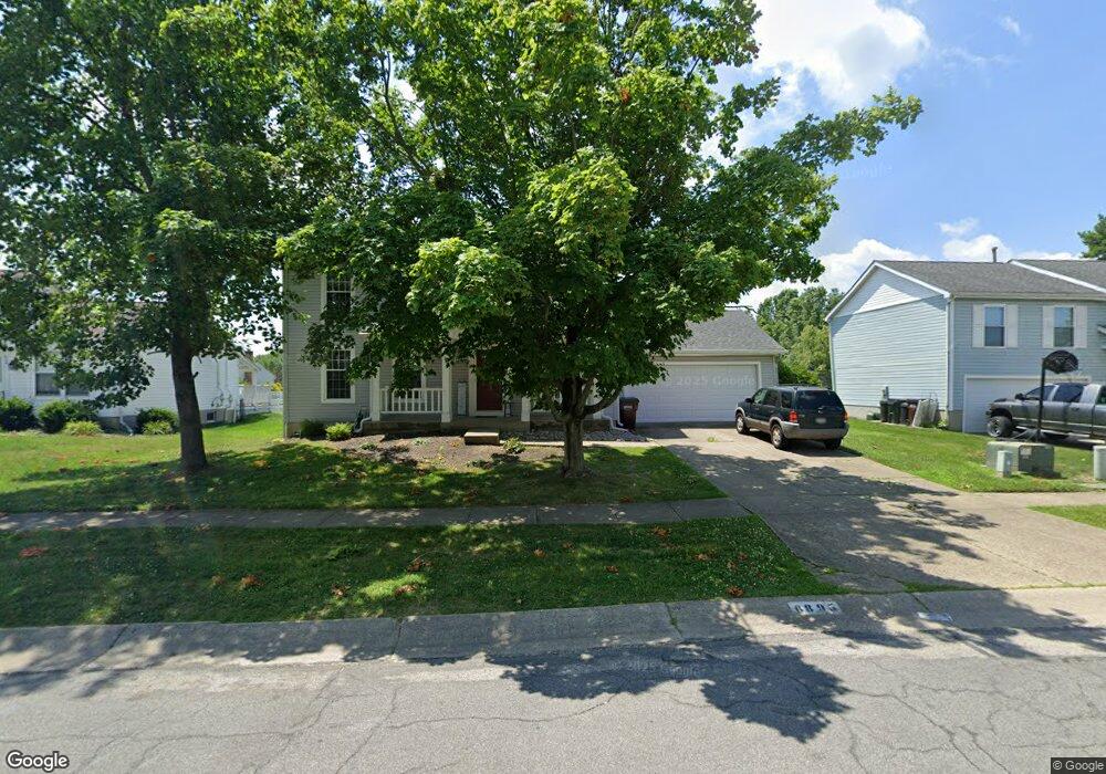
6895 Spring Arbor Dr Mason, OH 45040
Deerfield Township NeighborhoodEstimated Value: $350,000 - $488,000
3
Beds
3
Baths
1,930
Sq Ft
$226/Sq Ft
Est. Value
About This Home
This home is located at 6895 Spring Arbor Dr, Mason, OH 45040 and is currently estimated at $435,420, approximately $225 per square foot. 6895 Spring Arbor Dr is a home located in Warren County with nearby schools including Mason Intermediate Elementary School, Mason Middle School, and William Mason High School.
Ownership History
Date
Name
Owned For
Owner Type
Purchase Details
Closed on
Mar 28, 2016
Sold by
Minnielli Shelley Kay and Estate Of Jennifer Jayne Rigl
Bought by
Abbinante Jodie L
Current Estimated Value
Purchase Details
Closed on
Oct 5, 1992
Sold by
Morgan Morgan and Morgan David J
Bought by
Rigling Rigling and Rigling Jennifer J
Purchase Details
Closed on
May 23, 1988
Sold by
Ryan Homes & Inc
Bought by
Morgan and Morgan David J
Purchase Details
Closed on
Feb 9, 1988
Sold by
Mozzone Mozzone and Mozzone Andrew J
Bought by
Ryan Homes & Inc
Purchase Details
Closed on
Jun 2, 1987
Sold by
Mozzone Mozzone and Mozzone Andrew J.Trustee
Bought by
Tr. Mozzone and Tr. Andrew
Create a Home Valuation Report for This Property
The Home Valuation Report is an in-depth analysis detailing your home's value as well as a comparison with similar homes in the area
Home Values in the Area
Average Home Value in this Area
Purchase History
| Date | Buyer | Sale Price | Title Company |
|---|---|---|---|
| Abbinante Jodie L | -- | Attorney | |
| Rigling Rigling | $117,000 | -- | |
| Morgan | $108,000 | -- | |
| Ryan Homes & Inc | $15,900 | -- | |
| Tr. Mozzone | -- | -- |
Source: Public Records
Tax History Compared to Growth
Tax History
| Year | Tax Paid | Tax Assessment Tax Assessment Total Assessment is a certain percentage of the fair market value that is determined by local assessors to be the total taxable value of land and additions on the property. | Land | Improvement |
|---|---|---|---|---|
| 2024 | $5,122 | $118,850 | $31,500 | $87,350 |
| 2023 | $4,831 | $92,330 | $16,800 | $75,530 |
| 2022 | $4,801 | $92,330 | $16,800 | $75,530 |
| 2021 | $4,492 | $92,330 | $16,800 | $75,530 |
| 2020 | $4,408 | $76,941 | $14,000 | $62,941 |
| 2019 | $4,086 | $76,941 | $14,000 | $62,941 |
| 2018 | $4,063 | $76,941 | $14,000 | $62,941 |
| 2017 | $3,715 | $63,683 | $12,807 | $50,876 |
| 2016 | $3,788 | $63,683 | $12,807 | $50,876 |
| 2015 | $3,757 | $63,683 | $12,807 | $50,876 |
| 2014 | $3,507 | $54,900 | $11,040 | $43,860 |
| 2013 | $3,514 | $69,630 | $14,000 | $55,630 |
Source: Public Records
Map
Nearby Homes
- 8224 Summer View Dr
- 6589 Quail Lake
- 6930 Walnut Meadows Dr
- 8606 Charleston Valley Dr
- 6374 Hunters Green Dr
- 9302 W Meadow Dr
- 7839 Meadowbrook Dr
- 8655 Charleston Creek Dr
- 0 Castle Dr Unit 1837833
- 8642 Bluebird Ct
- 8141 Stone Dr
- 8178 Stone Dr
- Margot Plan at Losh Landing - Masterpiece Collection
- Mitchell Plan at Losh Landing - Masterpiece Collection
- Clay Plan at Losh Landing - Masterpiece Collection
- Huxley Plan at Losh Landing - Masterpiece Collection
- Leland Plan at Losh Landing - Masterpiece Collection
- Beckett Plan at Losh Landing - Masterpiece Collection
- Paxton Plan at Losh Landing - Masterpiece Collection
- Winslow Plan at Losh Landing - Masterpiece Collection
- 6881 Spring Arbor Dr
- 6907 Spring Arbor Dr
- 6888 Autumn Mist Ct
- 6919 Spring Arbor Dr
- 6867 Spring Arbor Dr
- 6878 Autumn Mist Ct
- 6894 Spring Arbor Dr
- 6906 Spring Arbor Dr
- 6880 Spring Arbor Dr
- 6890 Autumn Mist Ct
- 6864 Autumn Mist Ct
- 6857 Spring Arbor Dr
- 6868 Spring Arbor Dr
- 8188 Winters Ln
- 8200 Winters Ln
- 6852 Autumn Mist Ct
- 8212 Winters Ln
- 6858 Spring Arbor Dr
- 8160 Winters Ln
- 6845 Spring Arbor Dr