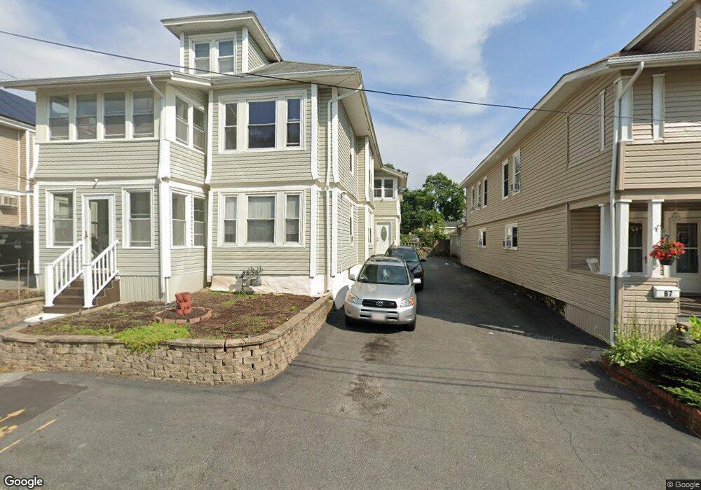
69-71 Elmwood Rd Methuen, MA 01844
The East End NeighborhoodEstimated Value: $694,000 - $776,000
6
Beds
2
Baths
2,736
Sq Ft
$267/Sq Ft
Est. Value
About This Home
This home is located at 69-71 Elmwood Rd, Methuen, MA 01844 and is currently estimated at $731,353, approximately $267 per square foot. 69-71 Elmwood Rd is a home located in Essex County with nearby schools including Timony Grammar School, South Point Elementary School, and Methuen High School.
Ownership History
Date
Name
Owned For
Owner Type
Purchase Details
Closed on
Oct 26, 2001
Sold by
Dellechiaie Katherine and Dellechiaie David A
Bought by
Lopez Leo F and Lugo Jose
Current Estimated Value
Home Financials for this Owner
Home Financials are based on the most recent Mortgage that was taken out on this home.
Original Mortgage
$208,000
Outstanding Balance
$82,135
Interest Rate
6.86%
Mortgage Type
Purchase Money Mortgage
Estimated Equity
$649,218
Create a Home Valuation Report for This Property
The Home Valuation Report is an in-depth analysis detailing your home's value as well as a comparison with similar homes in the area
Home Values in the Area
Average Home Value in this Area
Purchase History
| Date | Buyer | Sale Price | Title Company |
|---|---|---|---|
| Lopez Leo F | $208,000 | -- | |
| Lopez Leo F | $208,000 | -- |
Source: Public Records
Mortgage History
| Date | Status | Borrower | Loan Amount |
|---|---|---|---|
| Open | Lopez Leo F | $208,000 | |
| Closed | Lopez Leo F | $208,000 | |
| Previous Owner | Lopez Leo F | $112,500 |
Source: Public Records
Tax History Compared to Growth
Tax History
| Year | Tax Paid | Tax Assessment Tax Assessment Total Assessment is a certain percentage of the fair market value that is determined by local assessors to be the total taxable value of land and additions on the property. | Land | Improvement |
|---|---|---|---|---|
| 2025 | $7,578 | $716,300 | $188,500 | $527,800 |
| 2024 | $6,883 | $633,800 | $169,000 | $464,800 |
| 2023 | $6,731 | $575,300 | $149,500 | $425,800 |
| 2022 | $6,026 | $461,800 | $117,000 | $344,800 |
| 2021 | $5,768 | $437,300 | $110,500 | $326,800 |
| 2020 | $5,427 | $403,800 | $104,000 | $299,800 |
| 2019 | $4,957 | $349,300 | $97,500 | $251,800 |
| 2018 | $4,678 | $327,800 | $97,500 | $230,300 |
| 2017 | $4,496 | $306,900 | $91,000 | $215,900 |
| 2016 | $4,102 | $277,000 | $84,500 | $192,500 |
| 2015 | $3,704 | $253,700 | $70,200 | $183,500 |
Source: Public Records
Map
Nearby Homes
- 83 Oakside Ave
- 87 Oakside Ave
- 82 Oakside Ave
- 48 Larchwood Rd
- 18 Larchwood Rd
- 5 Arlington Terrace
- 2 Lawrence St
- 364 Lawrence St
- 183 Berkeley St
- 169 Berkeley St
- 100-102 Phillips St
- 7 Magnolia Rd
- 129-131 Lexington St
- 35 Hardy St
- 434-438 Hampshire St
- 69 Broadway
- 6 Longwood Dr
- 2 Horne St
- 27 Exchange St
- 29 Willow St Unit B
- 69 Elmwood Rd Unit 71
- 73 Elmwood Rd Unit 75
- 65 Elmwood Rd Unit 67
- 73-75 Elmwood Rd
- 70-72 Birchwood Rd
- 77 Elmwood Rd Unit 79
- 66 Birchwood Rd
- 70 Birchwood Rd Unit 72
- 70 Birchwood Rd Unit 1
- 80 Birchwood Rd
- 62 Birchwood Rd Unit 64
- 70 Elmwood Rd
- 76 Elmwood Rd Unit A
- 74 Elmwood Rd Unit 76
- 49 Elmwood Rd
- 56 Elmwood Rd
- 81 Elmwood Rd
- 58 Birchwood Rd
- 82 Elmwood Rd Unit 84
- 86 Birchwood Rd Unit 88