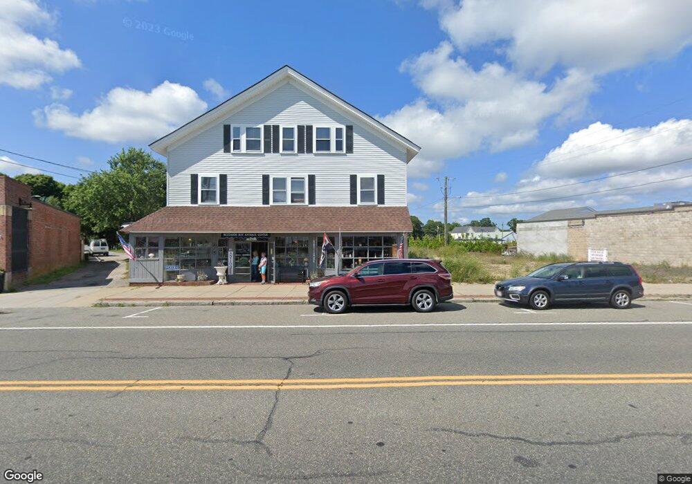
69-73 Main St Bourne, MA 2532
Buzzards Bay NeighborhoodEstimated Value: $259,071
--
Bed
--
Bath
--
Sq Ft
0.38
Acres
About This Home
This home is located at 69-73 Main St, Bourne, MA 2532 and is currently estimated at $259,071. 69-73 Main St is a home located in Barnstable County with nearby schools including Bourne High School.
Ownership History
Date
Name
Owned For
Owner Type
Purchase Details
Closed on
Dec 12, 2023
Sold by
Christopulos Rlty & Invs
Bought by
Patterson Deborah J and Patterson W C
Current Estimated Value
Purchase Details
Closed on
Dec 19, 2017
Sold by
Christopulos Rlty & Inve
Bought by
Patterson Florence C E
Purchase Details
Closed on
Sep 16, 1993
Sold by
State Street B & T Co
Bought by
Basso Carolyn
Purchase Details
Closed on
Jan 7, 1993
Sold by
Savoy Gregory A and Comfed Sb
Bought by
State St B & T Co
Create a Home Valuation Report for This Property
The Home Valuation Report is an in-depth analysis detailing your home's value as well as a comparison with similar homes in the area
Home Values in the Area
Average Home Value in this Area
Purchase History
| Date | Buyer | Sale Price | Title Company |
|---|---|---|---|
| Patterson Deborah J | -- | None Available | |
| Patterson Deborah J | -- | None Available | |
| Patterson Florence C E | -- | -- | |
| Patterson Florence C E | -- | -- | |
| Basso Carolyn | $62,000 | -- | |
| Basso Carolyn | $62,000 | -- | |
| State St B & T Co | $151,603 | -- | |
| State St B & T Co | $151,603 | -- |
Source: Public Records
Tax History Compared to Growth
Tax History
| Year | Tax Paid | Tax Assessment Tax Assessment Total Assessment is a certain percentage of the fair market value that is determined by local assessors to be the total taxable value of land and additions on the property. | Land | Improvement |
|---|---|---|---|---|
| 2025 | $1,984 | $254,000 | $253,900 | $100 |
| 2024 | $1,940 | $241,900 | $241,800 | $100 |
| 2023 | $2,049 | $232,600 | $232,500 | $100 |
| 2022 | $2,207 | $218,700 | $218,600 | $100 |
| 2021 | $2,285 | $212,200 | $212,200 | $0 |
| 2020 | $2,235 | $208,100 | $208,100 | $0 |
| 2019 | $2,144 | $204,000 | $204,000 | $0 |
| 2018 | $1,338 | $126,900 | $126,900 | $0 |
| 2017 | $1,812 | $175,900 | $125,600 | $50,300 |
| 2016 | $2,515 | $247,500 | $125,600 | $121,900 |
Source: Public Records
Map
Nearby Homes
- 16 Washington Ave
- 151 - 153 Main St
- 34 Washington Ave
- 46 Holt Rd
- 46 Holt Rd Unit A
- 3 Wolf Rd
- 56 Rip Van Winkle Way
- 17 Maple St
- 38 Old Bridge Rd
- 41 Lewis Point Rd
- 304 Main St
- 1 Pine Tree Dr
- 162 Puritan Rd
- 0 Lewis Point Rd
- 65 Lewis Point Rd
- 3 Fairway Dr Unit F
- 171 Puritan Rd
- 44 Cotuit Rd
- 73 Lewis Point Rd
- 60 Sandwich Rd
- 69-73 Main St & 0 Cohasset Ave
- 69-73 Main and 0 Cohaset Ave St
- 91 Main St
- 93 Main St Unit End Corner
- 85-93 Main St
- 57 Main St
- 51 Main St
- 97 Main St
- 95 Main St
- 47 Main St
- 95-97 Main St
- 49 Main St Unit 8
- 49 Main St Unit 12
- 49 Main St Unit 9
- 43 Main St
- 49 Main St Unit 11
- 49 Main St Unit 10
- 47 Main St
- 53 Main St Unit A
- 53 Main St