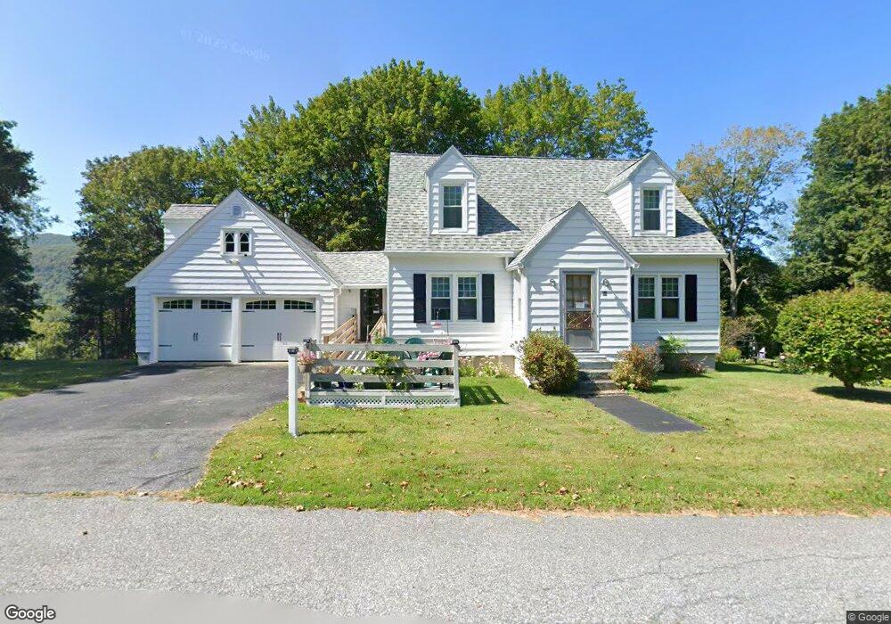
69 A St North Adams, MA 01247
Estimated Value: $229,000 - $285,000
3
Beds
1
Bath
1,229
Sq Ft
$202/Sq Ft
Est. Value
About This Home
This home is located at 69 A St, North Adams, MA 01247 and is currently estimated at $248,764, approximately $202 per square foot. 69 A St is a home located in Berkshire County with nearby schools including Brayton Elementary School, Drury High School, and Berkshire Arts & Technology Charter Public School.
Ownership History
Date
Name
Owned For
Owner Type
Purchase Details
Closed on
Apr 1, 1996
Sold by
Cozzaslio Lorraine Est and Lamoleaux 3R Raymond A
Bought by
Oakes Chester L
Current Estimated Value
Home Financials for this Owner
Home Financials are based on the most recent Mortgage that was taken out on this home.
Original Mortgage
$38,000
Interest Rate
6.9%
Mortgage Type
Purchase Money Mortgage
Create a Home Valuation Report for This Property
The Home Valuation Report is an in-depth analysis detailing your home's value as well as a comparison with similar homes in the area
Home Values in the Area
Average Home Value in this Area
Purchase History
| Date | Buyer | Sale Price | Title Company |
|---|---|---|---|
| Oakes Chester L | $76,000 | -- | |
| Oakes Chester L | $76,000 | -- |
Source: Public Records
Mortgage History
| Date | Status | Borrower | Loan Amount |
|---|---|---|---|
| Open | Oakes Chester L | $75,000 | |
| Closed | Oakes Chester L | $65,000 | |
| Closed | Oakes Chester L | $38,000 |
Source: Public Records
Tax History Compared to Growth
Tax History
| Year | Tax Paid | Tax Assessment Tax Assessment Total Assessment is a certain percentage of the fair market value that is determined by local assessors to be the total taxable value of land and additions on the property. | Land | Improvement |
|---|---|---|---|---|
| 2025 | $3,332 | $199,400 | $33,300 | $166,100 |
| 2024 | $3,128 | $182,500 | $30,500 | $152,000 |
| 2023 | $3,034 | $171,700 | $30,500 | $141,200 |
| 2022 | $2,744 | $148,100 | $30,500 | $117,600 |
| 2021 | $2,551 | $137,100 | $28,200 | $108,900 |
| 2020 | $2,393 | $128,500 | $28,100 | $100,400 |
| 2019 | $2,287 | $119,700 | $28,100 | $91,600 |
| 2018 | $2,195 | $119,400 | $29,500 | $89,900 |
| 2017 | $2,089 | $118,200 | $29,200 | $89,000 |
| 2016 | $2,028 | $116,600 | $29,200 | $87,400 |
| 2015 | $1,964 | $117,700 | $30,300 | $87,400 |
Source: Public Records
Map
Nearby Homes
- 17 A St
- 1268 Curran Hwy
- 14 Apache Dr
- 0 Ashland St Unit 245228
- 388 Ashland St Unit 1
- 153 Corinth St
- 54 Pinehill Terrace
- 235 Kemp Ave
- 100 Autumn Dr
- 921 Mohawk Trail
- 350 Mohawk Trail
- parcel 1 Mohawk Trail
- Parcel 2 Mohawk Trail
- 0 Oak Hill Unit 237953
- 30 Dover St
- 31 Dover St
- 11-15 Perry St
- 301 Walnut St
- 297 Walnut St
- 132 E Quincy St