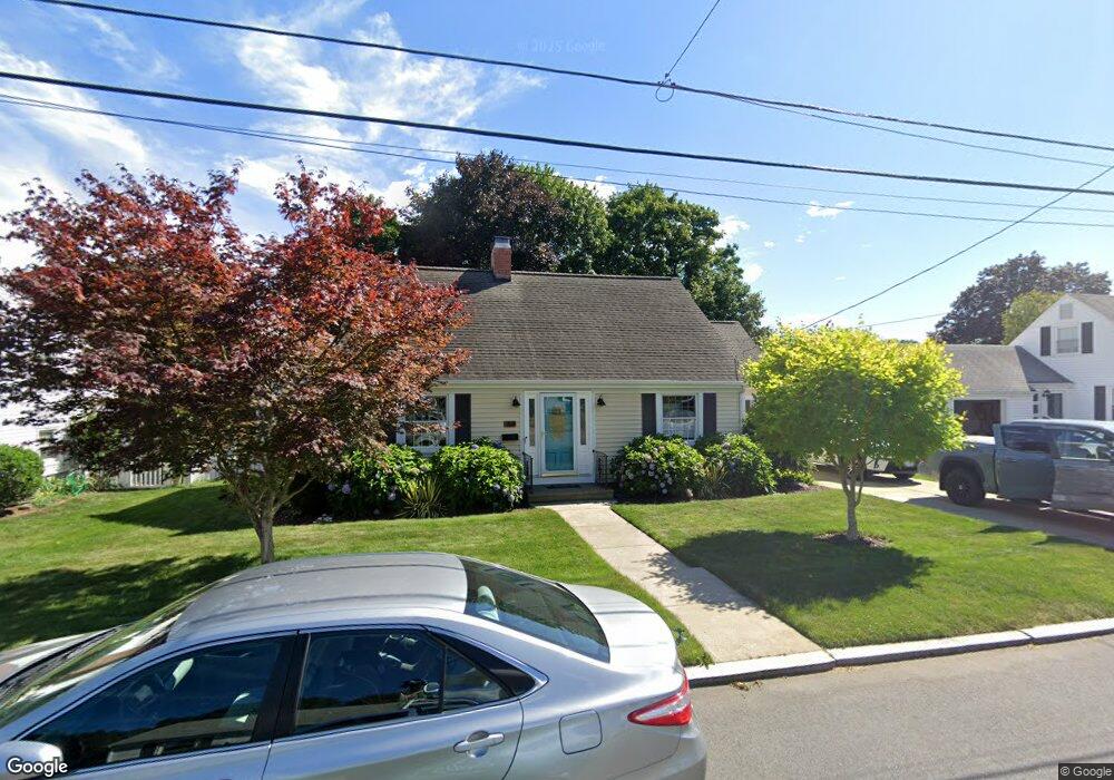
69 Allerton Ave East Providence, RI 02914
Kent Heights NeighborhoodEstimated Value: $477,694 - $499,000
3
Beds
3
Baths
1,428
Sq Ft
$342/Sq Ft
Est. Value
About This Home
This home is located at 69 Allerton Ave, East Providence, RI 02914 and is currently estimated at $488,674, approximately $342 per square foot. 69 Allerton Ave is a home located in Providence County with nearby schools including East Providence High School, The Gordon School, and St Mary Academy-Bay View.
Ownership History
Date
Name
Owned For
Owner Type
Purchase Details
Closed on
Apr 25, 2014
Sold by
Bowen M Rosalie
Bought by
Mcaree Patrick
Current Estimated Value
Home Financials for this Owner
Home Financials are based on the most recent Mortgage that was taken out on this home.
Original Mortgage
$154,800
Outstanding Balance
$117,766
Interest Rate
4.36%
Mortgage Type
New Conventional
Estimated Equity
$370,908
Create a Home Valuation Report for This Property
The Home Valuation Report is an in-depth analysis detailing your home's value as well as a comparison with similar homes in the area
Home Values in the Area
Average Home Value in this Area
Purchase History
| Date | Buyer | Sale Price | Title Company |
|---|---|---|---|
| Mcaree Patrick | $193,500 | -- | |
| Mcaree Patrick | $193,500 | -- | |
| Mcaree Patrick | $193,500 | -- |
Source: Public Records
Mortgage History
| Date | Status | Borrower | Loan Amount |
|---|---|---|---|
| Open | Mcaree Patrick | $154,800 | |
| Closed | Mcaree Patrick | $154,800 | |
| Previous Owner | Mcaree Patrick | $100,000 |
Source: Public Records
Tax History Compared to Growth
Tax History
| Year | Tax Paid | Tax Assessment Tax Assessment Total Assessment is a certain percentage of the fair market value that is determined by local assessors to be the total taxable value of land and additions on the property. | Land | Improvement |
|---|---|---|---|---|
| 2025 | $5,717 | $437,400 | $128,600 | $308,800 |
| 2024 | $5,767 | $376,200 | $107,300 | $268,900 |
| 2023 | $5,553 | $376,200 | $107,300 | $268,900 |
| 2022 | $5,664 | $259,100 | $57,400 | $201,700 |
| 2021 | $5,571 | $259,100 | $57,400 | $201,700 |
| 2020 | $5,335 | $259,100 | $57,400 | $201,700 |
| 2019 | $5,187 | $259,100 | $57,400 | $201,700 |
| 2018 | $5,244 | $229,200 | $58,600 | $170,600 |
| 2017 | $5,127 | $229,200 | $58,600 | $170,600 |
| 2016 | $5,102 | $229,200 | $58,600 | $170,600 |
| 2015 | $4,978 | $216,900 | $51,700 | $165,200 |
| 2014 | $4,978 | $216,900 | $51,700 | $165,200 |
Source: Public Records
Map
Nearby Homes
- 25 Ide Ave
- 180 Grassmere Ave
- 53 Wampanoag Trail
- 25 Fairview Ave
- 164 Brightridge Ave
- 108 Ivan Ave
- 10 Fairfield Ave
- 74 Brookhaven Dr
- 26 Mayflower St
- 82 Martin St
- 132 S Rose St
- 87 Vincent Ave
- 93 Crown Ave
- 83 Mountain Ave
- 109 Bliss St
- 108 Bliss St
- 34 Ridge Dr
- 59 Merritt Rd
- 17 Brown St Unit 19
- 1402 S Broadway
- 63 Allerton Ave
- 71 Allerton Ave
- 62 Wannamoisett Rd
- 66 Wannamoisett Rd
- 57 Allerton Ave
- 68 Allerton Ave
- 68 Allerton Ave
- 72 Wannamoisett Rd
- 70 Allerton Ave
- 56 Allerton Ave
- 60 Wannamoisett Rd
- 75 Allerton Ave
- 72 Allerton Ave
- 82 Wannamoisett Rd
- 300 Dover Ave
- 298 Dover Ave
- 78 Allerton Ave
- 83 Allerton Ave
- 63 Wannamoisett Rd
- 280 Dover Ave