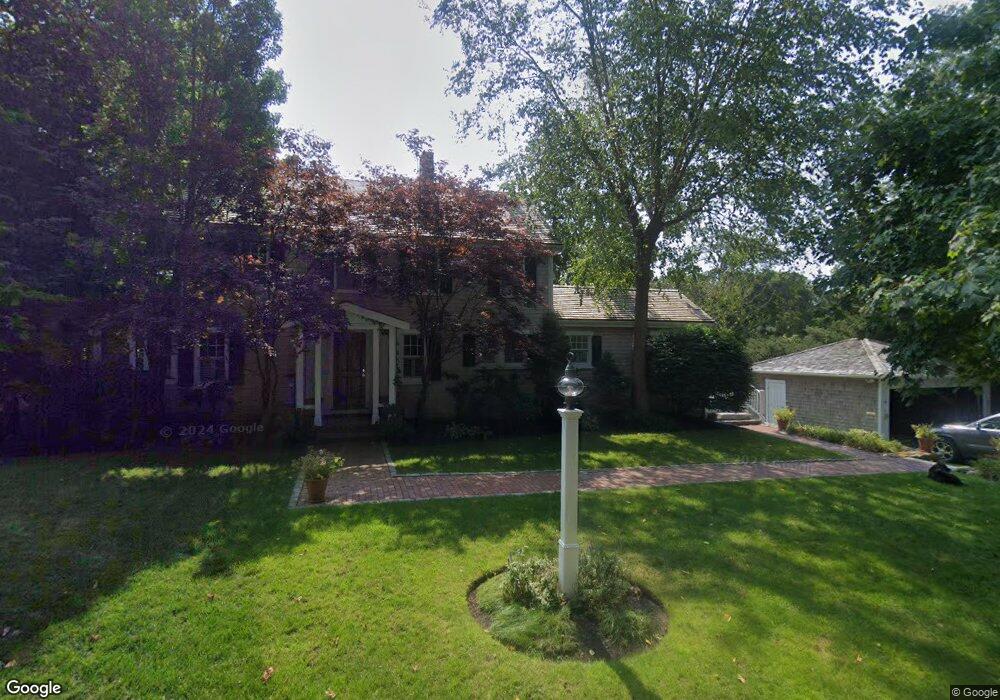
69 Bacon Ln Centerville, MA 02632
Centerville NeighborhoodEstimated Value: $941,000 - $1,205,000
About This Home
This home is located at 69 Bacon Ln, Centerville, MA 02632 and is currently estimated at $1,105,777, approximately $401 per square foot. 69 Bacon Ln is a home located in Barnstable County with nearby schools including Centerville Elementary School, Barnstable United Elementary School, and Barnstable Intermediate School.
Ownership History
We collect this data history from publicly available records. To have your information removed, we recommend requesting removal directly through your county’s website.
Purchase Details
Purchase Details
Home Financials for this Owner
Home Financials are based on the most recent Mortgage that was taken out on this home.Home Values in the Area
Average Home Value in this Area
Purchase History
We collect this data history from publicly available records. To have your information removed, we recommend requesting removal directly through your county’s website.
| Date | Buyer | Sale Price | Title Company |
|---|---|---|---|
| -- | -- | ||
| $291,000 | -- |
Mortgage History
We collect this data history from publicly available records. To have your information removed, we recommend requesting removal directly through your county’s website.
| Date | Status | Borrower | Loan Amount |
|---|---|---|---|
| Previous Owner | $150,000 | ||
| Previous Owner | $250,000 | ||
| Previous Owner | $141,000 |
Tax History
We collect this data history from publicly available records. To have your information removed, we recommend requesting removal directly through your county’s website.
| Year | Tax Paid | Tax Assessment Tax Assessment Total Assessment is a certain percentage of the fair market value that is determined by local assessors to be the total taxable value of land and additions on the property. | Land | Improvement |
|---|---|---|---|---|
| 2025 | $8,378 | $1,035,600 | $336,400 | $699,200 |
| 2024 | $6,578 | $842,200 | $336,400 | $505,800 |
| 2023 | $6,245 | $748,800 | $312,800 | $436,000 |
| 2022 | $5,576 | $578,400 | $216,200 | $362,200 |
| 2021 | $5,904 | $562,800 | $236,800 | $326,000 |
| 2020 | $5,325 | $485,900 | $236,800 | $249,100 |
| 2019 | $5,607 | $497,100 | $247,100 | $250,000 |
| 2018 | $5,230 | $466,100 | $249,300 | $216,800 |
| 2017 | $4,949 | $459,900 | $249,300 | $210,600 |
| 2016 | $5,035 | $461,900 | $251,300 | $210,600 |
| 2015 | $5,292 | $487,700 | $243,900 | $243,800 |
Map
- 442 Bay Ln
- 25 Joyce Anne Rd
- 498 Elliott Rd
- 16 Maple Rd
- 123 Old Post Rd
- 14 Valley Brook Rd
- 139 Fuller Rd
- 175 Old Post Rd
- 1309 Shootflying Hill Rd
- 1309 Shootflying Hill Rd
- 48 Starboard Ln
- 22 Southwinds Cir
- 65 Richardson Rd
- 228 Phinneys Ln
- 168 Highland Dr
- 63 Main St
- 251 Phinneys Ln
- 35 Stoney Cliff Rd
- 181 Elliott Rd
- 3 Yacht Club Rd
Ask me questions while you tour the home.