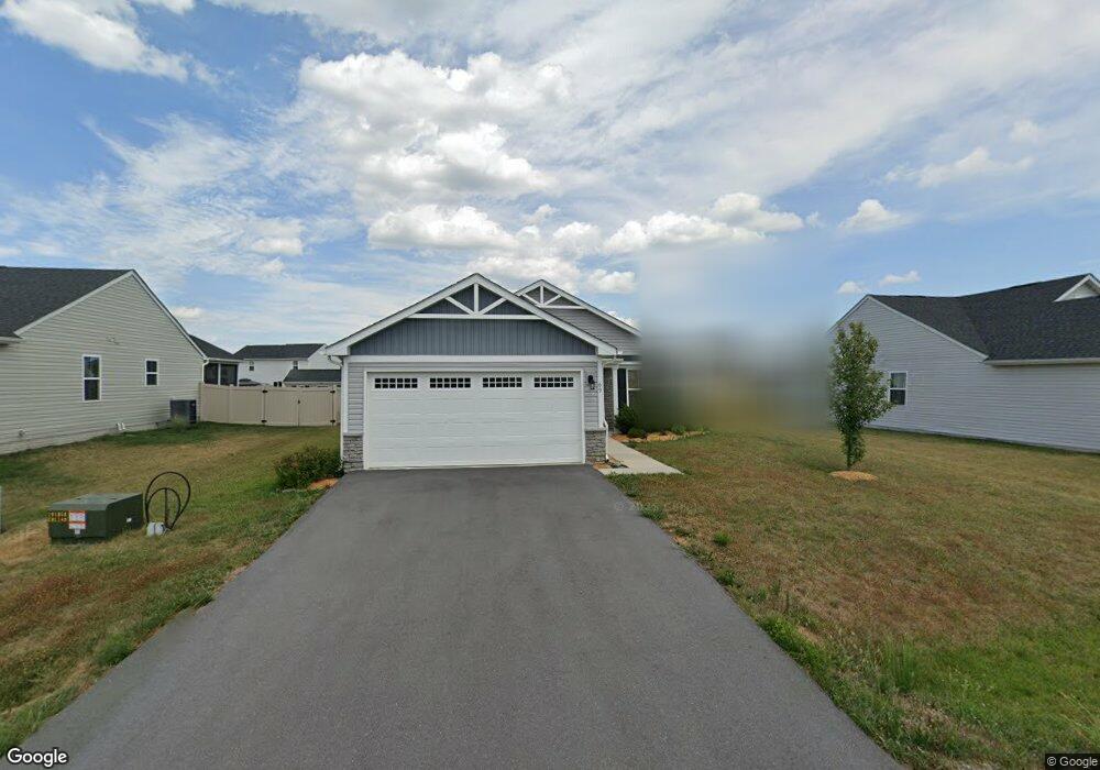
69 Banks Ave Bunker Hill, WV 25413
Estimated Value: $348,000 - $415,000
3
Beds
2
Baths
1,720
Sq Ft
$219/Sq Ft
Est. Value
About This Home
This home is located at 69 Banks Ave, Bunker Hill, WV 25413 and is currently estimated at $377,217, approximately $219 per square foot. 69 Banks Ave is a home located in Berkeley County with nearby schools including Bunker Hill Elementary School, Mill Creek Intermediate School, and Musselman Middle School.
Ownership History
Date
Name
Owned For
Owner Type
Purchase Details
Closed on
Jul 10, 2019
Sold by
Nvr Inc
Bought by
Barnot Randal
Current Estimated Value
Home Financials for this Owner
Home Financials are based on the most recent Mortgage that was taken out on this home.
Original Mortgage
$77,996
Outstanding Balance
$68,037
Interest Rate
3.82%
Mortgage Type
New Conventional
Estimated Equity
$309,180
Create a Home Valuation Report for This Property
The Home Valuation Report is an in-depth analysis detailing your home's value as well as a comparison with similar homes in the area
Home Values in the Area
Average Home Value in this Area
Purchase History
| Date | Buyer | Sale Price | Title Company |
|---|---|---|---|
| Barnot Randal | $199,990 | None Available |
Source: Public Records
Mortgage History
| Date | Status | Borrower | Loan Amount |
|---|---|---|---|
| Open | Barnot Randal | $77,996 |
Source: Public Records
Tax History Compared to Growth
Tax History
| Year | Tax Paid | Tax Assessment Tax Assessment Total Assessment is a certain percentage of the fair market value that is determined by local assessors to be the total taxable value of land and additions on the property. | Land | Improvement |
|---|---|---|---|---|
| 2025 | $2,102 | $172,920 | $48,180 | $124,740 |
| 2024 | $2,082 | $169,620 | $45,180 | $124,440 |
| 2023 | $2,068 | $163,620 | $39,180 | $124,440 |
| 2022 | $1,787 | $153,540 | $39,180 | $114,360 |
| 2021 | $1,598 | $136,260 | $30,000 | $106,260 |
| 2020 | $705 | $30,000 | $30,000 | $0 |
| 2019 | $709 | $30,000 | $30,000 | $0 |
| 2018 | $71 | $3,000 | $3,000 | $0 |
| 2017 | $72 | $3,000 | $3,000 | $0 |
| 2016 | $72 | $3,000 | $3,000 | $0 |
| 2015 | $74 | $3,000 | $3,000 | $0 |
| 2014 | -- | $3,000 | $3,000 | $0 |
Source: Public Records
Map
Nearby Homes
- 93 Switchgrass Ct
- 421 Switchgrass Ct
- 44 Beaulah Ct
- 277 Specks Run Rd
- 159 Larian Dr
- 14 Colchester Ct
- 382 Fegan Rd
- 672 Montmorency Dr
- 284 Wigeon Ct
- 379 Eurasian Dr
- 0 Hoofprint Dr
- 60 Grey Spring Ave
- 229 Charming Ln
- 107 Loblolly Dr
- 13 Glenaire Rd
- 74 Colchester Ct
- 86 Glenaire Rd
- 371 Ruebuck Rd
- 10167 Winchester Ave
- 30 Kirby Ct
- 57 Banks Ave
- 64 Banks Ave
- 78 Banks Ave
- 97 Banks Ave
- 52 Banks Ave
- 92 Banks Ave
- 109 Banks Ave
- 38 Banks Ave
- LOT 147 Chandlers Glen Dr
- 235 Chandlers Glen Dr
- 235 Chandler's Glen Dr
- 241 Chandlers Glen Dr
- 106 Banks Ave
- 223 Chandlers Glen Dr
- 223 Chandler's Glen Dr
- 253 Chandlers Glen Dr
- 48 Chandlers Glen Dr
- 128 Tickseed Ct
- 112 Tickseed Ct
- 26 Banks Ave