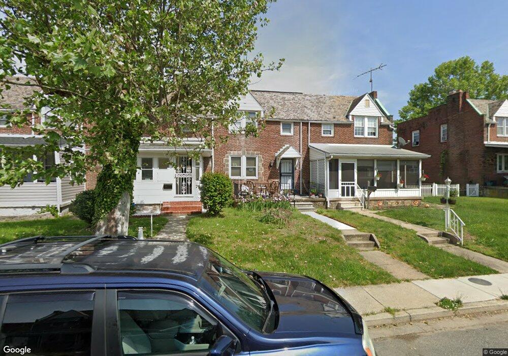
69 Broadship Rd Dundalk, MD 21222
Estimated Value: $146,556 - $194,000
--
Bed
1
Bath
1,160
Sq Ft
$155/Sq Ft
Est. Value
About This Home
This home is located at 69 Broadship Rd, Dundalk, MD 21222 and is currently estimated at $179,639, approximately $154 per square foot. 69 Broadship Rd is a home located in Baltimore County with nearby schools including Dundalk Elementary, Dundalk Middle School, and Dundalk High School.
Ownership History
Date
Name
Owned For
Owner Type
Purchase Details
Closed on
Dec 23, 2008
Sold by
Allen Francine E
Current Estimated Value
Home Financials for this Owner
Home Financials are based on the most recent Mortgage that was taken out on this home.
Original Mortgage
$127,187
Interest Rate
6.27%
Mortgage Type
FHA
Purchase Details
Closed on
Dec 5, 2008
Sold by
Allen Francine E
Home Financials for this Owner
Home Financials are based on the most recent Mortgage that was taken out on this home.
Original Mortgage
$127,187
Interest Rate
6.27%
Mortgage Type
FHA
Purchase Details
Closed on
Jan 31, 1995
Sold by
Te Glushakon Robert S
Bought by
Allen Francine E
Home Financials for this Owner
Home Financials are based on the most recent Mortgage that was taken out on this home.
Original Mortgage
$72,950
Interest Rate
9.24%
Purchase Details
Closed on
Jul 16, 1991
Sold by
Borowy Steven J
Bought by
Mayhew William W
Create a Home Valuation Report for This Property
The Home Valuation Report is an in-depth analysis detailing your home's value as well as a comparison with similar homes in the area
Home Values in the Area
Average Home Value in this Area
Purchase History
| Date | Buyer | Sale Price | Title Company |
|---|---|---|---|
| -- | -- | -- | |
| -- | -- | -- | |
| Allen Francine E | $73,000 | -- | |
| Mayhew William W | $70,500 | -- |
Source: Public Records
Mortgage History
| Date | Status | Borrower | Loan Amount |
|---|---|---|---|
| Closed | -- | $127,187 | |
| Closed | -- | $127,187 | |
| Previous Owner | Allen Francine E | $72,950 | |
| Closed | Allen Francine E | $4,139 |
Source: Public Records
Tax History Compared to Growth
Tax History
| Year | Tax Paid | Tax Assessment Tax Assessment Total Assessment is a certain percentage of the fair market value that is determined by local assessors to be the total taxable value of land and additions on the property. | Land | Improvement |
|---|---|---|---|---|
| 2025 | $1,813 | $120,700 | -- | -- |
| 2024 | $1,813 | $112,100 | $0 | $0 |
| 2023 | $898 | $103,500 | $36,000 | $67,500 |
| 2022 | $1,674 | $102,367 | $0 | $0 |
| 2021 | $2,173 | $101,233 | $0 | $0 |
| 2020 | $2,173 | $100,100 | $36,000 | $64,100 |
| 2019 | $1,722 | $96,867 | $0 | $0 |
| 2018 | $1,520 | $93,633 | $0 | $0 |
| 2017 | $1,509 | $90,400 | $0 | $0 |
| 2016 | $1,412 | $87,600 | $0 | $0 |
| 2015 | $1,412 | $84,800 | $0 | $0 |
| 2014 | $1,412 | $82,000 | $0 | $0 |
Source: Public Records
Map
Nearby Homes
- 37 Liberty Pkwy
- 2493 Fairway
- 16 Portship Rd
- 86 Kinship Rd
- 101 Willow Spring Rd
- 6800 Crossway
- 2529 Liberty Pkwy
- 2527 Liberty Pkwy
- 41 Township Rd
- 70 N Dundalk Ave
- 1849 Portship Rd
- 32 Township Rd
- 7113 Foundry St
- 1901 Four Roses St
- 213 Colgate Ave
- 35 Kinship Rd
- 30 Flagship Rd
- Mozart 4 Story Plan at Foundry Station - Townhomes
- Mozart 3 Story Plan at Foundry Station - Townhomes
- Clarendon 3 Story Plan at Foundry Station - Townhomes
- 71 Broadship Rd
- 67 Broadship Rd
- 73 Broadship Rd
- 65 Broadship Rd
- 75 Broadship Rd
- 63 Broadship Rd
- 61 Broadship Rd
- 64 Portship Rd
- 66 Portship Rd
- 62 Portship Rd
- 68 Portship Rd
- 59 Broadship Rd
- 70 Portship Rd
- 60 Portship Rd
- 74 Broadship Rd
- 76 Broadship Rd
- 72 Broadship Rd
- 58 Portship Rd
- 78 Broadship Rd
- 70 Broadship Rd