Estimated Value: $463,601 - $3,561,000
--
Bed
--
Bath
--
Sq Ft
54.97
Acres
About This Home
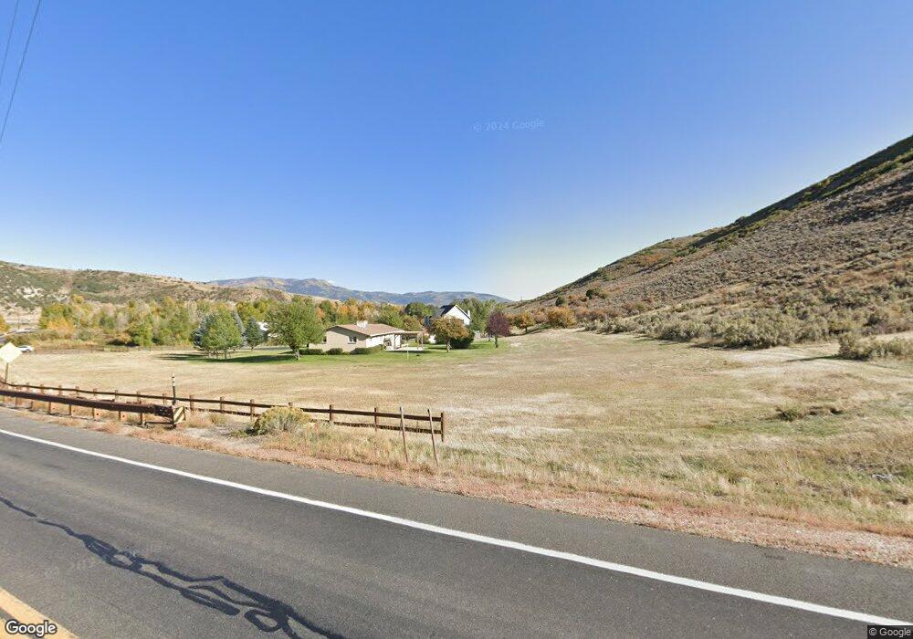
This home is located at 69 Browns Canyon Unit 69, Peoa, UT 84061 and is currently estimated at $2,012,301. 69 Browns Canyon Unit 69 is a home located in Summit County with nearby schools including South Summit Elementary School and South Summit High School.
Ownership History
Date
Name
Owned For
Owner Type
Purchase Details
Closed on
Jan 10, 2024
Sold by
Paul Jared Trunnell Family Trust
Bought by
Phillips Wayne and Phillips Gay
Current Estimated Value
Purchase Details
Closed on
Jan 29, 2018
Sold by
Browns Canyon Storage Llc
Bought by
High Mountain View Land T Rust
Home Financials for this Owner
Home Financials are based on the most recent Mortgage that was taken out on this home.
Original Mortgage
$555,000
Interest Rate
4.15%
Purchase Details
Closed on
May 6, 2016
Sold by
Dprkt Enterprises Inc
Bought by
Browns Canyon Storage Llc
Purchase Details
Closed on
Nov 12, 2012
Sold by
Lapham Joseph G and Lapham Mae L
Bought by
Dprkt Enterprises Inc
Purchase Details
Closed on
Sep 11, 2010
Sold by
Trunnell Paul and Trunnell Barbara
Bought by
Lapham Joseph G and Lapham Mae L
Create a Home Valuation Report for This Property
The Home Valuation Report is an in-depth analysis detailing your home's value as well as a comparison with similar homes in the area
Home Values in the Area
Average Home Value in this Area
Purchase History
| Date | Buyer | Sale Price | Title Company |
|---|---|---|---|
| Phillips Wayne | -- | None Listed On Document | |
| High Mountain View Land T Rust | $652,900 | -- | |
| Browns Canyon Storage Llc | -- | None Available | |
| Dprkt Enterprises Inc | -- | Us Title Park City | |
| Lapham Joseph G | -- | -- |
Source: Public Records
Mortgage History
| Date | Status | Borrower | Loan Amount |
|---|---|---|---|
| Previous Owner | High Mountain View Land T Rust | $555,000 | |
| Previous Owner | High Mountain View Land T Rust | -- |
Source: Public Records
Tax History Compared to Growth
Tax History
| Year | Tax Paid | Tax Assessment Tax Assessment Total Assessment is a certain percentage of the fair market value that is determined by local assessors to be the total taxable value of land and additions on the property. | Land | Improvement |
|---|---|---|---|---|
| 2024 | $1,451 | $291,321 | $284,925 | $6,396 |
| 2023 | $1,451 | $291,321 | $284,925 | $6,396 |
| 2022 | $1,558 | $235,924 | $229,528 | $6,396 |
| 2021 | $1,590 | $198,924 | $192,528 | $6,396 |
| 2020 | $1,688 | $198,924 | $192,528 | $6,396 |
| 2019 | $1,625 | $198,924 | $192,528 | $6,396 |
| 2018 | $1,831 | $198,924 | $192,528 | $6,396 |
| 2017 | $1,675 | $198,924 | $192,528 | $6,396 |
| 2016 | $1,747 | $198,924 | $192,528 | $6,396 |
| 2015 | $1,663 | $198,924 | $0 | $0 |
| 2013 | $1,784 | $198,924 | $0 | $0 |
Source: Public Records
Map
Nearby Homes
- 7795 Browns Rd
- 6325 N Elk Ridge Rd Unit 5
- 6117 N Rocky Ridge Rd
- 6117 Rocky Ridge Rd
- 2640 W State Road 32
- 2575 W State Road 32
- 672 Carson Ln
- 5402 N 750 W
- 5685 N State Road 32
- 5167 Rodeo Cir
- 5167 Rodeo Cir Unit 6
- 5661 N State Road 32
- 5924 N Triple Crown Trail Unit 16
- 972 River Haven Rd Unit 101
- 949 River Haven Rd S Unit 115
- 1400 E Weber Wild Rd
- 4498 E Weber Canyon Rd S
- 5467 E Lewis And Clark Rd N
- 87 N Yosemite Unit 87A
- 940 River Haven Rd W Unit 103
- 5 Marchant Ln
- 6000 N Elk Ridge Rd
- 77 Browns Canyon
- 6860 Lost Creek Rd
- 6325 N Elk Ridge Rd
- 4 N State Rd #32 Unit 4
- 3 N State Rd #32 Unit 3
- 2 S State Rd #32 Unit 2
- 94 Lr-2-94 Unit 94
- 6000 N Elk Ridge Rd Unit 1
- 23 N Browns Canyon Unit 23
- 23 E Browns Canyon Unit 23
- 0 See Remarks Unit 449473
- 0 See Remarks Unit 362160
- 7472 W Lower Bowl Rd Unit 22
- 567 Marchant Ln
- 266 N Sage E Unit 266
- 1 State Road 32
- 5 Marchant Ln Unit 5-7
- 301 W Crestline Blvd Unit 301