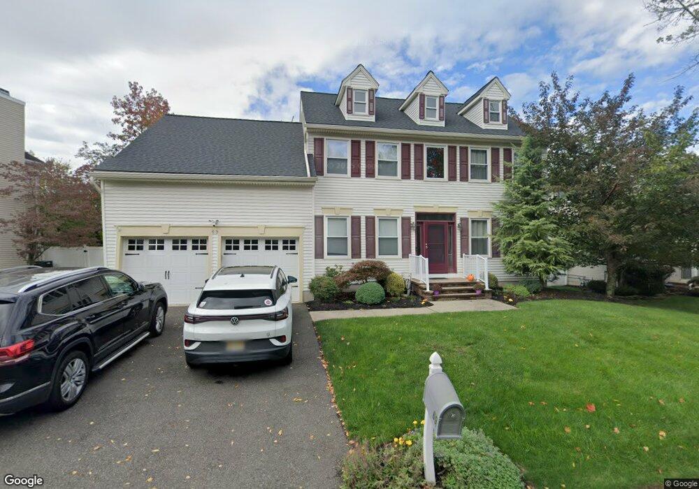
69 Clydesdale Rd Scotch Plains, NJ 07076
Estimated Value: $712,870 - $1,395,000
--
Bed
--
Bath
2,296
Sq Ft
$494/Sq Ft
Est. Value
About This Home
This home is located at 69 Clydesdale Rd, Scotch Plains, NJ 07076 and is currently estimated at $1,133,968, approximately $493 per square foot. 69 Clydesdale Rd is a home located in Union County with nearby schools including J. Ackerman Coles Elementary School, Terrill Middle School, and Scotch Plains-Fanwood High School.
Ownership History
Date
Name
Owned For
Owner Type
Purchase Details
Closed on
Jun 28, 2006
Sold by
Hoblitzell Anthony Todd
Bought by
Wolff Daniel and Wolff Yelena
Current Estimated Value
Home Financials for this Owner
Home Financials are based on the most recent Mortgage that was taken out on this home.
Original Mortgage
$628,000
Outstanding Balance
$371,798
Interest Rate
6.6%
Mortgage Type
New Conventional
Estimated Equity
$762,170
Purchase Details
Closed on
Oct 7, 1997
Sold by
Krug Thomas J and Krug Elke
Bought by
Hoblitzell Anthony Todd and Hoblitzell Anne Marie
Home Financials for this Owner
Home Financials are based on the most recent Mortgage that was taken out on this home.
Original Mortgage
$256,000
Interest Rate
7.12%
Purchase Details
Closed on
Jul 29, 1994
Sold by
Saugatuck Associates Inc
Bought by
Krug Thomas J
Create a Home Valuation Report for This Property
The Home Valuation Report is an in-depth analysis detailing your home's value as well as a comparison with similar homes in the area
Home Values in the Area
Average Home Value in this Area
Purchase History
| Date | Buyer | Sale Price | Title Company |
|---|---|---|---|
| Wolff Daniel | $785,000 | -- | |
| Hoblitzell Anthony Todd | $331,000 | -- | |
| Krug Thomas J | $330,015 | -- |
Source: Public Records
Mortgage History
| Date | Status | Borrower | Loan Amount |
|---|---|---|---|
| Open | Wolff Daniel | $628,000 | |
| Previous Owner | Hoblitzell Anthony Todd | $256,000 |
Source: Public Records
Tax History Compared to Growth
Tax History
| Year | Tax Paid | Tax Assessment Tax Assessment Total Assessment is a certain percentage of the fair market value that is determined by local assessors to be the total taxable value of land and additions on the property. | Land | Improvement |
|---|---|---|---|---|
| 2025 | $18,958 | $161,100 | $58,100 | $103,000 |
| 2024 | $18,399 | $161,100 | $58,100 | $103,000 |
| 2023 | $18,399 | $161,100 | $58,100 | $103,000 |
| 2022 | $18,180 | $161,100 | $58,100 | $103,000 |
| 2021 | $18,150 | $161,100 | $58,100 | $103,000 |
| 2020 | $18,063 | $161,100 | $58,100 | $103,000 |
| 2019 | $17,929 | $161,100 | $58,100 | $103,000 |
| 2018 | $17,628 | $161,100 | $58,100 | $103,000 |
| 2017 | $17,236 | $161,100 | $58,100 | $103,000 |
| 2016 | $16,904 | $161,100 | $58,100 | $103,000 |
| 2015 | $16,627 | $161,100 | $58,100 | $103,000 |
| 2014 | $16,079 | $161,100 | $58,100 | $103,000 |
Source: Public Records
Map
Nearby Homes
- 1191 Cooper Rd
- 49 Highlander Dr
- 1231 Rahway Rd
- 1627 Prospect Ave Unit 47
- 19 Ravenswood Ln
- 1232 Sunnyfield Ln
- 1224 Sunnyfield Ln
- 19 Highlander Dr
- 1691 Frank St
- 1009 Mayfair Way
- 1535 Frank St
- 980 Raritan Rd
- 1657 Forest Hill Rd Unit 63
- 1158 Woodmere Place
- 1380 Terrill Rd
- 1358 Marlborough Ave Unit 60
- 1354 Chetwynd Ave Unit 58
- 771 Ravine Rd
- 767 Ravine Rd Unit 73
- 939-45 Post Dr
- 67 Clydesdale Rd
- 71 Clydesdale Rd
- 73 Clydesdale Rd
- 18 Autumn Dr
- 65 Clydesdale Rd
- 70 Clydesdale Rd
- 72 Clydesdale Rd
- 26 Autumn Dr
- 22 Autumn Dr
- 68 Clydesdale Rd
- 14 Autumn Dr
- 74 Clydesdale Rd
- 75 Clydesdale Rd
- 2 Sassafras Ct
- 66 Clydesdale Rd
- 77 Clydesdale Rd
- 64 Clydesdale Rd
- 63 Clydesdale Rd
- 1 Sassafras Ct
- 4 Sassafras Ct