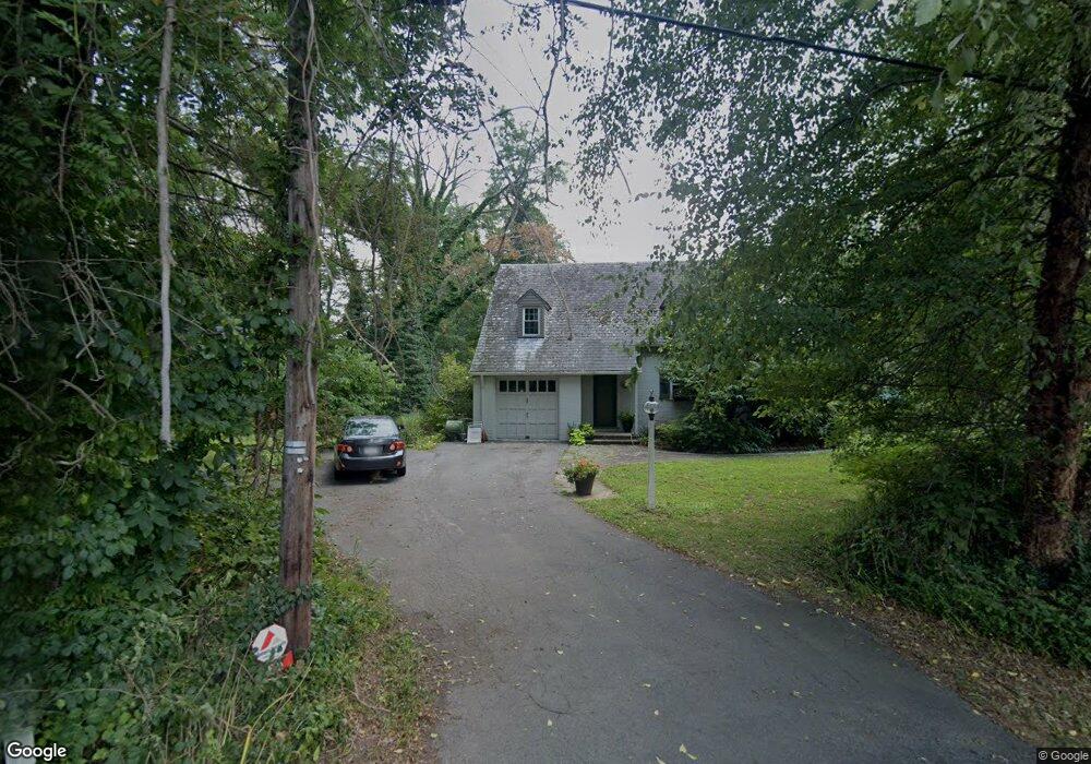
69 Conestoga Dr Lancaster, PA 17602
Conestoga Woods NeighborhoodEstimated Value: $372,000 - $474,000
3
Beds
2
Baths
1,983
Sq Ft
$215/Sq Ft
Est. Value
About This Home
This home is located at 69 Conestoga Dr, Lancaster, PA 17602 and is currently estimated at $427,294, approximately $215 per square foot. 69 Conestoga Dr is a home located in Lancaster County with nearby schools including Burrowes Elementary School, Wickersham Elementary School, and Lincoln Middle School.
Ownership History
Date
Name
Owned For
Owner Type
Purchase Details
Closed on
Jun 17, 2005
Sold by
Mcgrann B John and Mcgrann Mara Creswell
Bought by
Crable Ad A and Kopf Jennifer L
Current Estimated Value
Home Financials for this Owner
Home Financials are based on the most recent Mortgage that was taken out on this home.
Original Mortgage
$168,000
Outstanding Balance
$88,045
Interest Rate
5.82%
Mortgage Type
Fannie Mae Freddie Mac
Estimated Equity
$339,249
Purchase Details
Closed on
Jul 20, 2000
Sold by
Schoelkopf Thomas Edward and Schoelkopf Barbara W
Bought by
Mcgrann B John and Mcgrann Mara Creswell
Home Financials for this Owner
Home Financials are based on the most recent Mortgage that was taken out on this home.
Original Mortgage
$121,500
Interest Rate
7.87%
Create a Home Valuation Report for This Property
The Home Valuation Report is an in-depth analysis detailing your home's value as well as a comparison with similar homes in the area
Home Values in the Area
Average Home Value in this Area
Purchase History
| Date | Buyer | Sale Price | Title Company |
|---|---|---|---|
| Crable Ad A | $210,000 | -- | |
| Mcgrann B John | $135,100 | Fidelity National Title Ins |
Source: Public Records
Mortgage History
| Date | Status | Borrower | Loan Amount |
|---|---|---|---|
| Open | Crable Ad A | $168,000 | |
| Previous Owner | Mcgrann B John | $121,500 |
Source: Public Records
Tax History Compared to Growth
Tax History
| Year | Tax Paid | Tax Assessment Tax Assessment Total Assessment is a certain percentage of the fair market value that is determined by local assessors to be the total taxable value of land and additions on the property. | Land | Improvement |
|---|---|---|---|---|
| 2025 | $5,182 | $179,700 | $49,600 | $130,100 |
| 2024 | $5,182 | $179,700 | $49,600 | $130,100 |
| 2023 | $5,063 | $179,700 | $49,600 | $130,100 |
| 2022 | $4,761 | $179,700 | $49,600 | $130,100 |
| 2021 | $4,617 | $179,700 | $49,600 | $130,100 |
| 2020 | $4,617 | $179,700 | $49,600 | $130,100 |
| 2019 | $4,519 | $179,700 | $49,600 | $130,100 |
| 2018 | $3,396 | $179,700 | $49,600 | $130,100 |
| 2017 | $5,038 | $154,100 | $42,800 | $111,300 |
| 2016 | $4,945 | $154,100 | $42,800 | $111,300 |
| 2015 | $668 | $154,100 | $42,800 | $111,300 |
| 2014 | $3,684 | $154,100 | $42,800 | $111,300 |
Source: Public Records
Map
Nearby Homes
- 6 Woodlyn Ct
- 11 Clayton Ave
- 1036 E King St
- 305 Conestoga Blvd
- 415 Lampeter Rd
- 235 Landis Dr
- 980 E Orange St
- 911 E King St
- 516 Conestoga Greenway Trail
- 728 E End Ave
- 452 Longfellow Dr
- 257 Longfellow Dr
- 817 E Orange St
- 1015 E Walnut St
- 154 River Bend Park
- 121 S Marshall St
- 604 E End Ave
- 620 E King St
- 53 S Marshall St
- 1153 S Duke St
- 15 Conestoga Rd
- 0 Conestoga Rd
- 19 Conestoga Rd
- 38 S Conestoga Dr
- 42 Conestoga Dr
- 31 Conestoga Dr
- 105 Conestoga Dr Unit 11
- 100 Conestoga Dr Unit 13
- 14 Conestoga Woods Rd
- 38 Conestoga Dr
- 13 Conestoga Rd
- 113 Conestoga Dr
- 113 Conestoga Dr Unit 9
- 17 Conestoga Woods Rd
- 19 Conestoga Woods Rd
- 106 Conestoga Dr
- 145 City Mill Rd
- 32 Conestoga Dr
- 121 Conestoga Dr Unit 7
- 154 City Mill Rd