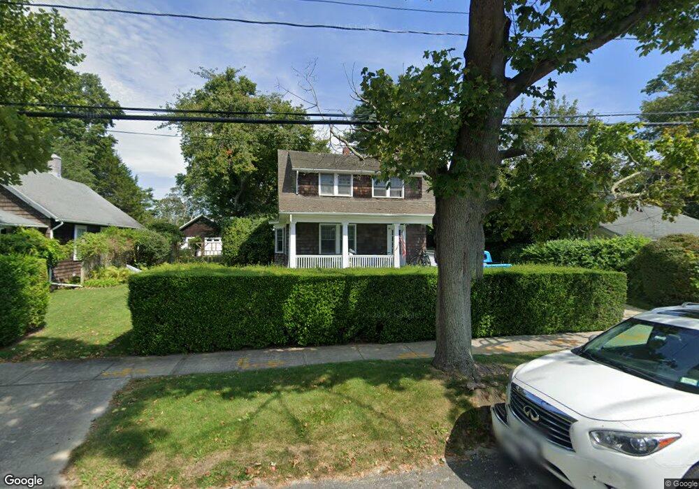
69 Corwith Ave Bridgehampton, NY 11932
Estimated Value: $1,655,000 - $2,836,197
3
Beds
1
Bath
1,400
Sq Ft
$1,694/Sq Ft
Est. Value
About This Home
This home is located at 69 Corwith Ave, Bridgehampton, NY 11932 and is currently estimated at $2,372,049, approximately $1,694 per square foot. 69 Corwith Ave is a home with nearby schools including Bridgehampton School, The Hayground School, and Ross Lower School.
Ownership History
Date
Name
Owned For
Owner Type
Purchase Details
Closed on
Jul 18, 2013
Sold by
Warner Alden Y
Bought by
Worth Carter Braxton and Worth Jill
Current Estimated Value
Home Financials for this Owner
Home Financials are based on the most recent Mortgage that was taken out on this home.
Original Mortgage
$750,000
Outstanding Balance
$546,052
Interest Rate
3.95%
Mortgage Type
New Conventional
Estimated Equity
$1,825,997
Purchase Details
Closed on
Jan 24, 1997
Sold by
Traphagen Laura Tuttle
Bought by
Warner Alden Y
Purchase Details
Closed on
Jan 23, 1996
Sold by
Cinelli Michael and Brown John S
Bought by
Traphagen Laura T
Create a Home Valuation Report for This Property
The Home Valuation Report is an in-depth analysis detailing your home's value as well as a comparison with similar homes in the area
Home Values in the Area
Average Home Value in this Area
Purchase History
| Date | Buyer | Sale Price | Title Company |
|---|---|---|---|
| Worth Carter Braxton | $1,175,000 | -- | |
| Warner Alden Y | $360,000 | First American Title Ins Co | |
| Traphagen Laura T | $286,000 | Chicago Title Insurance Co |
Source: Public Records
Mortgage History
| Date | Status | Borrower | Loan Amount |
|---|---|---|---|
| Open | Worth Carter Braxton | $750,000 |
Source: Public Records
Tax History
| Year | Tax Paid | Tax Assessment Tax Assessment Total Assessment is a certain percentage of the fair market value that is determined by local assessors to be the total taxable value of land and additions on the property. | Land | Improvement |
|---|---|---|---|---|
| 2024 | -- | $1,345,300 | $1,078,100 | $267,200 |
| 2023 | -- | $1,345,300 | $1,078,100 | $267,200 |
| 2022 | $4,188 | $1,347,300 | $1,078,100 | $269,200 |
| 2021 | $4,188 | $1,347,300 | $1,078,100 | $269,200 |
| 2020 | $4,910 | $1,347,300 | $1,078,100 | $269,200 |
| 2019 | $4,910 | $0 | $0 | $0 |
| 2018 | -- | $1,330,700 | $1,071,100 | $259,600 |
| 2017 | $4,439 | $1,216,000 | $956,400 | $259,600 |
| 2016 | $4,188 | $1,105,400 | $869,400 | $236,000 |
| 2015 | -- | $1,105,400 | $869,400 | $236,000 |
| 2014 | -- | $1,105,400 | $869,400 | $236,000 |
Source: Public Records
Map
Nearby Homes
- 74 Chester St
- 88 Rose Way
- 95 Church Ln
- 19 and 33 Bridgefield Rd
- 15 Hildreth Ln
- 125 Hildreth Ln
- 54 Sawasett Ave
- 81 Hildreth Ln
- 162 Norris Ln
- 131 Narrow Ln
- 53 Williams Way
- 154 Narrow Ln
- 120 Halsey Ln
- 110 Halsey Ln
- 65 Audubon Ave
- 2749 Montauk Hwy
- 136 Trelawney Rd
- 7 Kellis Way
- 145 Sea Farm Ln
- 71 Tansey Ln
- 73 Corwith Ave
- 63 Corwith Ave
- 85 Corwith Ave
- 18 Halsey Ln
- 47 Corwith Ave
- 93 Corwith Ave
- 32 Halsey St
- 39 Corwith Ave
- 35 Newman Ave
- 7 Halsey St
- 101 Corwith Ave
- 7 Halsey St
- 15 Halsey St
- 107 Corwith Ave
- 81 Birchwood Lot 21 Ln
- 586 Millstone Rd
- 77 Huntington Cross
- 47 Newman Ave
- 115 Corwith Ave
- 2414 Montauk Hwy
Your Personal Tour Guide
Ask me questions while you tour the home.