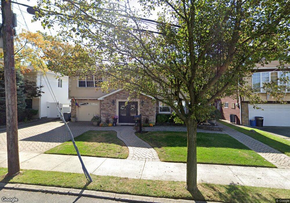
69 Dawson Cir Staten Island, NY 10314
Bulls Head NeighborhoodEstimated Value: $990,923 - $1,132,000
4
Beds
4
Baths
3,000
Sq Ft
$352/Sq Ft
Est. Value
About This Home
This home is located at 69 Dawson Cir, Staten Island, NY 10314 and is currently estimated at $1,057,481, approximately $352 per square foot. 69 Dawson Cir is a home located in Richmond County with nearby schools including P.S. 060 Alice Austen School, Is 72 Rocco Laurie, and Port Richmond High School.
Ownership History
Date
Name
Owned For
Owner Type
Purchase Details
Closed on
Mar 24, 2006
Sold by
Calabrese Charles and Bennett Josephine
Bought by
Demarinis Pasquale and Demarinis Bernadine
Current Estimated Value
Home Financials for this Owner
Home Financials are based on the most recent Mortgage that was taken out on this home.
Original Mortgage
$500,000
Outstanding Balance
$294,610
Interest Rate
6.9%
Mortgage Type
Balloon
Estimated Equity
$762,871
Create a Home Valuation Report for This Property
The Home Valuation Report is an in-depth analysis detailing your home's value as well as a comparison with similar homes in the area
Home Values in the Area
Average Home Value in this Area
Purchase History
| Date | Buyer | Sale Price | Title Company |
|---|---|---|---|
| Demarinis Pasquale | $750,000 | Stewart Title Insurance Co |
Source: Public Records
Mortgage History
| Date | Status | Borrower | Loan Amount |
|---|---|---|---|
| Open | Demarinis Pasquale | $500,000 |
Source: Public Records
Tax History Compared to Growth
Tax History
| Year | Tax Paid | Tax Assessment Tax Assessment Total Assessment is a certain percentage of the fair market value that is determined by local assessors to be the total taxable value of land and additions on the property. | Land | Improvement |
|---|---|---|---|---|
| 2025 | $9,675 | $58,140 | $11,818 | $46,322 |
| 2024 | $4,838 | $53,340 | $12,734 | $40,606 |
| 2023 | $9,266 | $45,626 | $10,471 | $35,155 |
| 2022 | $8,593 | $51,000 | $14,100 | $36,900 |
| 2021 | $8,546 | $45,780 | $14,100 | $31,680 |
| 2020 | $8,596 | $48,300 | $14,100 | $34,200 |
| 2019 | $8,398 | $48,360 | $14,100 | $34,260 |
| 2018 | $7,751 | $38,022 | $11,977 | $26,045 |
| 2017 | $7,312 | $35,870 | $13,275 | $22,595 |
| 2016 | $6,765 | $33,840 | $14,100 | $19,740 |
| 2015 | $6,420 | $35,460 | $10,483 | $24,977 |
| 2014 | $6,420 | $33,453 | $11,305 | $22,148 |
Source: Public Records
Map
Nearby Homes
- 96 Amsterdam Ave
- 87 Amsterdam Ave
- 20 Toddy Ave
- 18 Signs Rd
- 149 Forest St
- 180 Dinsmore St Unit E
- 72 Toddy Ave
- 3 Nostrand Ave
- 4 Gary Place
- 1775 Richmond Ave
- 35 Sideview Ave
- 80 Dinsmore St Unit A
- 94 Saybrook St
- 94 Gary Place
- 45 Sommer Ave
- 57 Speedwell Ave
- 96 Paulding Ave
- 117 Gary Place
- 80 Freedom Ave
- 6 Mulberry Ave
- 63 Dawson Cir Unit rose barlow
- 63 Dawson Cir
- 75 Dawson Cir
- 124 Amsterdam Ave
- 118 Amsterdam Ave
- 130 Amsterdam Ave
- 112 Amsterdam Ave
- 68 Dawson Cir
- 74 Dawson Cir
- 62 Dawson Cir
- 53 Dawson Cir
- 108 Amsterdam Ave
- 89 Dawson Cir
- 56 Dawson Cir
- 104 Amsterdam Ave
- 142 Amsterdam Ave
- 88 Dawson Cir
- 45 Dawson Cir
- 93 Dawson Cir
- 106 Carnegie Ave