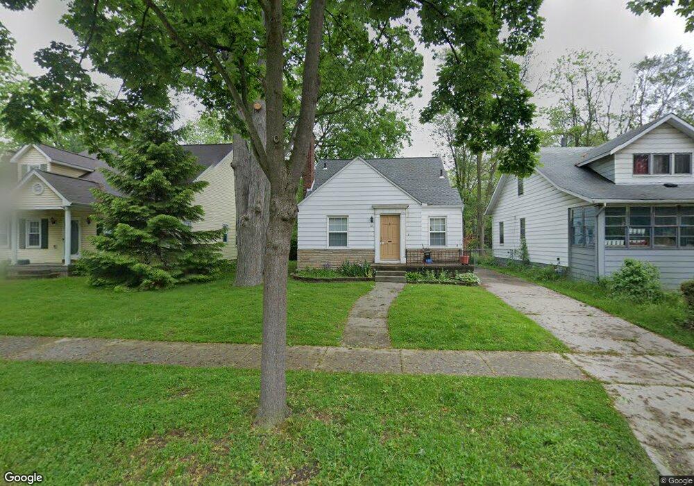
69 Devonshire Rd Pleasant Ridge, MI 48069
Estimated Value: $326,380 - $420,000
3
Beds
1
Bath
1,038
Sq Ft
$357/Sq Ft
Est. Value
About This Home
This home is located at 69 Devonshire Rd, Pleasant Ridge, MI 48069 and is currently estimated at $370,845, approximately $357 per square foot. 69 Devonshire Rd is a home located in Oakland County with nearby schools including Ferndale Lower Elementary Campus, Ferndale Upper Elementary Campus, and Ferndale Middle School.
Ownership History
Date
Name
Owned For
Owner Type
Purchase Details
Closed on
Jan 26, 2021
Sold by
Wagnitz Marily J and Ashman Marilyn J
Bought by
Woodmansee Adam
Current Estimated Value
Home Financials for this Owner
Home Financials are based on the most recent Mortgage that was taken out on this home.
Original Mortgage
$167,902
Outstanding Balance
$149,909
Interest Rate
2.6%
Mortgage Type
FHA
Estimated Equity
$220,936
Create a Home Valuation Report for This Property
The Home Valuation Report is an in-depth analysis detailing your home's value as well as a comparison with similar homes in the area
Home Values in the Area
Average Home Value in this Area
Purchase History
| Date | Buyer | Sale Price | Title Company |
|---|---|---|---|
| Woodmansee Adam | $171,000 | Partners Title Agency Llc |
Source: Public Records
Mortgage History
| Date | Status | Borrower | Loan Amount |
|---|---|---|---|
| Open | Woodmansee Adam | $167,902 |
Source: Public Records
Tax History Compared to Growth
Tax History
| Year | Tax Paid | Tax Assessment Tax Assessment Total Assessment is a certain percentage of the fair market value that is determined by local assessors to be the total taxable value of land and additions on the property. | Land | Improvement |
|---|---|---|---|---|
| 2024 | $7,348 | $163,640 | $0 | $0 |
| 2023 | $7,088 | $158,470 | $0 | $0 |
| 2022 | $7,035 | $149,740 | $0 | $0 |
| 2021 | $3,537 | $140,430 | $0 | $0 |
| 2020 | $3,367 | $129,410 | $0 | $0 |
| 2019 | $3,436 | $126,910 | $0 | $0 |
| 2018 | $3,364 | $129,220 | $0 | $0 |
| 2017 | $3,309 | $125,990 | $0 | $0 |
| 2016 | $3,314 | $112,970 | $0 | $0 |
| 2015 | -- | $97,550 | $0 | $0 |
| 2014 | -- | $0 | $0 | $0 |
| 2011 | -- | $79,370 | $0 | $0 |
Source: Public Records
Map
Nearby Homes
- 1530 Maryland Club Dr
- 1566 Maryland Club Dr
- 1468 Maryland Club Dr
- 1552 Maryland Club Dr Unit 87
- 622 MacWilliams Ln Unit 1
- 1509 Anne Dr
- 617 MacWilliams Ln Unit 14
- 400 James Cir Unit 63
- 3245 Inman St
- 1300 Batavia Ave Unit 2
- 1300 Batavia Ave Unit 1
- 722 E Parent Ave
- 3 Fairwood Blvd
- 1213 Batavia Ave
- 1260 Diamond Ct Unit A
- 1118 Longfellow Ave
- 1412 Etowah Ave
- 1515 Etowah Ave
- 1212 Wyandotte Ave
- 573 E Oakridge St
- 65 Devonshire Rd
- 71 Devonshire Rd
- 67 Devonshire Rd
- 61 Devonshire Rd
- 102 Kensington Blvd
- 100 Kensington Blvd
- 104 Kensington Blvd
- 98 Kensington Blvd
- 72 Devonshire Rd
- 68 Devonshire Rd
- 90 Kensington Blvd
- 74 Devonshire Rd
- 66 Devonshire Rd
- 59 Devonshire Rd
- 64 Devonshire Rd
- 88 Kensington Blvd Unit Bldg-Unit
- 88 Kensington Blvd
- 62 Devonshire Rd
- 84 Kensington Blvd Unit Bldg-Unit
- 84 Kensington Blvd