
Seller's Agent in 2026
Shirley Ryan
Tarter Realty
(330) 221-3585
116 in this area
433 Total Sales
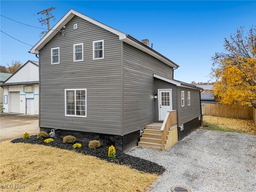

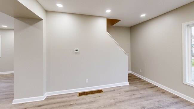


A true hidden gem—completely transformed and absolutely stunning! This fully updated 3-bedroom, 2-bath home delivers the luxury, comfort, and style today’s buyers dream of. From the moment you step inside, you’ll feel the sparkling newness of every detail. The heart of the home is the showstopping open-concept kitchen, designed to impress with its massive granite island—an entertainer’s dream and the perfect centerpiece for gatherings. Brand-new appliances, modern lighting, fresh drywall, and gorgeous finishes create an upscale, magazine-worthy look throughout. This home doesn’t just shine on the surface—everything behind the walls has been upgraded, too. Enjoy total peace of mind with all-new furnace, central air, plumbing, wiring, and more. Convenient first-floor laundry adds everyday ease and functionality. Stylish, modern, and thoughtfully reimagined from top to bottom. Don’t miss your chance to own this hidden treasure!
Last Agent to Sell the Property
Tarter Realty Brokerage Email: TarterRealty@aol.com, 330-221-3585 License #2008001912 Listed on: 11/22/2025
| Date | Type | Sale Price | Title Company |
|---|---|---|---|
| Warranty Deed | $169,000 | Heritage Union Title | |
| Quit Claim Deed | -- | None Listed On Document | |
| Sheriffs Deed | $420,000 | None Available | |
| Quit Claim Deed | -- | None Available | |
| Quit Claim Deed | -- | None Available | |
| Quit Claim Deed | -- | None Available | |
| Sheriffs Deed | $2,322 | None Available |
| Date | Status | Loan Amount | Loan Type |
|---|---|---|---|
| Open | $151,050 | New Conventional |
| Date | Event | Price | List to Sale | Price per Sq Ft |
|---|---|---|---|---|
| 01/27/2026 01/27/26 | Sold | $159,000 | -0.6% | $107 / Sq Ft |
| 12/27/2025 12/27/25 | Pending | -- | -- | -- |
| 12/09/2025 12/09/25 | Price Changed | $159,900 | -5.9% | $107 / Sq Ft |
| 11/22/2025 11/22/25 | For Sale | $169,900 | -- | $114 / Sq Ft |
| Year | Tax Paid | Tax Assessment Tax Assessment Total Assessment is a certain percentage of the fair market value that is determined by local assessors to be the total taxable value of land and additions on the property. | Land | Improvement |
|---|---|---|---|---|
| 2025 | -- | $7,420 | $3,640 | $3,780 |
| 2024 | -- | $7,420 | $3,640 | $3,780 |
| 2023 | $219 | $5,320 | $1,960 | $3,360 |
| 2022 | $785 | $5,500 | $1,960 | $3,540 |
| 2021 | $533 | $8,230 | $1,960 | $6,270 |
| 2020 | $308 | $7,110 | $1,720 | $5,390 |
| 2019 | $304 | $7,110 | $1,720 | $5,390 |
| 2018 | $305 | $7,110 | $1,720 | $5,390 |
| 2017 | $749 | $6,200 | $1,440 | $4,760 |
| 2016 | $1,079 | $6,200 | $1,440 | $4,760 |
| 2015 | $289 | $6,200 | $1,440 | $4,760 |
| 2014 | $187 | $4,000 | $1,300 | $2,700 |
| 2013 | $93 | $4,000 | $1,300 | $2,700 |
Seller's Agent in 2026
Shirley Ryan
Tarter Realty
(330) 221-3585
116 in this area
433 Total Sales
Buyer's Agent in 2026
Jessica Conrad
Keller Williams Chervenic Rlty
(330) 614-8862
62 in this area
419 Total Sales
Source: MLS Now
MLS Number: 5172928
APN: 00105175
Disclaimer: Certain information contained herein is derived from information provided by parties other than Homes.com. All information provided is deemed reliable, but is not guaranteed to be accurate and should be independently verified.
![]() IDX information is provided exclusively for personal, non-commercial use, and may not be used for any purpose other than to identify prospective properties consumers may be interested in purchasing. Information is deemed reliable but not guaranteed.
IDX information is provided exclusively for personal, non-commercial use, and may not be used for any purpose other than to identify prospective properties consumers may be interested in purchasing. Information is deemed reliable but not guaranteed.
Ask me questions while you tour the home.