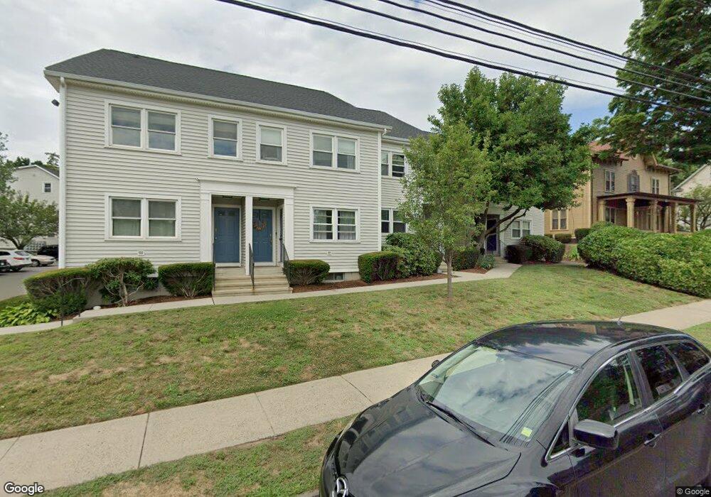
69 Ellsworth St Unit 104 Bridgeport, CT 06605
Black Rock NeighborhoodEstimated Value: $348,541 - $449,000
2
Beds
2
Baths
1,340
Sq Ft
$294/Sq Ft
Est. Value
About This Home
This home is located at 69 Ellsworth St Unit 104, Bridgeport, CT 06605 and is currently estimated at $394,385, approximately $294 per square foot. 69 Ellsworth St Unit 104 is a home located in Fairfield County with nearby schools including Black Rock School, Bassick High School, and Great Oaks Charter School Bridgeport.
Ownership History
Date
Name
Owned For
Owner Type
Purchase Details
Closed on
Jun 10, 2022
Sold by
Sloan Daniel J
Bought by
Henwood Rachel
Current Estimated Value
Purchase Details
Closed on
Jun 20, 2007
Sold by
Cahill Christopher
Bought by
Sloan Daniel
Home Financials for this Owner
Home Financials are based on the most recent Mortgage that was taken out on this home.
Original Mortgage
$199,500
Interest Rate
6.14%
Purchase Details
Closed on
Jun 16, 2005
Sold by
Poidomani Christopher
Bought by
Cahill Christopher
Purchase Details
Closed on
May 5, 2003
Sold by
Treidel Ann and Treidel Alfred
Bought by
Lacasky Andrea M and Piodomani Christopher J
Create a Home Valuation Report for This Property
The Home Valuation Report is an in-depth analysis detailing your home's value as well as a comparison with similar homes in the area
Home Values in the Area
Average Home Value in this Area
Purchase History
| Date | Buyer | Sale Price | Title Company |
|---|---|---|---|
| Henwood Rachel | $286,500 | None Available | |
| Sloan Daniel | $266,000 | -- | |
| Sloan Daniel | $266,000 | -- | |
| Cahill Christopher | $239,900 | -- | |
| Cahill Christopher | $239,900 | -- | |
| Lacasky Andrea M | $165,500 | -- | |
| Lacasky Andrea M | $165,500 | -- |
Source: Public Records
Mortgage History
| Date | Status | Borrower | Loan Amount |
|---|---|---|---|
| Previous Owner | Lacasky Andrea M | $192,543 | |
| Previous Owner | Lacasky Andrea M | $199,500 |
Source: Public Records
Tax History Compared to Growth
Tax History
| Year | Tax Paid | Tax Assessment Tax Assessment Total Assessment is a certain percentage of the fair market value that is determined by local assessors to be the total taxable value of land and additions on the property. | Land | Improvement |
|---|---|---|---|---|
| 2025 | $5,589 | $128,630 | $0 | $128,630 |
| 2024 | $5,589 | $128,630 | $0 | $128,630 |
| 2023 | $5,589 | $128,630 | $0 | $128,630 |
| 2022 | $5,589 | $128,630 | $0 | $128,630 |
| 2021 | $5,589 | $128,630 | $0 | $128,630 |
| 2020 | $4,737 | $87,730 | $0 | $87,730 |
| 2019 | $4,737 | $87,730 | $0 | $87,730 |
| 2018 | $4,770 | $87,730 | $0 | $87,730 |
| 2017 | $4,770 | $87,730 | $0 | $87,730 |
| 2016 | $4,770 | $87,730 | $0 | $87,730 |
| 2015 | $6,375 | $151,060 | $0 | $151,060 |
| 2014 | $6,375 | $151,060 | $0 | $151,060 |
Source: Public Records
Map
Nearby Homes
- 317 Brewster St
- 75 Homestead Ave Unit 77
- 554 Brewster St Unit 4
- 26 Rowsley St Unit 3
- 37 Rowsley St Unit 6
- 39 Jetland Place Unit 41
- 166 Alfred St
- 105 Fox St Unit 107
- 165 Bennett St
- 855 Brewster St Unit 857
- 167 Scofield Ave
- 82 Waldorf Ave
- 25 Whittier St
- 31 Whittier St
- 135 Whittier St
- 0 Battery Park Dr
- 361 Riverside Dr
- 95 Bedford Ave
- 130 Brentwood Ave
- 118 Berwick Ave
- 69 Ellsworth St Unit 110
- 69 Ellsworth St Unit 109
- 69 Ellsworth St Unit 108
- 69 Ellsworth St Unit 107
- 69 Ellsworth St Unit 106
- 69 Ellsworth St Unit 105
- 69 Ellsworth St Unit 103
- 65 Ellsworth St Unit 316
- 65 Ellsworth St Unit 314
- 65 Ellsworth St Unit 313
- 65 Ellsworth St Unit 312
- 65 Ellsworth St Unit 311
- 65 Ellsworth St Unit 310
- 65 Ellsworth St Unit 309
- 65 Ellsworth St Unit 308
- 65 Ellsworth St Unit 307
- 65 Ellsworth St Unit 306
- 65 Ellsworth St Unit 305
- 65 Ellsworth St Unit 304
- 65 Ellsworth St Unit 303