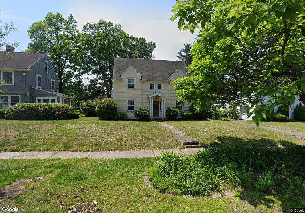
69 Emerson Rd Longmeadow, MA 01106
Estimated Value: $419,000 - $577,000
4
Beds
2
Baths
1,905
Sq Ft
$253/Sq Ft
Est. Value
About This Home
This home is located at 69 Emerson Rd, Longmeadow, MA 01106 and is currently estimated at $482,619, approximately $253 per square foot. 69 Emerson Rd is a home located in Hampden County with nearby schools including Center Elementary School, Williams Middle School, and Longmeadow High School.
Ownership History
Date
Name
Owned For
Owner Type
Purchase Details
Closed on
Jun 29, 2000
Sold by
Reilly Jennifer M and Reilly Douglas W
Bought by
Bradshaw Peter G and Bradshaw Tracy P
Current Estimated Value
Home Financials for this Owner
Home Financials are based on the most recent Mortgage that was taken out on this home.
Original Mortgage
$140,000
Interest Rate
8.59%
Mortgage Type
Purchase Money Mortgage
Purchase Details
Closed on
Aug 31, 1998
Sold by
Oconnor Jennifer M
Bought by
Reilly Jennifer M and Reilly Douglas W
Home Financials for this Owner
Home Financials are based on the most recent Mortgage that was taken out on this home.
Original Mortgage
$185,150
Interest Rate
6.9%
Mortgage Type
Purchase Money Mortgage
Purchase Details
Closed on
Apr 3, 1997
Sold by
Mcivor Carole M
Bought by
Oconnor Gregory G and Toppi Jennifer M
Create a Home Valuation Report for This Property
The Home Valuation Report is an in-depth analysis detailing your home's value as well as a comparison with similar homes in the area
Home Values in the Area
Average Home Value in this Area
Purchase History
| Date | Buyer | Sale Price | Title Company |
|---|---|---|---|
| Bradshaw Peter G | $190,000 | -- | |
| Reilly Jennifer M | $194,900 | -- | |
| Oconnor Gregory G | $155,000 | -- |
Source: Public Records
Mortgage History
| Date | Status | Borrower | Loan Amount |
|---|---|---|---|
| Open | Oconnor Gregory G | $228,000 | |
| Closed | Oconnor Gregory G | $146,000 | |
| Closed | Oconnor Gregory G | $140,000 | |
| Previous Owner | Oconnor Gregory G | $185,150 |
Source: Public Records
Tax History
| Year | Tax Paid | Tax Assessment Tax Assessment Total Assessment is a certain percentage of the fair market value that is determined by local assessors to be the total taxable value of land and additions on the property. | Land | Improvement |
|---|---|---|---|---|
| 2025 | $8,205 | $388,500 | $153,600 | $234,900 |
| 2024 | $8,034 | $388,500 | $153,600 | $234,900 |
| 2023 | $7,754 | $338,300 | $132,200 | $206,100 |
| 2022 | $7,505 | $304,600 | $132,200 | $172,400 |
| 2021 | $7,214 | $291,600 | $125,900 | $165,700 |
| 2020 | $7,048 | $291,100 | $119,000 | $172,100 |
| 2019 | $6,711 | $278,600 | $119,000 | $159,600 |
| 2018 | $6,535 | $268,500 | $142,200 | $126,300 |
| 2017 | $6,331 | $268,500 | $142,200 | $126,300 |
| 2016 | $6,027 | $247,700 | $129,400 | $118,300 |
| 2015 | $5,820 | $246,400 | $128,100 | $118,300 |
Source: Public Records
Map
Nearby Homes
- 32 Edgewood Ave
- 50 Elmwood Ave
- 58 Englewood Rd
- 124 Tecumseh Dr
- 70 Tennyson Dr
- 0 Dennis Rd
- 55 Fernleaf Ave
- 0 Mill Rd
- 19 Greenwood St
- 114 Park Dr
- 112 Grassy Gutter Rd
- 47 Roberta Cir
- 64 Magnolia Cir
- 153 Porter Lake Dr Unit 153
- 144 River Rd
- Lot 114 Bark Haul Rd
- 1077 Main St
- 283 Longhill St
- 47 Corey Colonial
- 35 Spruceland Ave
Your Personal Tour Guide
Ask me questions while you tour the home.