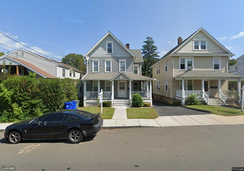
69 Fairfield Ave Unit 2ND F Norwalk, CT 06854
Brookside NeighborhoodEstimated Value: $591,000 - $1,083,123
2
Beds
1
Bath
1,000
Sq Ft
$919/Sq Ft
Est. Value
About This Home
This home is located at 69 Fairfield Ave Unit 2ND F, Norwalk, CT 06854 and is currently estimated at $918,531, approximately $918 per square foot. 69 Fairfield Ave Unit 2ND F is a home located in Fairfield County with nearby schools including Jefferson Marine Science Elementary School, Ponus Ridge Middle School, and Brien Mcmahon High School.
Ownership History
Date
Name
Owned For
Owner Type
Purchase Details
Closed on
Apr 28, 2025
Sold by
Iannone Franco
Bought by
67-69 Fairfield Ave Llc
Current Estimated Value
Purchase Details
Closed on
Dec 20, 2021
Sold by
Roseco 2 Llc
Bought by
67-69 Fairfield Ave Llc
Home Financials for this Owner
Home Financials are based on the most recent Mortgage that was taken out on this home.
Original Mortgage
$609,000
Interest Rate
2.98%
Mortgage Type
Commercial
Create a Home Valuation Report for This Property
The Home Valuation Report is an in-depth analysis detailing your home's value as well as a comparison with similar homes in the area
Home Values in the Area
Average Home Value in this Area
Purchase History
| Date | Buyer | Sale Price | Title Company |
|---|---|---|---|
| 67-69 Fairfield Ave Llc | -- | None Available | |
| 67-69 Fairfield Ave Llc | -- | None Available | |
| 67-69 Fairfield Ave Llc | $870,000 | None Available | |
| 67-69 Fairfield Ave Llc | $870,000 | None Available |
Source: Public Records
Mortgage History
| Date | Status | Borrower | Loan Amount |
|---|---|---|---|
| Previous Owner | 67-69 Fairfield Ave Llc | $609,000 |
Source: Public Records
Tax History Compared to Growth
Tax History
| Year | Tax Paid | Tax Assessment Tax Assessment Total Assessment is a certain percentage of the fair market value that is determined by local assessors to be the total taxable value of land and additions on the property. | Land | Improvement |
|---|---|---|---|---|
| 2025 | $16,223 | $678,800 | $138,640 | $540,160 |
| 2024 | $15,982 | $678,800 | $138,640 | $540,160 |
| 2023 | $13,045 | $520,000 | $120,730 | $399,270 |
| 2022 | $12,763 | $520,000 | $120,730 | $399,270 |
| 2021 | $12,462 | $520,000 | $120,730 | $399,270 |
| 2020 | $12,457 | $520,000 | $120,730 | $399,270 |
| 2019 | $12,124 | $520,000 | $120,730 | $399,270 |
| 2018 | $8,034 | $301,990 | $116,100 | $185,890 |
| 2017 | $7,756 | $301,990 | $116,100 | $185,890 |
| 2016 | $7,683 | $301,990 | $116,100 | $185,890 |
| 2015 | $7,661 | $301,990 | $116,100 | $185,890 |
| 2014 | $7,562 | $301,990 | $116,100 | $185,890 |
Source: Public Records
Map
Nearby Homes
- 22 Dr Martin Luther King Blvd Unit C6
- 14 Ferris Ave Unit 9
- 42 Stuart Ave Unit A1
- 59 Taylor Ave
- 32 Pine St Unit 26
- 8 Crown Ave
- 47 Taylor Ave
- 10 Ann St Unit 206
- 33 N Water St Unit 607
- 33 N Water St Unit 505
- 33 N Water St Unit 804
- 6 W Couch St
- 187 Flax Hill Rd Unit A4
- 187 Flax Hill Rd Unit D5
- 63 Ferris Ave
- 94 Washington St Unit 20
- 15 Madison St Unit F9
- 15 Madison St Unit G11
- 1 Horizon Dr Unit 2
- 118 Washington St Unit 304
- 69 Fairfield Ave Unit 1ST F
- 75 Fairfield Ave Unit 6
- 75 Fairfield Ave Unit 5
- 75 Fairfield Ave Unit 4
- 75 Fairfield Ave Unit 3
- 75 Fairfield Ave Unit 2
- 75 Fairfield Ave Unit 1
- 75 Fairfield Ave Unit 9
- 75 Fairfield Ave Unit 8
- 75 Fairfield Ave Unit 7
- 75 Fairfield Ave Unit 10
- 75 Fairfield Ave
- 55 Cedar St
- 55 Cedar St Unit 1
- 57 Cedar St Unit A4
- 57 Cedar St Unit A3
- 57 Cedar St Unit A2
- 57 Cedar St Unit A1
- 53 Cedar St
- 67 Fairfield Ave Unit UPPER