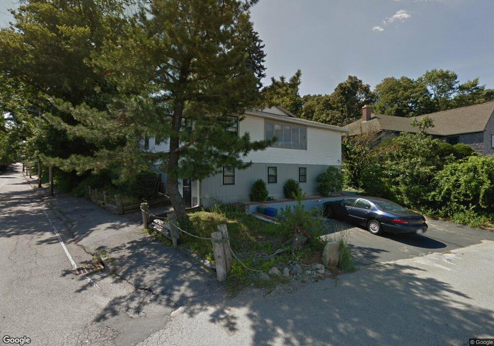
69 Fore River Ave North Weymouth, MA 02191
North Weymouth NeighborhoodEstimated Value: $603,326 - $667,000
3
Beds
2
Baths
1,296
Sq Ft
$487/Sq Ft
Est. Value
About This Home
This home is located at 69 Fore River Ave, North Weymouth, MA 02191 and is currently estimated at $630,582, approximately $486 per square foot. 69 Fore River Ave is a home located in Norfolk County with nearby schools including Wessagusset Elementary School, Abigail Adams Middle School, and Weymouth Middle School Chapman.
Ownership History
Date
Name
Owned For
Owner Type
Purchase Details
Closed on
Jun 28, 2010
Sold by
Bennett Paul M
Bought by
Damelio Richard H
Current Estimated Value
Home Financials for this Owner
Home Financials are based on the most recent Mortgage that was taken out on this home.
Original Mortgage
$196,000
Outstanding Balance
$131,926
Interest Rate
4.98%
Mortgage Type
Purchase Money Mortgage
Estimated Equity
$498,656
Purchase Details
Closed on
Dec 31, 1998
Sold by
Panek Edwin R
Bought by
Bennett Paul M
Home Financials for this Owner
Home Financials are based on the most recent Mortgage that was taken out on this home.
Original Mortgage
$164,000
Interest Rate
6.84%
Mortgage Type
Purchase Money Mortgage
Create a Home Valuation Report for This Property
The Home Valuation Report is an in-depth analysis detailing your home's value as well as a comparison with similar homes in the area
Home Values in the Area
Average Home Value in this Area
Purchase History
| Date | Buyer | Sale Price | Title Company |
|---|---|---|---|
| Damelio Richard H | $280,000 | -- | |
| Bennett Paul M | $205,000 | -- |
Source: Public Records
Mortgage History
| Date | Status | Borrower | Loan Amount |
|---|---|---|---|
| Open | Damelio Richard H | $196,000 | |
| Previous Owner | Bennett Paul M | $164,000 |
Source: Public Records
Tax History Compared to Growth
Tax History
| Year | Tax Paid | Tax Assessment Tax Assessment Total Assessment is a certain percentage of the fair market value that is determined by local assessors to be the total taxable value of land and additions on the property. | Land | Improvement |
|---|---|---|---|---|
| 2025 | $5,340 | $528,700 | $364,700 | $164,000 |
| 2024 | $5,172 | $503,600 | $347,400 | $156,200 |
| 2023 | $4,969 | $475,500 | $321,700 | $153,800 |
| 2022 | $5,115 | $446,300 | $313,500 | $132,800 |
| 2021 | $4,952 | $421,800 | $313,500 | $108,300 |
| 2020 | $4,937 | $414,200 | $313,500 | $100,700 |
| 2019 | $4,711 | $388,700 | $301,500 | $87,200 |
| 2018 | $4,294 | $343,500 | $258,400 | $85,100 |
| 2017 | $4,244 | $331,300 | $246,100 | $85,200 |
| 2016 | $3,960 | $309,400 | $223,500 | $85,900 |
| 2015 | $3,937 | $305,200 | $223,500 | $81,700 |
| 2014 | $4,001 | $300,800 | $208,000 | $92,800 |
Source: Public Records
Map
Nearby Homes
- 6 Grand View Rd
- 29 Wituwamat Rd
- 137 Wessagussett Rd
- 104 Kings Cove Beach Rd
- 159 Wessagussett Rd
- 28 Birchbrow Ave
- 41 Pecksuot Rd
- 43 Standish St
- 14 Crescent Rd
- 21 Athens St Unit 11
- 16 Howard St
- 69 Great Hill Dr
- 65 Saning Rd
- 51 Beals St Unit 53
- 34 Bowes Ave
- 95 Fuller Rd
- 295 Rock Island Rd
- 211 Glenrose Ave
- 107 Spring St
- 613 South St Unit 1
- 59 Fore River Ave
- 245 Sea St
- 239 Sea St
- 236 Sea St
- 236 Sea St Unit A
- 236 Sea St Unit Right
- 236 Sea St Unit 1
- 49 Fore River Ave
- 14 Ocean Ave
- 235 Sea St
- 18 Ocean Ave
- 230 Sea St
- 20 Ocean Ave
- 3 Ocean Ave
- 15 Ocean Ave
- 47 Fore River Ave
- 47 Fore River Ave Unit 1
- 43 Bicknell Rd
- 32 Ocean Ave
- 32 Ocean Ave Unit ocean