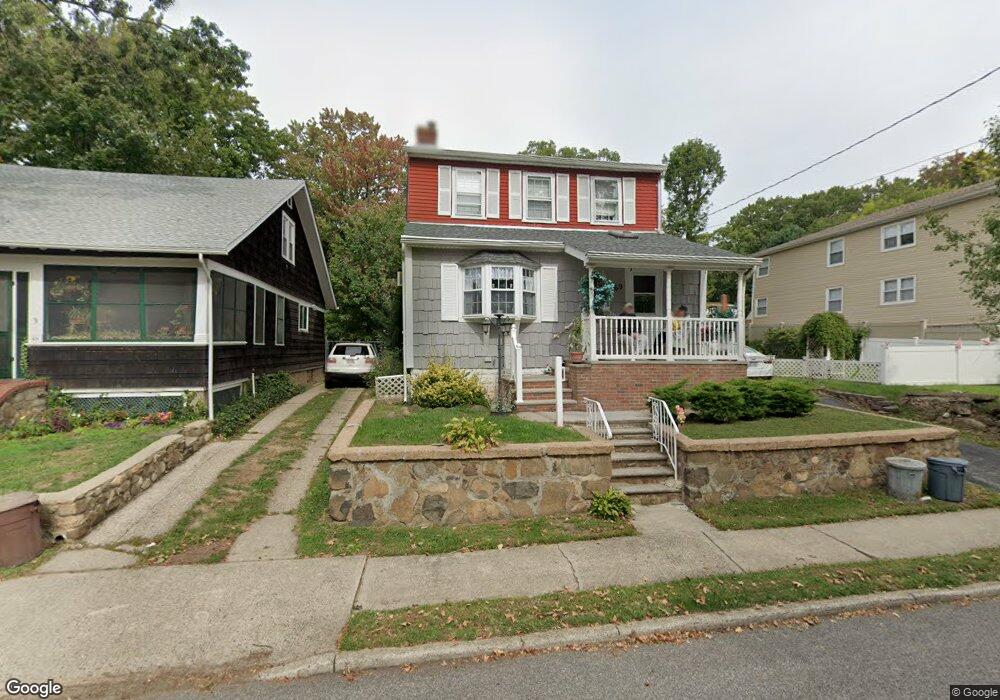
69 Gibson Ave Staten Island, NY 10308
Great Kills NeighborhoodEstimated Value: $564,141 - $878,000
--
Bed
4
Baths
993
Sq Ft
$730/Sq Ft
Est. Value
About This Home
This home is located at 69 Gibson Ave, Staten Island, NY 10308 and is currently estimated at $725,285, approximately $730 per square foot. 69 Gibson Ave is a home located in Richmond County with nearby schools including P.S. 32 The Gifford School, Myra S. Barnes Intermediate School 24, and Susan E Wagner High School.
Ownership History
Date
Name
Owned For
Owner Type
Purchase Details
Closed on
Jun 13, 2025
Sold by
Anthony Fiorella and Anthony Carol Fiorella
Bought by
Gibson Ave Development Llc
Current Estimated Value
Purchase Details
Closed on
Mar 23, 2022
Sold by
Fiorella Anthony B and Fiorella Carol B
Bought by
Anthony Fiorella And Carol Fiorella Irrevocab
Create a Home Valuation Report for This Property
The Home Valuation Report is an in-depth analysis detailing your home's value as well as a comparison with similar homes in the area
Home Values in the Area
Average Home Value in this Area
Purchase History
| Date | Buyer | Sale Price | Title Company |
|---|---|---|---|
| Gibson Ave Development Llc | $875,000 | Gem Abstract | |
| Anthony Fiorella And Carol Fiorella Irrevocab | -- | None Listed On Document |
Source: Public Records
Tax History Compared to Growth
Tax History
| Year | Tax Paid | Tax Assessment Tax Assessment Total Assessment is a certain percentage of the fair market value that is determined by local assessors to be the total taxable value of land and additions on the property. | Land | Improvement |
|---|---|---|---|---|
| 2025 | $4,238 | $36,900 | $10,698 | $26,202 |
| 2024 | $4,342 | $32,760 | $11,368 | $21,392 |
| 2023 | $4,082 | $28,145 | $9,120 | $19,025 |
| 2022 | $3,745 | $34,620 | $12,540 | $22,080 |
| 2021 | $3,991 | $31,440 | $12,540 | $18,900 |
| 2020 | $3,878 | $31,980 | $12,540 | $19,440 |
| 2019 | $3,217 | $32,460 | $12,540 | $19,920 |
| 2018 | $3,144 | $23,454 | $11,671 | $11,783 |
| 2017 | $3,624 | $23,389 | $10,936 | $12,453 |
| 2016 | $3,422 | $22,620 | $12,540 | $10,080 |
| 2015 | $2,941 | $21,861 | $10,143 | $11,718 |
| 2014 | $2,941 | $20,624 | $8,365 | $12,259 |
Source: Public Records
Map
Nearby Homes
- 59 Gibson Ave
- 66 Gibson Ave
- 168 Leverett Ave
- 171 Dewey Ave
- 157 Exeter St
- 17 Greaves Ct
- 200 Giffords Ln
- 98 Kennington St
- 132 Dewey Ave
- 83 Katan Ave
- 108 Giffords Ln
- 42 Greaves Ave
- 271 Doane Ave
- 28 N Rhett Ave
- 47 Jumel St
- 52 Barlow Ave
- 221B Katan Ave Unit 33B
- 221 B Katan Ave
- 3871 Amboy Rd Unit 105
- 34 Stern Ct
- 75 Gibson Ave Unit 2
- 75 Gibson Ave
- 59 Gibson Ave Unit 1
- 76 Howton Ave
- 68 Howton Ave
- 55 Gibson Ave
- 62 Howton Ave Unit 66
- 62-66 Howton Ave
- 81 Gibson Ave
- 58 Howton Ave
- 53 Gibson Ave
- 82 Howton Ave
- 177 Miles Ave
- 68 Gibson Ave
- 175 Miles Ave
- 52 Howton Ave
- 56 Gibson Ave
- 87 Gibson Ave
- 88 Howton Ave
- 173 Miles Ave