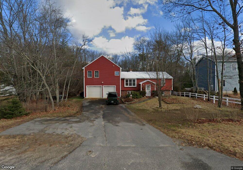
69 Gorham Rd Scarborough, ME 04074
Estimated Value: $523,908 - $583,000
3
Beds
1
Bath
1,706
Sq Ft
$323/Sq Ft
Est. Value
About This Home
This home is located at 69 Gorham Rd, Scarborough, ME 04074 and is currently estimated at $551,227, approximately $323 per square foot. 69 Gorham Rd is a home located in Cumberland County with nearby schools including Scarborough High School and Cornerstone Baptist Academy.
Ownership History
Date
Name
Owned For
Owner Type
Purchase Details
Closed on
Aug 20, 2012
Sold by
Gross Olga V and Gross-Balzano Olga V
Bought by
Balzano Joseph A and Gross-Balzano Olga V
Current Estimated Value
Purchase Details
Closed on
Sep 18, 2006
Sold by
Gross Steven F
Bought by
Gross Steven F and Gross Olga V
Home Financials for this Owner
Home Financials are based on the most recent Mortgage that was taken out on this home.
Original Mortgage
$200,000
Interest Rate
6.71%
Mortgage Type
Commercial
Create a Home Valuation Report for This Property
The Home Valuation Report is an in-depth analysis detailing your home's value as well as a comparison with similar homes in the area
Home Values in the Area
Average Home Value in this Area
Purchase History
| Date | Buyer | Sale Price | Title Company |
|---|---|---|---|
| Balzano Joseph A | -- | -- | |
| Gross Steven F | -- | -- |
Source: Public Records
Mortgage History
| Date | Status | Borrower | Loan Amount |
|---|---|---|---|
| Closed | Gross Steven F | $200,000 |
Source: Public Records
Tax History Compared to Growth
Tax History
| Year | Tax Paid | Tax Assessment Tax Assessment Total Assessment is a certain percentage of the fair market value that is determined by local assessors to be the total taxable value of land and additions on the property. | Land | Improvement |
|---|---|---|---|---|
| 2024 | $3,830 | $350,400 | $106,900 | $243,500 |
| 2023 | $4,596 | $287,800 | $93,800 | $194,000 |
| 2022 | $4,429 | $287,800 | $93,800 | $194,000 |
| 2021 | $4,323 | $287,800 | $93,800 | $194,000 |
| 2020 | $4,277 | $287,800 | $93,800 | $194,000 |
| 2019 | $4,231 | $287,800 | $93,800 | $194,000 |
| 2017 | $3,743 | $227,000 | $120,400 | $106,600 |
| 2016 | $3,614 | $227,000 | $120,400 | $106,600 |
| 2015 | $3,516 | $227,000 | $120,400 | $106,600 |
| 2014 | $3,277 | $227,000 | $120,400 | $106,600 |
| 2013 | -- | $227,000 | $120,400 | $106,600 |
Source: Public Records
Map
Nearby Homes
- 14 Holbrook Farms Way Unit 1
- 73 Maple Ave
- 14 Oakdale Dr Unit 14
- 8 Overlook Dr Unit 7
- 22 Jameco Mill Rd
- 14 Herbert Dr
- 2 Owens Way
- 10 Leighton Farm Rd
- 46 Pacer Way
- 8 Plover Way Unit 20
- 30 Stratton Rd Unit 30
- 29 Stratton Rd
- 11 Westwood Ave
- 32 Pacer Way Unit 336
- 1 Stratton Rd Unit 1
- 19 Millbrook Rd
- 1 Teal Point Dr Unit 1
- 1 Cross St Unit 212
- 1 Cross St Unit 213
- 1 Cross St Unit 220
- 67 Gorham Rd
- 71 Gorham Rd
- 75 Gorham Rd
- 2 Pin Oak Dr
- 131 Sawyer Rd
- 129 Sawyer Rd
- 127 Sawyer Rd
- 21 Abigail Way
- 1 Green Needle Dr
- 3 Green Needle Dr
- 86 Gorham Rd
- 5 Green Needle Dr
- 128 Sawyer Rd
- 19 Abigail Way
- 62 Gorham Rd
- 7 Green Needle Dr
- 2 Green Needle Dr
- 126 Sawyer Rd
- 4 Green Needle Dr
- 17 Abigail Way