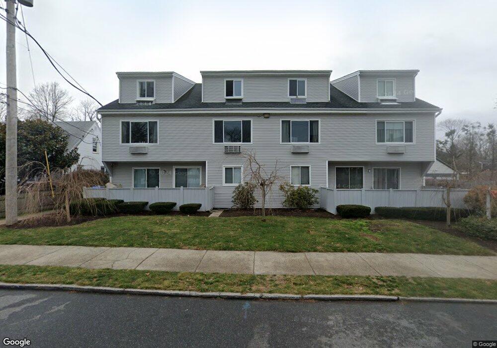
69 Harbor Ave Unit E1 Bridgeport, CT 06605
Black Rock NeighborhoodEstimated Value: $189,000 - $335,444
2
Beds
1
Bath
1,200
Sq Ft
$215/Sq Ft
Est. Value
About This Home
This home is located at 69 Harbor Ave Unit E1, Bridgeport, CT 06605 and is currently estimated at $257,611, approximately $214 per square foot. 69 Harbor Ave Unit E1 is a home located in Fairfield County with nearby schools including Bassick High School, Great Oaks Charter School Bridgeport, and Catholic Academy of Bridgeport-St. Ann Academy.
Ownership History
Date
Name
Owned For
Owner Type
Purchase Details
Closed on
Nov 20, 2024
Sold by
Darwick Frances Est and Hermanns
Bought by
Robinson Renard C
Current Estimated Value
Home Financials for this Owner
Home Financials are based on the most recent Mortgage that was taken out on this home.
Original Mortgage
$212,800
Outstanding Balance
$210,760
Interest Rate
6.32%
Mortgage Type
Purchase Money Mortgage
Estimated Equity
$46,851
Purchase Details
Closed on
Jun 13, 1983
Bought by
Darwick Frances
Create a Home Valuation Report for This Property
The Home Valuation Report is an in-depth analysis detailing your home's value as well as a comparison with similar homes in the area
Home Values in the Area
Average Home Value in this Area
Purchase History
| Date | Buyer | Sale Price | Title Company |
|---|---|---|---|
| Robinson Renard C | $224,000 | None Available | |
| Robinson Renard C | $224,000 | None Available | |
| Robinson Renard C | $224,000 | None Available | |
| Darwick Frances | -- | -- |
Source: Public Records
Mortgage History
| Date | Status | Borrower | Loan Amount |
|---|---|---|---|
| Open | Robinson Renard C | $212,800 | |
| Closed | Robinson Renard C | $212,800 |
Source: Public Records
Tax History
| Year | Tax Paid | Tax Assessment Tax Assessment Total Assessment is a certain percentage of the fair market value that is determined by local assessors to be the total taxable value of land and additions on the property. | Land | Improvement |
|---|---|---|---|---|
| 2025 | $3,138 | $72,210 | $0 | $72,210 |
| 2024 | $3,138 | $72,210 | $0 | $72,210 |
| 2023 | $3,138 | $72,210 | $0 | $72,210 |
| 2022 | $3,138 | $72,210 | $0 | $72,210 |
| 2021 | $3,138 | $72,210 | $0 | $72,210 |
| 2020 | $3,291 | $60,960 | $0 | $60,960 |
| 2019 | $3,291 | $60,960 | $0 | $60,960 |
| 2018 | $3,314 | $60,960 | $0 | $60,960 |
| 2017 | $3,314 | $60,960 | $0 | $60,960 |
| 2016 | $3,314 | $60,960 | $0 | $60,960 |
| 2015 | $5,239 | $124,150 | $0 | $124,150 |
| 2014 | $5,239 | $124,150 | $0 | $124,150 |
Source: Public Records
Map
Nearby Homes
- 37 Bartram Ave
- 5 Durando Place
- 22 Monroe St Unit 24
- 78 Rowsley St Unit 4
- 27 Nash Ln Unit 5
- 23 Rowsley St Unit 6
- 554 Brewster St Unit 4
- 78 Haddon St Unit 1
- 318 Grovers Ave
- 188 Monroe St Unit 190
- 8-10 Jetland Place
- 115 King St Unit 117
- 97 Fayerweather Terrace
- 132 Bennett St Unit 302
- 377 Midland St
- 855 Brewster St Unit 857
- 25 Whittier St
- 287 Hansen Ave
- 31 Whittier St
- 165 Bennett St
- 69 Harbor Ave Unit A3
- 69 Harbor Ave Unit B2
- 69 Harbor Ave Unit E4
- 69 Harbor Ave Unit E3
- 69 Harbor Ave Unit E2
- 69 Harbor Ave Unit D4
- 69 Harbor Ave Unit D3
- 69 Harbor Ave Unit D2
- 69 Harbor Ave Unit D1
- 69 Harbor Ave Unit C4
- 69 Harbor Ave Unit C3
- 69 Harbor Ave Unit C2
- 69 Harbor Ave Unit C1
- 69 Harbor Ave Unit B4
- 69 Harbor Ave Unit B3
- 69 Harbor Ave Unit B1
- 69 Harbor Ave Unit A4
- 69 Harbor Ave Unit A2
- 69 Harbor Ave Unit A1
- 69 Harbor Ave Unit D2
Your Personal Tour Guide
Ask me questions while you tour the home.