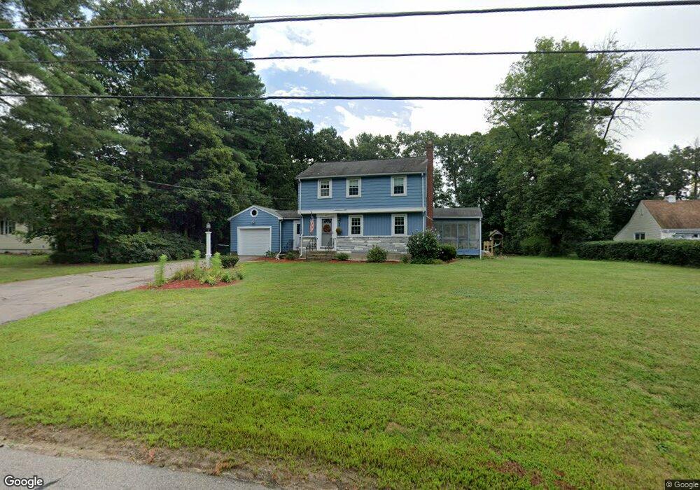
69 Harvard Ln Wrentham, MA 02093
Estimated Value: $562,000 - $645,000
3
Beds
2
Baths
1,270
Sq Ft
$476/Sq Ft
Est. Value
About This Home
This home is located at 69 Harvard Ln, Wrentham, MA 02093 and is currently estimated at $604,901, approximately $476 per square foot. 69 Harvard Ln is a home located in Norfolk County with nearby schools including Delaney Elementary School and Charles E Roderick.
Ownership History
Date
Name
Owned For
Owner Type
Purchase Details
Closed on
Oct 17, 2005
Sold by
Gover Claudine J and Gover Thomas J
Bought by
Coffin Joseph F and Coffin Kim A
Current Estimated Value
Home Financials for this Owner
Home Financials are based on the most recent Mortgage that was taken out on this home.
Original Mortgage
$319,410
Outstanding Balance
$171,178
Interest Rate
5.78%
Mortgage Type
Purchase Money Mortgage
Estimated Equity
$433,723
Purchase Details
Closed on
Nov 17, 1993
Sold by
Daly James C and Daly Janis R
Bought by
Gover Thomas J and Gover Claudine
Purchase Details
Closed on
May 24, 1989
Sold by
Logan Elizabeth
Bought by
Daly James C
Create a Home Valuation Report for This Property
The Home Valuation Report is an in-depth analysis detailing your home's value as well as a comparison with similar homes in the area
Purchase History
| Date | Buyer | Sale Price | Title Company |
|---|---|---|---|
| Coffin Joseph F | $375,000 | -- | |
| Gover Thomas J | $158,000 | -- | |
| Daly James C | $171,500 | -- |
Source: Public Records
Mortgage History
| Date | Status | Borrower | Loan Amount |
|---|---|---|---|
| Open | Coffin Joseph F | $319,410 | |
| Previous Owner | Daly James C | $21,300 | |
| Previous Owner | Daly James C | $188,000 | |
| Previous Owner | Daly James C | $135,000 |
Source: Public Records
Tax History
| Year | Tax Paid | Tax Assessment Tax Assessment Total Assessment is a certain percentage of the fair market value that is determined by local assessors to be the total taxable value of land and additions on the property. | Land | Improvement |
|---|---|---|---|---|
| 2025 | $6,492 | $560,100 | $327,100 | $233,000 |
| 2024 | $6,438 | $536,500 | $332,100 | $204,400 |
| 2023 | $6,112 | $484,300 | $308,800 | $175,500 |
| 2022 | $5,479 | $400,800 | $249,700 | $151,100 |
| 2021 | $5,183 | $368,400 | $228,900 | $139,500 |
| 2020 | $4,938 | $346,500 | $198,500 | $148,000 |
| 2019 | $4,689 | $332,100 | $190,600 | $141,500 |
| 2018 | $4,664 | $327,500 | $190,700 | $136,800 |
| 2017 | $4,410 | $309,500 | $187,000 | $122,500 |
| 2016 | $4,331 | $303,300 | $181,600 | $121,700 |
| 2015 | $4,217 | $281,500 | $174,600 | $106,900 |
| 2014 | $4,147 | $270,900 | $167,900 | $103,000 |
Source: Public Records
Map
Nearby Homes
- 500 Franklin St
- 50 Reed Fulton Ave Unit Lot 61
- 10 Nature View Dr
- 15 Nature View Dr
- 246 Forest Grove Ave
- 45 Joshua Rd
- 135 Creek St Unit 2
- 2 Earle Stewart Ln
- 12 Earle Stewart Ln
- 3 Earle Stewart Ln
- 10 Earle Stewart Ln Unit Lot 5
- 0 W Birch Rd
- 8 Ridgefield Rd
- 11 Weber Farm Rd Unit 11
- 8 Weber Farm Rd Unit 8
- 1 Weber Farm Rd Unit 1
- 576 Dedham St
- 30 Weber Farm Rd Unit 30
- 9 Elliot Mills Unit 5
- 8 Elliot Mills Unit 30
Your Personal Tour Guide
Ask me questions while you tour the home.