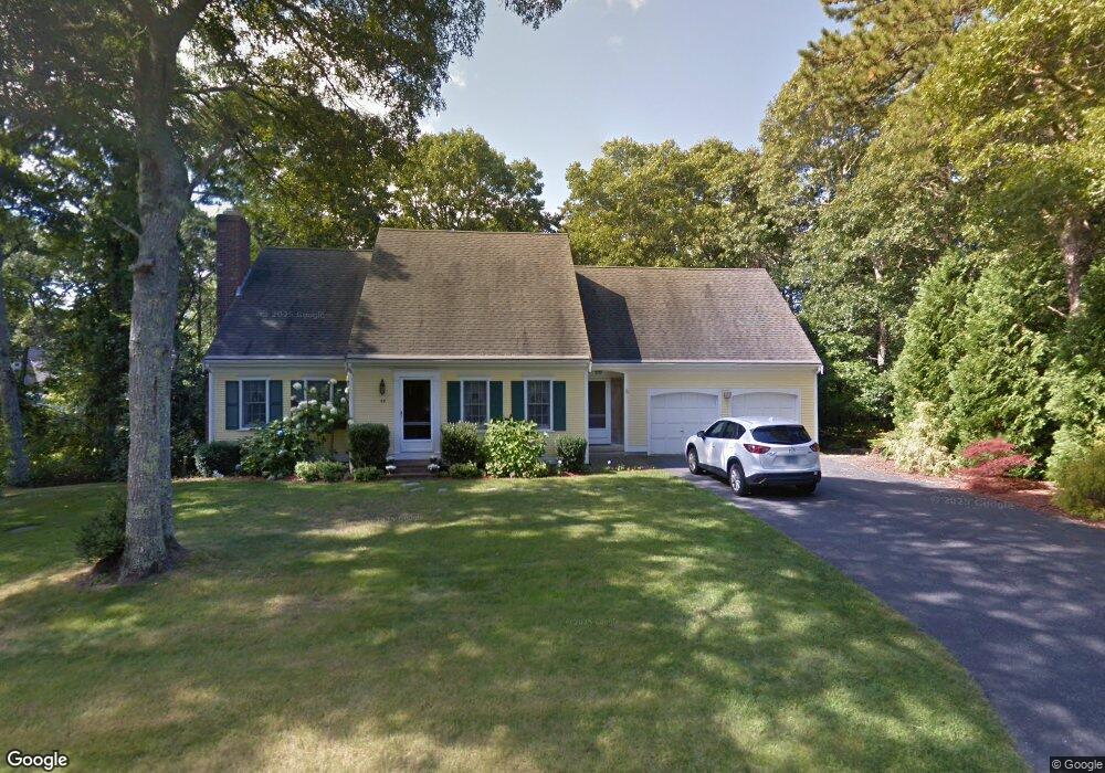
69 High Noon Dr Centerville, MA 02632
Centerville NeighborhoodEstimated Value: $683,000 - $952,000
3
Beds
2
Baths
2,011
Sq Ft
$398/Sq Ft
Est. Value
About This Home
This home is located at 69 High Noon Dr, Centerville, MA 02632 and is currently estimated at $800,488, approximately $398 per square foot. 69 High Noon Dr is a home located in Barnstable County with nearby schools including Centerville Elementary School, Barnstable United Elementary School, and Barnstable Intermediate School.
Create a Home Valuation Report for This Property
The Home Valuation Report is an in-depth analysis detailing your home's value as well as a comparison with similar homes in the area
Home Values in the Area
Average Home Value in this Area
Map
Nearby Homes
- 66 Tern Ln
- 844 Shootflying Hill Rd
- 17 Outpost Ln
- 38 White Oak Trail
- 10 Marthas Way
- 195 Knotty Pine Ln
- 1115 Shootflying Hill Rd
- 80 Holder Ln
- 39 Indian Trail
- 350/360 Plum St
- 3 Yacht Club Rd
- 179 Sheaffer Rd
- 23 Baird Way
- 169 Cedric Rd
- 168 Highland Dr
- 1020 Old Falmouth Rd
- 20 Shannon Way
- 16 Morgan Way
- 96 Saddler Ln
- 17 Hadrada Ln
- 15 Judith Eve Ln
- 53 High Noon Dr
- 26 Judith Eve Ln
- 25 Judith Eve Ln
- 76 High Noon Dr
- 33 High Noon Dr
- 33 High Noon Dr Unit E
- 30 Judith Eve Ln
- 6 Judith Eve Ln
- 60 High Noon Dr
- 40 High Noon Dr
- 223 Rolling Hitch Rd
- 209 Rolling Hitch Rd
- 235 Rolling Hitch Rd
- 26 High Noon Dr
- 19 High Noon Dr
- 364 White Oak Trail
- 366 White Oak Trail
- 351 Gleneagle Dr
- 242 Rolling Hitch Rd
Your Personal Tour Guide
Ask me questions while you tour the home.