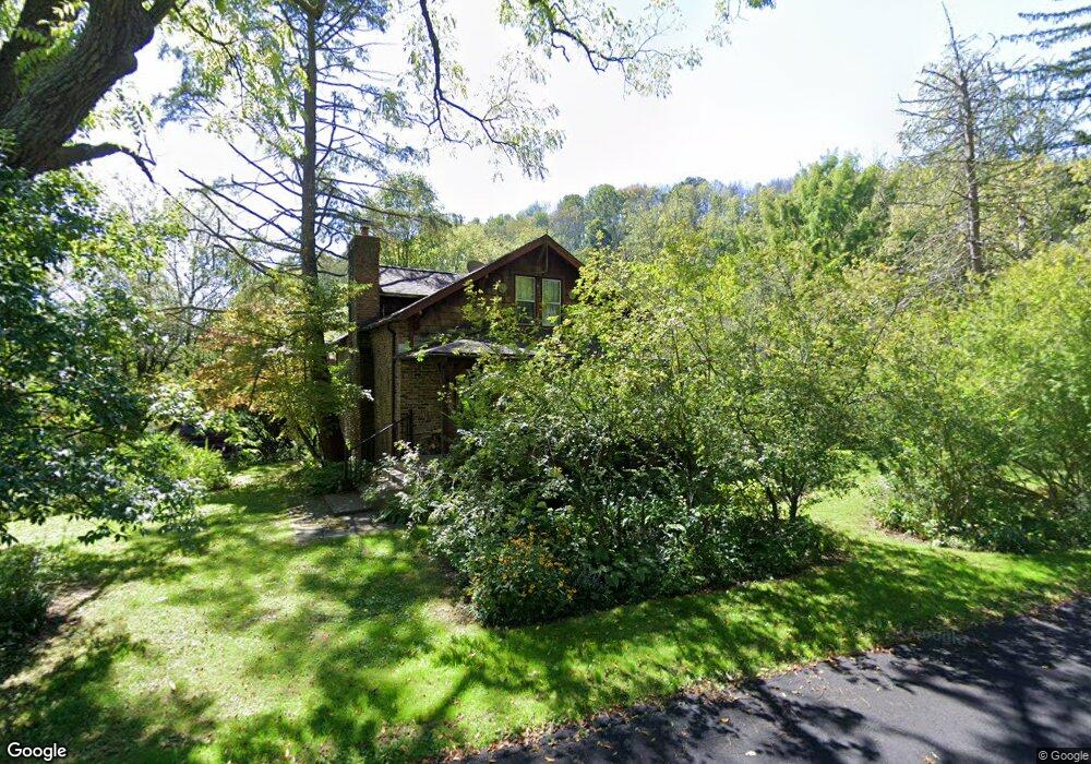
69 Kostenbader Rd Blairstown, NJ 07825
Estimated Value: $375,000 - $467,000
3
Beds
1
Bath
1,350
Sq Ft
$301/Sq Ft
Est. Value
About This Home
This home is located at 69 Kostenbader Rd, Blairstown, NJ 07825 and is currently estimated at $406,620, approximately $301 per square foot. 69 Kostenbader Rd is a home located in Warren County with nearby schools including Hope Township Elementary School.
Ownership History
Date
Name
Owned For
Owner Type
Purchase Details
Closed on
Aug 8, 2000
Sold by
Martin Nancy
Bought by
Martin Thomas and Martin Nancy
Current Estimated Value
Home Financials for this Owner
Home Financials are based on the most recent Mortgage that was taken out on this home.
Original Mortgage
$106,000
Interest Rate
9.87%
Purchase Details
Closed on
Apr 24, 1996
Sold by
Hunt Philip M and Martin Nancy
Bought by
Martin Nancy
Create a Home Valuation Report for This Property
The Home Valuation Report is an in-depth analysis detailing your home's value as well as a comparison with similar homes in the area
Home Values in the Area
Average Home Value in this Area
Purchase History
| Date | Buyer | Sale Price | Title Company |
|---|---|---|---|
| Martin Thomas | -- | -- | |
| Martin Nancy | -- | -- |
Source: Public Records
Mortgage History
| Date | Status | Borrower | Loan Amount |
|---|---|---|---|
| Closed | Martin Thomas | $106,000 |
Source: Public Records
Tax History Compared to Growth
Tax History
| Year | Tax Paid | Tax Assessment Tax Assessment Total Assessment is a certain percentage of the fair market value that is determined by local assessors to be the total taxable value of land and additions on the property. | Land | Improvement |
|---|---|---|---|---|
| 2025 | $6,030 | $176,100 | $44,800 | $131,300 |
| 2024 | $5,625 | $176,100 | $44,800 | $131,300 |
| 2023 | $5,397 | $176,100 | $44,800 | $131,300 |
| 2022 | $5,397 | $176,100 | $44,800 | $131,300 |
| 2021 | $5,163 | $176,100 | $44,800 | $131,300 |
| 2020 | $5,306 | $176,100 | $44,800 | $131,300 |
| 2019 | $5,033 | $176,100 | $44,800 | $131,300 |
| 2018 | $5,033 | $176,100 | $44,800 | $131,300 |
| 2017 | $5,511 | $216,900 | $114,700 | $102,200 |
| 2016 | $5,485 | $216,900 | $114,700 | $102,200 |
| 2015 | $5,449 | $216,900 | $114,700 | $102,200 |
| 2014 | $5,186 | $216,900 | $114,700 | $102,200 |
Source: Public Records
Map
Nearby Homes
- 522 Delaware Rd
- 19-23-28 Swayze Mill Rd
- 12 Locust Lake Rd
- 22 Hissim Rd
- 341 Mount Hermon Rd
- 44 Lake Just It Rd
- 95 Auble Rd
- 135 N Locust Lake Rd
- 138 Lakeside Dr W
- 100 Marble Hill Rd
- 178 Lakeside Dr
- 2 Frontage Rd
- 5 Warren Ln
- 413 Mountain Lake Rd
- 395 Mountain Lake Rd
- 312 Mountain Lake Rd
- 393 Mountain Lake Rd
- 5 Ash Ln
- 3 Rock N' Wood Rd
- 213 Free Union Rd
- 121 Swayze Mill Rd
- 68 Kostenbader Rd
- 65 Kostenbader Rd
- 136 Swayze Mill Rd
- 67 Kostenbader Rd
- 112 Swayze Mill Rd
- 61 Kostenbader Rd
- 111 Swayze Mill Rd
- 141 Swayze Mill Rd
- 59 Kostenbader Rd
- 420 Delaware Rd
- 62 Kostenbader Rd
- 56 Kostenbader Rd
- 107 Swayze Mill Rd
- 420 Delaware Rd
- 58 Kostenbader Rd
- 105 Swayze Mill Rd
- 54 Kostenbader Rd
- 384 Delaware Rd
- 51 Kostenbader Rd