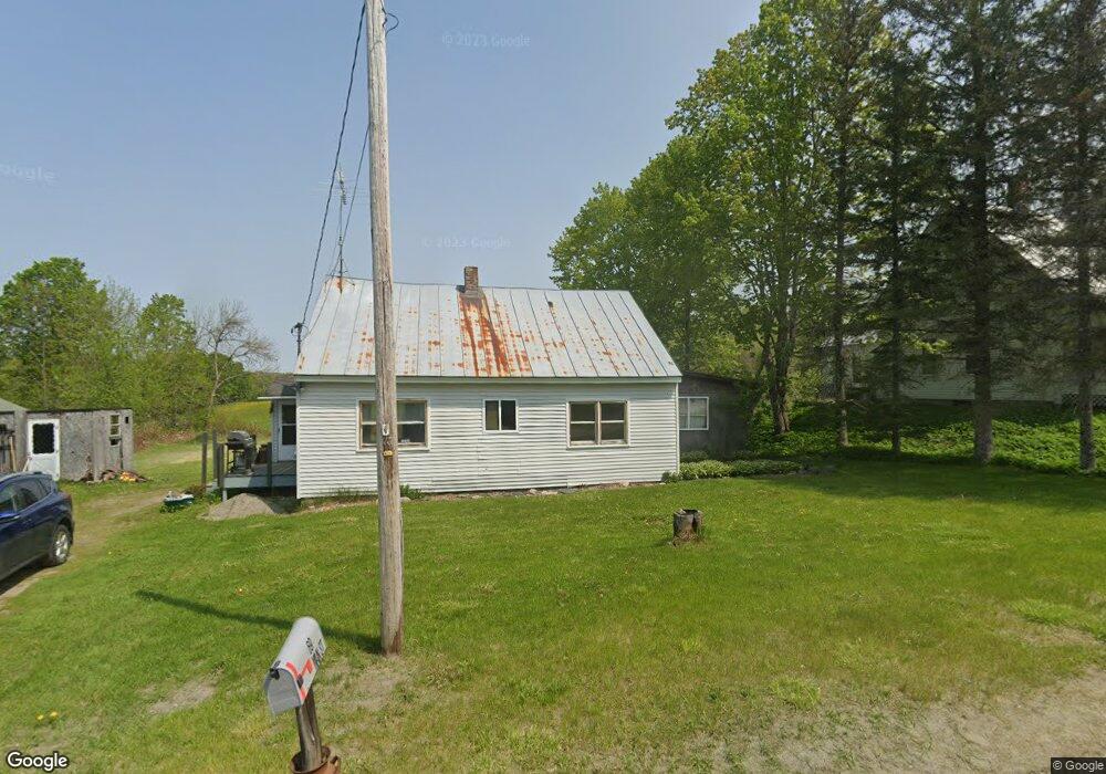
69 Main St Mercer, ME 04957
Estimated Value: $186,700 - $272,000
--
Bed
--
Bath
--
Sq Ft
6,534
Sq Ft Lot
About This Home
This home is located at 69 Main St, Mercer, ME 04957 and is currently estimated at $224,175. 69 Main St is a home.
Create a Home Valuation Report for This Property
The Home Valuation Report is an in-depth analysis detailing your home's value as well as a comparison with similar homes in the area
Home Values in the Area
Average Home Value in this Area
Tax History Compared to Growth
Tax History
| Year | Tax Paid | Tax Assessment Tax Assessment Total Assessment is a certain percentage of the fair market value that is determined by local assessors to be the total taxable value of land and additions on the property. | Land | Improvement |
|---|---|---|---|---|
| 2024 | $1,728 | $164,600 | $39,300 | $125,300 |
| 2023 | $1,250 | $67,218 | $20,857 | $46,361 |
| 2022 | $1,174 | $66,719 | $20,857 | $45,862 |
| 2021 | $1,174 | $66,719 | $20,857 | $45,862 |
| 2020 | $1,148 | $65,219 | $19,357 | $45,862 |
| 2019 | $1,128 | $65,219 | $19,357 | $45,862 |
| 2018 | $1,070 | $65,219 | $19,357 | $45,862 |
| 2017 | $1,043 | $65,219 | $19,357 | $45,862 |
| 2016 | $1,040 | $65,219 | $19,357 | $45,862 |
| 2015 | $1,032 | $65,219 | $19,357 | $45,862 |
| 2014 | $994 | $65,219 | $19,357 | $45,862 |
Source: Public Records
Map
Nearby Homes
- 510 Branns Mill Rd
- M18L13 Mercer Rd
- Lot 59&60 Starks Rd
- 331 Beans Corner Rd
- 0 Poor Farm Rd Unit 1637355
- 2679 Industry Rd
- M1 L19 Homestead Hill Rd
- 17 Anson Rd
- 735 Sandy River Rd
- 10 Trista Ln
- 257 Sandy River Rd
- 137 Butterfield Rd
- Lot 1 Oak Hill Rd
- Lot 2 Oak Hill Rd
- 35 Industry Rd
- 681 Mile Hill Rd
- 43 Doane Rd
- 33 Kimball Pond
- 257 Sawyers Mills Rd
- 55 Cape Cod Hill Rd