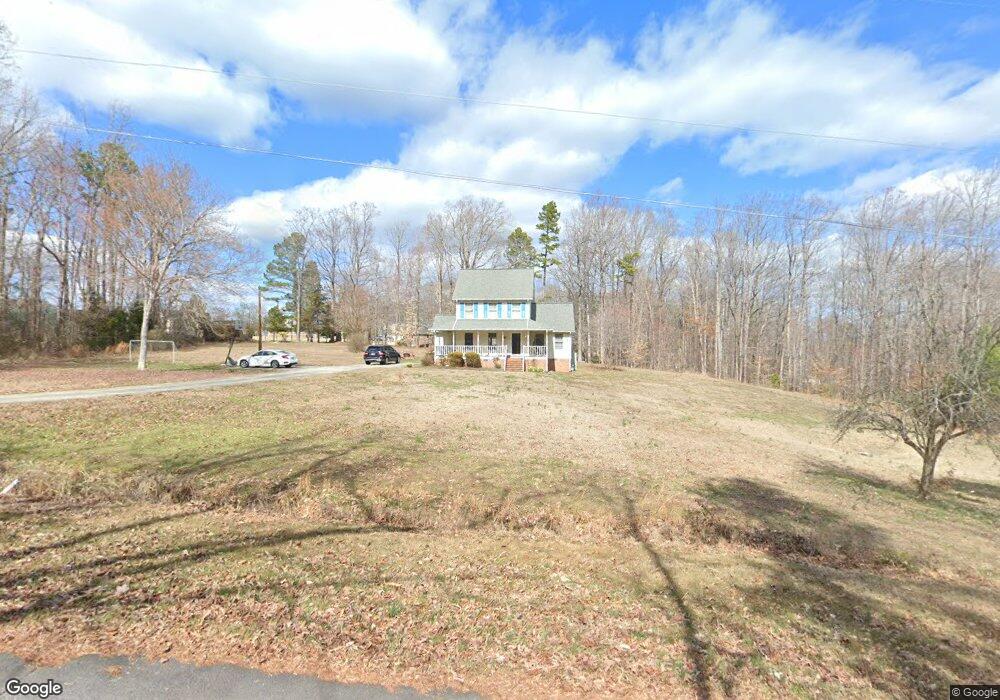
69 Maple Ridge Rd Roxboro, NC 27574
Estimated Value: $270,000 - $314,000
3
Beds
3
Baths
1,633
Sq Ft
$181/Sq Ft
Est. Value
About This Home
This home is located at 69 Maple Ridge Rd, Roxboro, NC 27574 and is currently estimated at $295,371, approximately $180 per square foot. 69 Maple Ridge Rd is a home located in Person County with nearby schools including Person High School, Roxboro Community School, and Roxboro Christian Academy.
Ownership History
Date
Name
Owned For
Owner Type
Purchase Details
Closed on
Jan 15, 2019
Sold by
Holt Timothy R and Holt Sybil O
Bought by
Puryear Robert C and Puryear Suzette T
Current Estimated Value
Home Financials for this Owner
Home Financials are based on the most recent Mortgage that was taken out on this home.
Original Mortgage
$171,000
Outstanding Balance
$150,344
Interest Rate
4.6%
Mortgage Type
New Conventional
Estimated Equity
$145,027
Purchase Details
Closed on
May 18, 1990
Bought by
Holt Timothy and Holt Sybil O
Create a Home Valuation Report for This Property
The Home Valuation Report is an in-depth analysis detailing your home's value as well as a comparison with similar homes in the area
Purchase History
| Date | Buyer | Sale Price | Title Company |
|---|---|---|---|
| Puryear Robert C | $180,000 | None Available | |
| Holt Timothy | $8,000 | -- |
Source: Public Records
Mortgage History
| Date | Status | Borrower | Loan Amount |
|---|---|---|---|
| Open | Puryear Robert C | $171,000 |
Source: Public Records
Tax History Compared to Growth
Tax History
| Year | Tax Paid | Tax Assessment Tax Assessment Total Assessment is a certain percentage of the fair market value that is determined by local assessors to be the total taxable value of land and additions on the property. | Land | Improvement |
|---|---|---|---|---|
| 2025 | $1,664 | $247,525 | $0 | $0 |
| 2024 | $1,382 | $178,065 | $0 | $0 |
| 2023 | $1,382 | $178,065 | $0 | $0 |
| 2022 | $1,377 | $178,065 | $0 | $0 |
| 2021 | $1,337 | $178,065 | $0 | $0 |
| 2020 | $1,092 | $145,242 | $0 | $0 |
| 2019 | $1,106 | $145,242 | $0 | $0 |
| 2018 | $990 | $138,635 | $0 | $0 |
| 2017 | $976 | $138,635 | $0 | $0 |
| 2016 | $976 | $138,635 | $0 | $0 |
| 2015 | $976 | $138,635 | $0 | $0 |
| 2014 | $976 | $138,635 | $0 | $0 |
Source: Public Records
Map
Nearby Homes
- 60 Banbury Ct
- 11 Denada Path
- 120 Denada Path
- 1901 Carver Dr
- 305 Lochridge Dr
- 9 Buttonwood Ln
- 608 Hillhaven Terrace
- 150 Summit St
- 105 Misty Hollow Rd
- 417 Green St
- 508 Jones St
- 515 Reams Ave
- 240 Crestwood Dr
- 1249 Pointer St
- 45 Jasper Clayton Rd
- 209 Reade Dr
- 421 W Gordon St
- Lot 4 Forrestwood Dr
- 500 Jones Lester Rd
- 2 Semora Rd
- 90 Fox Ln
- 2112 Chub Lake Rd
- 80 Maple Ridge Rd
- 115 Maple Ridge Rd
- Lot 8 Fox Ln
- 0 Fox Ln
- Lot 8 Fox Ln Unit 8
- 2056 Chub Lake Rd
- 2156 Chub Lake Rd
- 115 Fox Ln
- 83 Fox Ln
- 149 Fox Ln
- 2030 Chub Lake Rd
- 51 Fox Ln
- 137 Fox Ln
- 2206 Chub Lake Rd
- 2010 Chub Lake Rd
- 2240 Chub Lake Rd
- 1 Acre lof Stories Creek School Rd
- 1 Acre loftis l Stories Creek School Rd Unit One Acre Loftis Loop