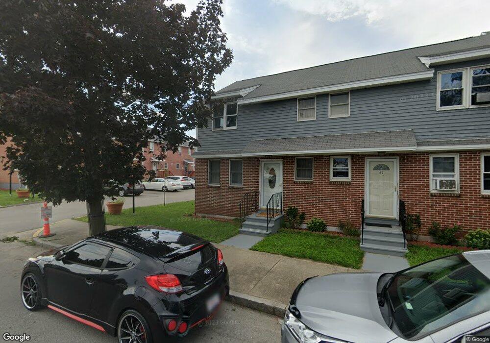
69 Maple St Lawrence, MA 01841
Downtown Lawrence NeighborhoodEstimated Value: $327,000 - $366,824
4
Beds
4
Baths
1,260
Sq Ft
$278/Sq Ft
Est. Value
About This Home
This home is located at 69 Maple St, Lawrence, MA 01841 and is currently estimated at $349,706, approximately $277 per square foot. 69 Maple St is a home located in Essex County with nearby schools including School For Exceptional Studies and Central Catholic High School.
Ownership History
Date
Name
Owned For
Owner Type
Purchase Details
Closed on
Jan 30, 2006
Sold by
Ovalles Maria
Bought by
Saenz Jose and Saenz Pilar
Current Estimated Value
Home Financials for this Owner
Home Financials are based on the most recent Mortgage that was taken out on this home.
Original Mortgage
$171,311
Outstanding Balance
$97,239
Interest Rate
6.34%
Mortgage Type
Purchase Money Mortgage
Estimated Equity
$252,467
Purchase Details
Closed on
Nov 20, 2003
Sold by
Kamuanga Luboya
Bought by
Ovalles Maria
Home Financials for this Owner
Home Financials are based on the most recent Mortgage that was taken out on this home.
Original Mortgage
$131,950
Interest Rate
5.98%
Mortgage Type
Purchase Money Mortgage
Create a Home Valuation Report for This Property
The Home Valuation Report is an in-depth analysis detailing your home's value as well as a comparison with similar homes in the area
Home Values in the Area
Average Home Value in this Area
Purchase History
| Date | Buyer | Sale Price | Title Company |
|---|---|---|---|
| Saenz Jose | $174,000 | -- | |
| Ovalles Maria | $135,000 | -- |
Source: Public Records
Mortgage History
| Date | Status | Borrower | Loan Amount |
|---|---|---|---|
| Open | Saenz Jose | $171,311 | |
| Previous Owner | Ovalles Maria | $131,950 |
Source: Public Records
Tax History
| Year | Tax Paid | Tax Assessment Tax Assessment Total Assessment is a certain percentage of the fair market value that is determined by local assessors to be the total taxable value of land and additions on the property. | Land | Improvement |
|---|---|---|---|---|
| 2025 | $2,640 | $300,000 | $0 | $300,000 |
| 2024 | $2,263 | $244,600 | $0 | $244,600 |
| 2023 | $2,224 | $218,900 | $0 | $218,900 |
| 2022 | $2,535 | $221,600 | $0 | $221,600 |
| 2021 | $2,555 | $208,200 | $0 | $208,200 |
| 2020 | $2,322 | $186,800 | $0 | $186,800 |
| 2019 | $2,384 | $174,300 | $0 | $174,300 |
| 2018 | $2,254 | $157,400 | $0 | $157,400 |
| 2017 | $1,930 | $125,800 | $0 | $125,800 |
| 2016 | $1,543 | $99,500 | $0 | $99,500 |
| 2015 | $1,504 | $99,500 | $0 | $99,500 |
Source: Public Records
Map
Nearby Homes
- 131A Lawrence St Unit 40
- 7-9 Bennington St
- 71-75 Common St
- 11 Lawrence St Unit 606
- 91 Summer St Unit 2
- 46 Amesbury St Unit 2B
- 192 Union St
- 89 Newbury St Unit 89B
- 5 Kendrick St
- 80-82 Haverhill St
- 129-131 Lexington St
- 27 Willow St Unit A
- 434-438 Hampshire St
- 202 Broadway Unit 3-2
- 202 Broadway Unit 3-3
- 324-326 Broadway
- 10 Holly St
- 29-31 Washington St
- 36 Manchester St
- 42 Morton St
- 69 Maple St Unit 34 69
- 63 Maple St
- 61 Maple St Unit 61
- 61 Maple St Unit 31
- 67 Maple St
- 65 Maple St
- 61 Maple St
- 59 Maple St
- 39 Maple St
- 35 Maple St
- 33 Maple St
- 33 Maple St Unit 33
- 67 Maple St Unit 34, 67
- 67 Maple St Unit 34
- 37 Maple St
- 31 Maple St
- 37 Maple St Unit 37
- 100 Maple St
- 129 Lawrence St
- 131 Lawrence St Unit B
Your Personal Tour Guide
Ask me questions while you tour the home.