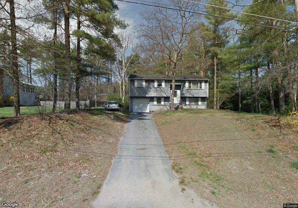
69 Mark Dr Raynham, MA 02767
Estimated Value: $541,000 - $596,000
3
Beds
4
Baths
1,735
Sq Ft
$333/Sq Ft
Est. Value
About This Home
This home is located at 69 Mark Dr, Raynham, MA 02767 and is currently estimated at $577,687, approximately $332 per square foot. 69 Mark Dr is a home located in Bristol County with nearby schools including LaLiberte Elementary School, Merrill Elementary School, and Williams Intermediate School.
Create a Home Valuation Report for This Property
The Home Valuation Report is an in-depth analysis detailing your home's value as well as a comparison with similar homes in the area
Home Values in the Area
Average Home Value in this Area
Tax History
| Year | Tax Paid | Tax Assessment Tax Assessment Total Assessment is a certain percentage of the fair market value that is determined by local assessors to be the total taxable value of land and additions on the property. | Land | Improvement |
|---|---|---|---|---|
| 2025 | $5,572 | $460,500 | $197,400 | $263,100 |
| 2024 | $5,625 | $452,900 | $189,800 | $263,100 |
| 2023 | $5,433 | $399,500 | $170,900 | $228,600 |
| 2022 | $5,238 | $353,200 | $151,900 | $201,300 |
| 2021 | $5,655 | $338,500 | $144,300 | $194,200 |
| 2020 | $4,797 | $332,900 | $144,300 | $188,600 |
| 2019 | $4,737 | $332,900 | $144,300 | $188,600 |
| 2018 | $4,609 | $309,300 | $144,300 | $165,000 |
| 2017 | $4,336 | $288,500 | $136,700 | $151,800 |
| 2016 | $4,275 | $285,400 | $133,600 | $151,800 |
| 2015 | $3,978 | $261,000 | $134,900 | $126,100 |
Source: Public Records
Map
Nearby Homes
- 173 Titicut Rd
- 21 Sully Rd
- 26 Nottingham Dr
- 33 White St
- 30 Edward Rd
- 84 Diniz Dr
- 53 Queens Cir
- 36 Stony Brook Rd
- 2 Maplewood Ln Unit 21-1
- 0 Maplewood Unit 21.3 73426136
- 40 Country Club Dr
- 935 King St
- 4-B High Ridge Dr
- 123 Center St
- 000 Old Pleasant St
- 224 Whippoorwill Dr
- 110 Cobblestone Ln
- 314 Britton St
- 646 Broadway
- 634 Broadway
Your Personal Tour Guide
Ask me questions while you tour the home.