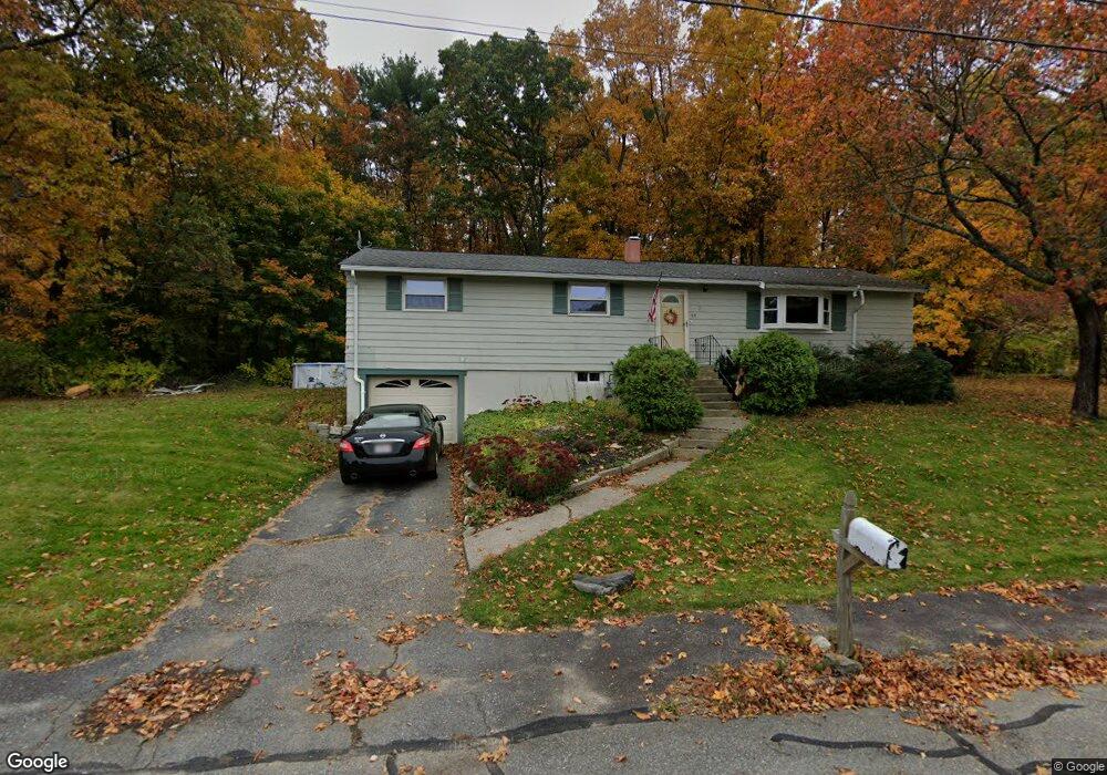
69 Melody Ln Marlborough, MA 01752
Estimated Value: $543,687 - $592,000
3
Beds
1
Bath
1,232
Sq Ft
$464/Sq Ft
Est. Value
About This Home
This home is located at 69 Melody Ln, Marlborough, MA 01752 and is currently estimated at $571,672, approximately $464 per square foot. 69 Melody Ln is a home located in Middlesex County with nearby schools including Marlborough High School, New Covenant Christian School, and Glenhaven Academy - JRI School.
Ownership History
Date
Name
Owned For
Owner Type
Purchase Details
Closed on
Aug 5, 1994
Sold by
Hayes Mary F
Bought by
Giugno David B and Giugno Diane M
Current Estimated Value
Home Financials for this Owner
Home Financials are based on the most recent Mortgage that was taken out on this home.
Original Mortgage
$118,750
Interest Rate
8.4%
Mortgage Type
Purchase Money Mortgage
Create a Home Valuation Report for This Property
The Home Valuation Report is an in-depth analysis detailing your home's value as well as a comparison with similar homes in the area
Home Values in the Area
Average Home Value in this Area
Purchase History
| Date | Buyer | Sale Price | Title Company |
|---|---|---|---|
| Giugno David B | $125,000 | -- |
Source: Public Records
Mortgage History
| Date | Status | Borrower | Loan Amount |
|---|---|---|---|
| Closed | Giugno David B | $118,750 | |
| Previous Owner | Giugno David B | $60,000 |
Source: Public Records
Tax History Compared to Growth
Tax History
| Year | Tax Paid | Tax Assessment Tax Assessment Total Assessment is a certain percentage of the fair market value that is determined by local assessors to be the total taxable value of land and additions on the property. | Land | Improvement |
|---|---|---|---|---|
| 2025 | $4,362 | $442,400 | $227,800 | $214,600 |
| 2024 | $4,415 | $431,200 | $207,100 | $224,100 |
| 2023 | $4,694 | $406,800 | $177,600 | $229,200 |
| 2022 | $4,599 | $350,500 | $169,100 | $181,400 |
| 2021 | $15,282 | $336,100 | $141,000 | $195,100 |
| 2020 | $4,591 | $323,800 | $134,300 | $189,500 |
| 2019 | $4,497 | $319,600 | $131,600 | $188,000 |
| 2018 | $4,216 | $288,200 | $112,700 | $175,500 |
| 2017 | $3,949 | $257,800 | $110,200 | $147,600 |
| 2016 | $3,815 | $248,700 | $110,200 | $138,500 |
| 2015 | $3,696 | $234,500 | $112,600 | $121,900 |
Source: Public Records
Map
Nearby Homes
- 17 Mcneil Cir
- 168 Blanchette Dr
- 38 Collins Dr
- 618 Sudbury St
- 551 Sudbury St
- 492 Stow Rd
- 3 Stonehill Rd
- 114 Linda Cir
- 274 Naugler Ave
- 28 Stetson Dr
- 256 Robert Rd
- 33A Russo Dr
- 16 Minehan Ln
- 137 Naugler Ave
- 688 Boston Post Rd E Unit 202
- 688 Boston Post Rd E Unit 304
- 688 Boston Post Rd E Unit 100
- 688 Boston Post Rd E Unit 324
- 688 Boston Post Rd E Unit 228
- 323 Robert Rd