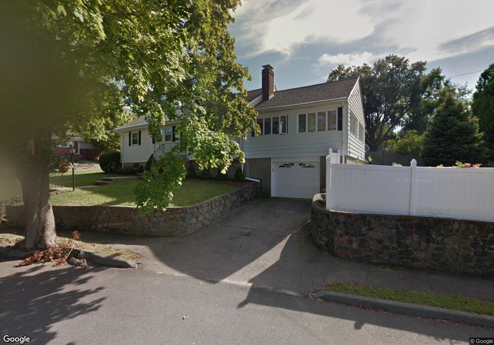
69 Moffatt Rd Salem, MA 01970
South Salem NeighborhoodEstimated Value: $658,000 - $719,000
3
Beds
2
Baths
1,446
Sq Ft
$469/Sq Ft
Est. Value
About This Home
This home is located at 69 Moffatt Rd, Salem, MA 01970 and is currently estimated at $677,675, approximately $468 per square foot. 69 Moffatt Rd is a home located in Essex County with nearby schools including Saltonstall School, Horace Mann Laboratory, and Witchcraft Heights Elementary School.
Create a Home Valuation Report for This Property
The Home Valuation Report is an in-depth analysis detailing your home's value as well as a comparison with similar homes in the area
Home Values in the Area
Average Home Value in this Area
Tax History
| Year | Tax Paid | Tax Assessment Tax Assessment Total Assessment is a certain percentage of the fair market value that is determined by local assessors to be the total taxable value of land and additions on the property. | Land | Improvement |
|---|---|---|---|---|
| 2025 | $6,872 | $606,000 | $230,500 | $375,500 |
| 2024 | $6,891 | $593,000 | $217,500 | $375,500 |
| 2023 | $6,530 | $522,000 | $198,000 | $324,000 |
| 2022 | $5,883 | $444,000 | $181,800 | $262,200 |
| 2021 | $5,681 | $411,700 | $168,800 | $242,900 |
| 2020 | $5,521 | $382,100 | $165,500 | $216,600 |
| 2019 | $5,385 | $356,600 | $155,800 | $200,800 |
| 2018 | $5,205 | $338,400 | $145,400 | $193,000 |
| 2017 | $5,147 | $324,500 | $136,300 | $188,200 |
| 2016 | $5,085 | $324,500 | $136,300 | $188,200 |
| 2015 | $4,741 | $288,900 | $120,100 | $168,800 |
Source: Public Records
Map
Nearby Homes
- 28 Surrey Rd
- 8 Russell Dr Unit 7D
- 3 Stillwell Dr Unit 10B
- 106 Broadway Unit 3
- 79 Lawrence St
- 469 Loring Ave
- 6 Arthur St Unit 3
- 259 Jefferson Ave
- 29 Willson St
- 4 Fairview Rd
- 24 Wisteria St Unit 2
- 326 Lafayette St Unit 2
- 11 Angenica Terrace
- 37 Weatherly Dr
- 49 Weatherly Dr
- 30 Weatherly Dr
- 11 Weatherly Dr
- 1008 Paradise Rd Unit 1M
- 1002 Paradise Rd Unit PHE
- 1004 Paradise Rd Unit 1K
Your Personal Tour Guide
Ask me questions while you tour the home.