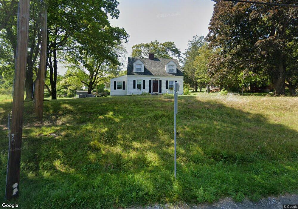
69 N Plain Rd Great Barrington, MA 01230
Estimated Value: $363,661 - $431,000
3
Beds
1
Bath
1,463
Sq Ft
$281/Sq Ft
Est. Value
About This Home
This home is located at 69 N Plain Rd, Great Barrington, MA 01230 and is currently estimated at $410,915, approximately $280 per square foot. 69 N Plain Rd is a home located in Berkshire County with nearby schools including Muddy Brook Regional Elementary School, W.E.B Du Bois Regional Middle School, and Monument Mountain Regional High School.
Ownership History
Date
Name
Owned For
Owner Type
Purchase Details
Closed on
Mar 1, 2022
Sold by
Kinne Marjorie A
Bought by
Deluise Anthony J and Deluise Katilyn M
Current Estimated Value
Home Financials for this Owner
Home Financials are based on the most recent Mortgage that was taken out on this home.
Original Mortgage
$261,000
Outstanding Balance
$240,419
Interest Rate
2.75%
Mortgage Type
Purchase Money Mortgage
Estimated Equity
$170,496
Purchase Details
Closed on
Apr 22, 2019
Sold by
Kinne Thomas A and Kinne Marjorie A
Bought by
Kinne Marjorie A
Purchase Details
Closed on
Aug 1, 1997
Sold by
Kellogg John E and Kellogg Madeleine H
Bought by
Kinne Marjorie A
Home Financials for this Owner
Home Financials are based on the most recent Mortgage that was taken out on this home.
Original Mortgage
$44,000
Interest Rate
7.55%
Mortgage Type
Purchase Money Mortgage
Create a Home Valuation Report for This Property
The Home Valuation Report is an in-depth analysis detailing your home's value as well as a comparison with similar homes in the area
Home Values in the Area
Average Home Value in this Area
Purchase History
| Date | Buyer | Sale Price | Title Company |
|---|---|---|---|
| Deluise Anthony J | $290,000 | None Available | |
| Kinne Marjorie A | -- | -- | |
| Kinne Marjorie A | $92,600 | -- |
Source: Public Records
Mortgage History
| Date | Status | Borrower | Loan Amount |
|---|---|---|---|
| Open | Deluise Anthony J | $261,000 | |
| Previous Owner | Kinne Marjorie A | $65,000 | |
| Previous Owner | Kinne Marjorie A | $63,000 | |
| Previous Owner | Kinne Marjorie A | $44,000 |
Source: Public Records
Tax History Compared to Growth
Tax History
| Year | Tax Paid | Tax Assessment Tax Assessment Total Assessment is a certain percentage of the fair market value that is determined by local assessors to be the total taxable value of land and additions on the property. | Land | Improvement |
|---|---|---|---|---|
| 2025 | $4,406 | $319,500 | $97,100 | $222,400 |
| 2024 | $4,010 | $288,700 | $93,300 | $195,400 |
| 2023 | $3,462 | $264,200 | $93,300 | $170,900 |
| 2022 | $3,462 | $233,000 | $84,800 | $148,200 |
| 2019 | $3,122 | $198,600 | $67,100 | $131,500 |
| 2018 | $2,936 | $196,000 | $67,100 | $128,900 |
| 2017 | $2,862 | $196,000 | $67,100 | $128,900 |
| 2016 | $2,875 | $201,200 | $71,400 | $129,800 |
| 2015 | $2,760 | $201,200 | $71,400 | $129,800 |
Source: Public Records
Map
Nearby Homes
- 28 Pearl St
- 41 Pearl St Unit 1-2
- 35 Mechanic St
- 78 State Rd
- 70 Main St
- 153 State Rd
- 185 State Rd
- 8 Stillwell St
- 105 Christian Hill Rd
- 6 Blue Hill Rd
- 6 Locust St
- Lot 1 Park St
- 81 Castle Hill Ave
- 36 Castle Ln
- 0 Hemlock Hill Rd
- 281 Main St Unit 2
- 20 Cooper Rd
- 228 East St
- 11 Prospect St
- 2 Rose Ct W Unit B-1