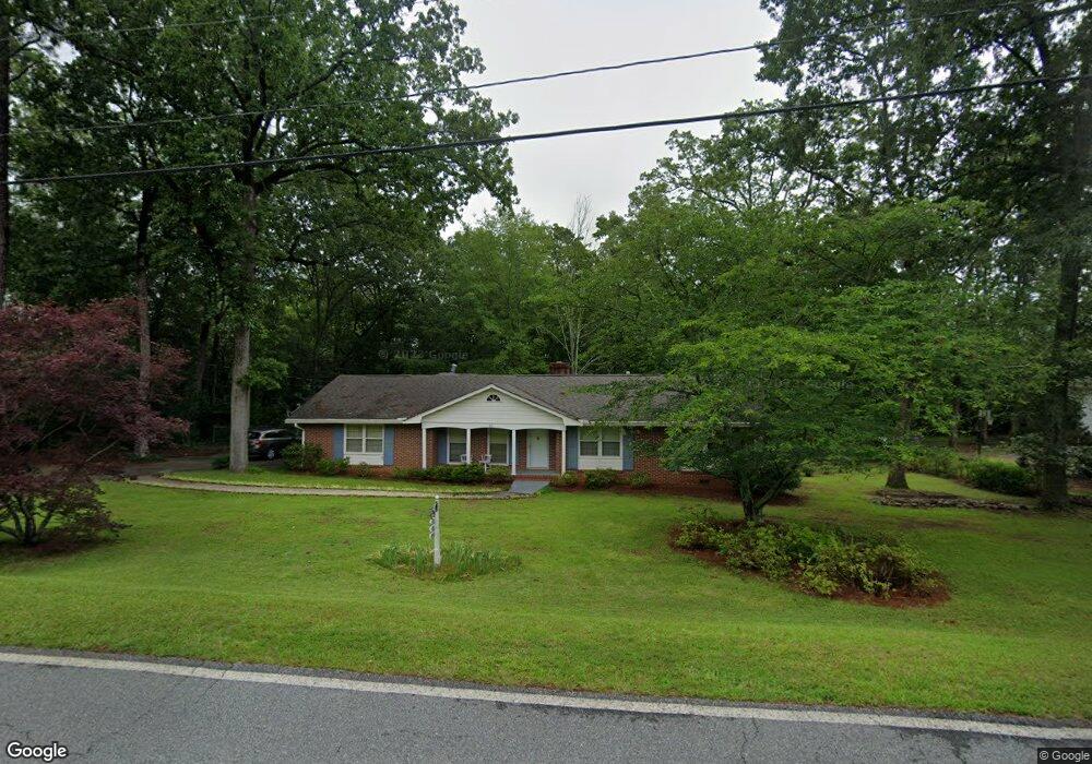
69 Oakridge Dr Forsyth, GA 31029
Estimated Value: $277,000 - $281,005
3
Beds
2
Baths
1,954
Sq Ft
$143/Sq Ft
Est. Value
About This Home
This home is located at 69 Oakridge Dr, Forsyth, GA 31029 and is currently estimated at $279,251, approximately $142 per square foot. 69 Oakridge Dr is a home located in Monroe County with nearby schools including Katherine B. Sutton Elementary School and Mary Persons High School.
Ownership History
Date
Name
Owned For
Owner Type
Purchase Details
Closed on
Jun 27, 2023
Sold by
Thompson Ernestine P
Bought by
Sold Sisters Inc
Current Estimated Value
Home Financials for this Owner
Home Financials are based on the most recent Mortgage that was taken out on this home.
Original Mortgage
$136,000
Interest Rate
6.79%
Mortgage Type
New Conventional
Purchase Details
Closed on
Jul 28, 2022
Sold by
Thompson Ernestine P
Bought by
Thompson Ernestine P and Thompson Joseph O
Purchase Details
Closed on
Dec 12, 1989
Sold by
Harkness Charles W and Harkness Barbara S
Bought by
Thompson Alec F and Thompson Ernestine P
Purchase Details
Closed on
Apr 12, 1983
Sold by
Harkness Charles
Bought by
Harkness Barbara S
Purchase Details
Closed on
May 5, 1966
Sold by
Zellner Harold L
Bought by
Harkness Charles
Create a Home Valuation Report for This Property
The Home Valuation Report is an in-depth analysis detailing your home's value as well as a comparison with similar homes in the area
Home Values in the Area
Average Home Value in this Area
Purchase History
| Date | Buyer | Sale Price | Title Company |
|---|---|---|---|
| Sold Sisters Inc | $170,000 | -- | |
| Thompson Ernestine P | -- | -- | |
| Thompson Alec F | $68,900 | -- | |
| Harkness Barbara S | -- | -- | |
| Harkness Charles | -- | -- |
Source: Public Records
Mortgage History
| Date | Status | Borrower | Loan Amount |
|---|---|---|---|
| Closed | Sold Sisters Inc | $136,000 |
Source: Public Records
Tax History Compared to Growth
Tax History
| Year | Tax Paid | Tax Assessment Tax Assessment Total Assessment is a certain percentage of the fair market value that is determined by local assessors to be the total taxable value of land and additions on the property. | Land | Improvement |
|---|---|---|---|---|
| 2024 | $2,030 | $67,320 | $9,680 | $57,640 |
| 2023 | $1,953 | $61,680 | $9,680 | $52,000 |
| 2022 | $948 | $61,680 | $9,680 | $52,000 |
| 2021 | $976 | $61,680 | $9,680 | $52,000 |
| 2020 | $700 | $51,400 | $9,680 | $41,720 |
| 2019 | $713 | $51,400 | $9,680 | $41,720 |
| 2018 | $715 | $51,680 | $9,680 | $42,000 |
| 2017 | $1,657 | $51,680 | $9,680 | $42,000 |
| 2016 | $578 | $48,120 | $9,680 | $38,440 |
| 2015 | $554 | $48,120 | $9,680 | $38,440 |
| 2014 | $560 | $48,120 | $9,680 | $38,440 |
Source: Public Records
Map
Nearby Homes
- 47 Ensign Rd
- 24 George St
- 3487 Georgia 42
- 3271 Georgia 42
- 3471 Georgia 42
- 81 Langston Ave
- 225 N Indian Springs Dr
- 200 Indian Springs Dr
- 205 Solomon St
- 5407 Felles Way Unit 356
- 4616 Capulet Ct
- 4631 Capulet Ct Unit 331
- 4631 Capulet Ct
- 397 Ensign Rd
- 5399 Felles Way Unit 358
- 5399 Felles Way
- 84 Hillsdale Rd
- 5393 Felles Way Unit 359
- 5387 Felles Way
- 5387 Felles Way Unit 360
- 69 Oak Ridge Dr
- 59 Oakridge Dr
- 5 Lakeside Dr
- 76 Oakridge Dr
- 76 Oak Ridge Dr
- 76 Oakridge Dr
- 66 Oakridge Dr
- 88 Oakridge Dr
- 53 Lakeside Dr
- 105 Pineview Cir
- 31 Lakeside Dr
- 44 Oakridge Dr
- 118 Pineview Cir
- 69 Lakeside Dr
- 114 Oakridge Dr
- 8 Lakeside Dr
- 98 Pineview Cir
- 18 Lakeside Dr
- 79 Lakeside Dr
- 133 Oakridge Dr