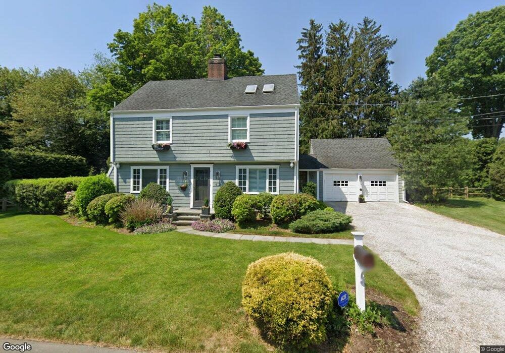
69 Osborne Ln Southport, CT 06890
Estimated Value: $1,187,000 - $1,392,065
3
Beds
3
Baths
2,231
Sq Ft
$586/Sq Ft
Est. Value
About This Home
This home is located at 69 Osborne Ln, Southport, CT 06890 and is currently estimated at $1,306,766, approximately $585 per square foot. 69 Osborne Ln is a home located in Fairfield County with nearby schools including Mill Hill School, Roger Ludlowe Middle School, and Fairfield Ludlowe High School.
Ownership History
Date
Name
Owned For
Owner Type
Purchase Details
Closed on
Apr 29, 1993
Sold by
Caspescha Daniel R and Caspescha Sandra L
Bought by
Cortellessa Richard and Cortellessa Susan R
Current Estimated Value
Purchase Details
Closed on
Feb 28, 1991
Sold by
Sheehan Peter F and Sheehan Sarah H
Bought by
Capescha Daniel R and Capescha Sandra
Purchase Details
Closed on
Feb 26, 1990
Sold by
Ford Cheryl A
Bought by
Sheehan Peter F
Create a Home Valuation Report for This Property
The Home Valuation Report is an in-depth analysis detailing your home's value as well as a comparison with similar homes in the area
Home Values in the Area
Average Home Value in this Area
Purchase History
| Date | Buyer | Sale Price | Title Company |
|---|---|---|---|
| Cortellessa Richard | $316,825 | -- | |
| Cortellessa Richard | $316,825 | -- | |
| Capescha Daniel R | $313,500 | -- | |
| Sheehan Peter F | $310,000 | -- |
Source: Public Records
Mortgage History
| Date | Status | Borrower | Loan Amount |
|---|---|---|---|
| Open | Sheehan Peter F | $326,600 | |
| Closed | Sheehan Peter F | $335,000 | |
| Closed | Sheehan Peter F | $200,000 |
Source: Public Records
Tax History Compared to Growth
Tax History
| Year | Tax Paid | Tax Assessment Tax Assessment Total Assessment is a certain percentage of the fair market value that is determined by local assessors to be the total taxable value of land and additions on the property. | Land | Improvement |
|---|---|---|---|---|
| 2025 | $13,975 | $492,240 | $312,270 | $179,970 |
| 2024 | $13,733 | $492,240 | $312,270 | $179,970 |
| 2023 | $13,542 | $492,240 | $312,270 | $179,970 |
| 2022 | $13,409 | $492,240 | $312,270 | $179,970 |
| 2021 | $13,281 | $492,240 | $312,270 | $179,970 |
| 2020 | $14,033 | $523,810 | $309,050 | $214,760 |
| 2019 | $14,033 | $523,810 | $309,050 | $214,760 |
| 2018 | $13,808 | $523,810 | $309,050 | $214,760 |
| 2017 | $13,525 | $523,810 | $309,050 | $214,760 |
| 2016 | $13,331 | $523,810 | $309,050 | $214,760 |
| 2015 | $12,485 | $503,650 | $325,430 | $178,220 |
| 2014 | $12,289 | $503,650 | $325,430 | $178,220 |
Source: Public Records
Map
Nearby Homes
- 153 Pease Ave
- 2 Elmwood Dr Unit 2
- 844 Mill Hill Terrace
- 125 Old Rd
- 220 Lansdowne
- 305 S Gate Ln
- 944 Pequot Ave
- 1 Coastal Ct
- 28 Mill Hill Rd Unit 28
- 7 High Gate Rd
- 107 Old Rd
- 260 Willow St
- 53 Hilltop Dr
- 476 Mill Hill Terrace
- 36 Maple Ave S
- 342 Greens Farms Rd
- 1213 Cedar Rd
- 1135 Mill Hill Rd
- 1001 Hulls Farm Rd
- 40 Maple Ave N